
| Bakhapcha Бахапча | |
|---|---|
 | |
 Mouth location in Magadan Oblast, Russia | |
| Location | |
| Country | Russia |
| Federal subject | Magadan Oblast |
| District | Yagodninsky District Khasynsky District Tenkinsky District |
| Physical characteristics | |
| Source | |
| • location | Lake Solnechnoye Kolyma Mountains |
| • coordinates | 60°55′04″N 150°30′04″E / 60.91778°N 150.50111°E |
| • elevation | 753 m (2,470 ft) |
| Mouth | Kolyma |
• coordinates | 62°06′32″N 150°36′03″E / 62.10889°N 150.60083°E[1] |
• elevation | 330 m (1,083 ft) |
| Length | 212 km (132 mi) |
| Basin size | 13,800 km2 (5,300 sq mi) |
| Discharge | |
| • average | 125 m3/s (4,400 cu ft/s) |
| Basin features | |
| Progression | Kolyma→ East Siberian Sea |
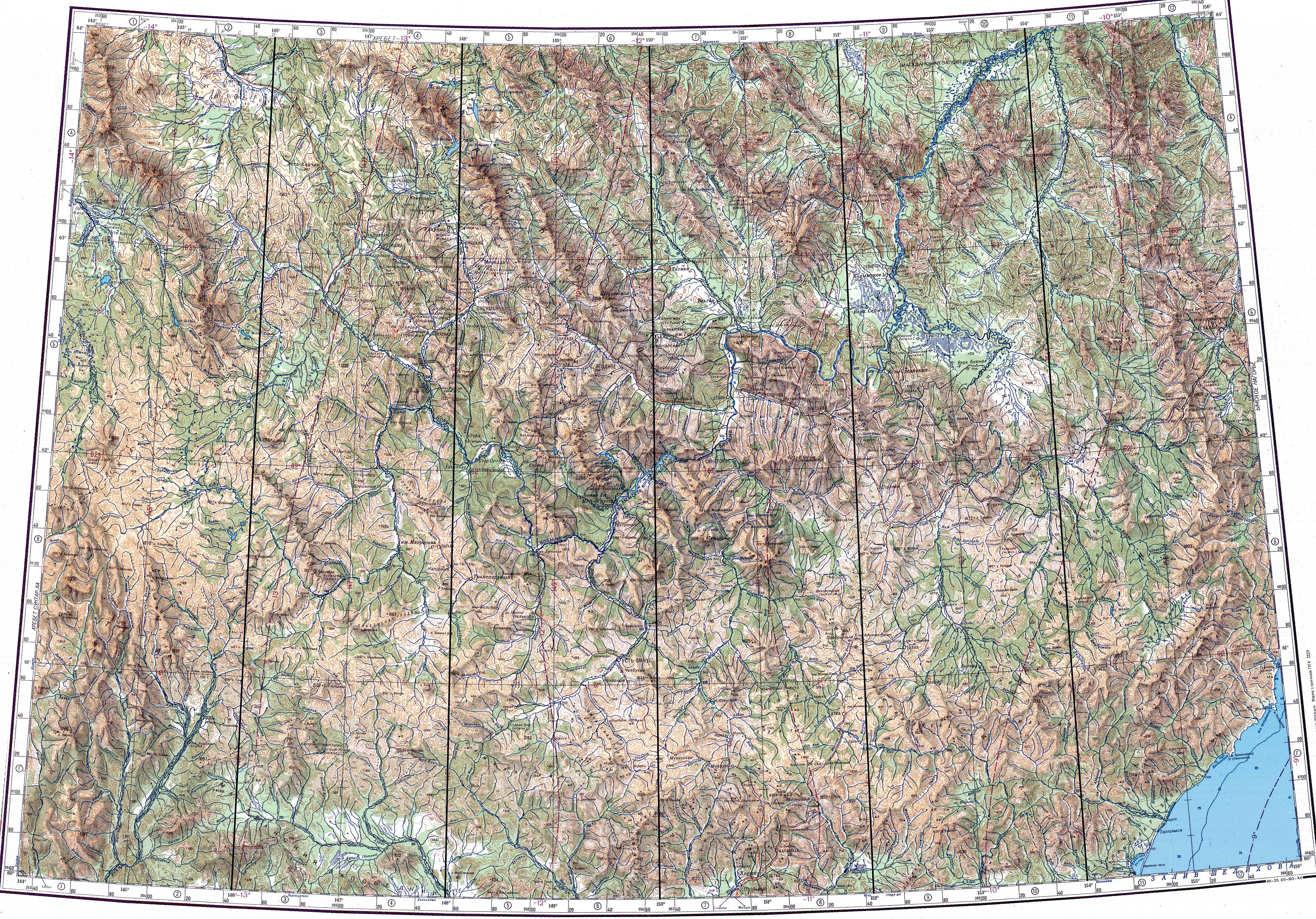
The Bakhapcha (Russian: Бахапча; also "Бохапча") is a river in Magadan Oblast, Russia. It has a length of 212 kilometres (132 mi) and a drainage basin of 13,800 square kilometres (5,300 sq mi).[2]
The Bakhapcha is a right tributary of the upper course of the Kolyma. The nearest village is Sinegorye, located to the west of its mouth.[3] The upper course of the river is a protected area.[4]
Course
The source of the Bakhapcha is in lake Solnechnoye, a small lake located west of the Olsky Plateau (Ольское плато), at the western end of the Kolyma Mountains. The Maymandzhin Range rises to the east of the river basin. The river heads across an uninhabited area roughly northwards until its mouth. Flowing across mountainous terrain there are many rapids. In the floodplain of the middle reaches the riverbed branches into sleeves with many islands in between. Further downstream the river is slightly meandering. Finally the Bakhapcha joins the right bank of the Kolyma 1,839 kilometres (1,143 mi) from its mouth, 5 km (3 mi) to the east of Sinegorye.[1][3][5][6]
The river freezes yearly between late October and late May. The main tributaries of the Bakhapcha are the 157 kilometres (98 mi) long Maltan and the 121 kilometres (75 mi) long Nerega from the right.[2][6]
See also
References
- ^ a b Google Earth
- ^ a b "Река Бохапча in the State Water Register of Russia". textual.ru (in Russian).
- ^ a b "Топографска карта P-55_56 - Topographic USSR Chart (in Russian)". Retrieved 13 March 2022.
- ^ Ольское плато - ООПТ России
- ^ Бахапча, Great Soviet Encyclopedia in 30 vols. / Ch. ed. A.M. Prokhorov – 3rd ed. – M, 1969-1978. (in Russian)
- ^ a b "Water of Russia - Бахапча". water-rf.ru. Retrieved 13 March 2022.
External links
- Хасынский район - Активный отдых для энергичных людей Tourist routes (in Russian)
This Magadan Oblast location article is a stub. You can help Wikipedia by expanding it. |
This article related to a river in Russia is a stub. You can help Wikipedia by expanding it. |