
Bad Häring
Bod Hearing | |
|---|---|
 Bad Häring in winter | |
 Coat of arms | |
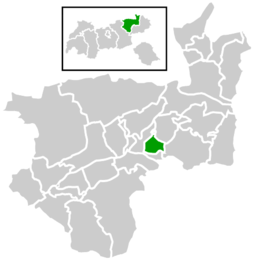 Location within Kufstein district | |
 Bad Häring Location within Austria | |
| Coordinates: 47°30′45″N 12°07′25″E / 47.51250°N 12.12361°E | |
| Country | Austria |
| State | Tyrol |
| District | Kufstein |
| Government | |
| • Mayor | Hermann Ritzer (SPÖ) |
| Area | |
| • Total | 9.27 km2 (3.58 sq mi) |
| Elevation | 650 m (2,130 ft) |
| Population (2018-01-01)[2] | |
| • Total | 2,777 |
| • Density | 300/km2 (780/sq mi) |
| Time zone | UTC+1 (CET) |
| • Summer (DST) | UTC+2 (CEST) |
| Postal code | 6323 |
| Area code | 05332 |
| Vehicle registration | KU |
| Website | https://badhaering.at/ |
Bad Häring (Central Bavarian: Bod Hearing) is a municipality in the Kufstein district in the Austrian state of Tyrol located 4.30 km northwest of Wörgl and 9 km south of Kufstein. A strong sulfur source was found in 1951 resulting in foundation of health tourism. In 1996 the location was named the "first air spa of Tyrol“.
YouTube Encyclopedic
-
1/3Views:51013 544706
-
Interview mit Peter Mayer Panorama Hotel in in Bad Häring - Tirol
-
Vier-Sterne-Superior Gesundheitsresort DAS SIEBEN
-
TSV 1860 München Trainigslager in Bad Häring.
Transcription
Population
| Year | Pop. | ±% |
|---|---|---|
| 1869 | 740 | — |
| 1880 | 1,043 | +40.9% |
| 1890 | 1,080 | +3.5% |
| 1900 | 1,470 | +36.1% |
| 1910 | 1,709 | +16.3% |
| 1923 | 1,772 | +3.7% |
| 1934 | 1,774 | +0.1% |
| 1939 | 1,656 | −6.7% |
| 1951 | 1,814 | +9.5% |
| 1961 | 1,807 | −0.4% |
| 1971 | 1,922 | +6.4% |
| 1981 | 2,065 | +7.4% |
| 1991 | 2,197 | +6.4% |
| 2001 | 2,265 | +3.1% |
| 2013 | 2,562 | +13.1% |
References
- ^ "Dauersiedlungsraum der Gemeinden Politischen Bezirke und Bundesländer - Gebietsstand 1.1.2018". Statistics Austria. Retrieved 10 March 2019.
- ^ "Einwohnerzahl 1.1.2018 nach Gemeinden mit Status, Gebietsstand 1.1.2018". Statistics Austria. Retrieved 9 March 2019.
External links
Wikimedia Commons has media related to Bad Häring.
- Website of the Health Resort Bad Häring
- Website of Bad Häring (in German)
- Bad Häring Tourist Board[permanent dead link]
| International | |
|---|---|
| National | |
This Tyrol location article is a stub. You can help Wikipedia by expanding it. |