
Athboy Aerodrome Ballyboy Airfield | |||||||||||
|---|---|---|---|---|---|---|---|---|---|---|---|
| Summary | |||||||||||
| Operator | Ballyboy House | ||||||||||
| Serves | Athboy, County Meath, Ireland | ||||||||||
| Elevation AMSL | 230 ft / 70 m | ||||||||||
| Coordinates | 53°38′16″N 6°52′43″W / 53.63778°N 6.87861°W | ||||||||||
| Website | https://www.ballyboyairfield.com | ||||||||||
| Map | |||||||||||
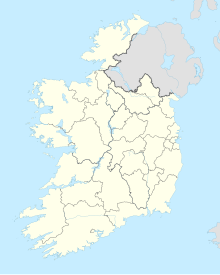 EIMH Location of airport in Ireland | |||||||||||
| Runways | |||||||||||
| |||||||||||
Athboy Aerodrome (ICAO: EIMH) is a small airfield located 2 nautical miles (4 km; 2 mi) northeast of Athboy (Irish: Baile Átha Buí), a town in County Meath (Contae na Mí), Ireland. This aerodrome is licensed by the Aeronautical Services Department of the Irish Aviation Authority.[1] It is also known as Ballyboy Airfield.[2]
Ballyboy Airfield is situated 2 nm northeast of Athboy County Meath, Ireland, only 40 minutes from Dublin by motorway.
The first plane to land in Ballyboy was in 1994, on a grass runway cut between two fields on the Ballyboy Farm of near east/west orientation.
Ballyboy is located outside controlled airspace and has a 600 metre grass runway, hangarage and Avgas and Jet A-1 fuel systems, with mogas by arrangement from Athboy town (2 km).[3]
Facilities
Athboy Aerodrome lies at an elevation of 230 feet (70 m) above mean sea level, and has one runway, designated 11/29, with a grass surface measuring 600 by 18 metres (1,969 by 59 ft). Fuels available on site are JET A1 and 100LL, while mogas (petrol) is available 2 miles away in the town of Athboy.[1]
Ballyboy has aircraft parking with hangarage. Limited maintenance facilities are also available.[3]
Airfield information
GPS coordinates: N53°38'27 W006°52'72.
- 600m grass runway 29/11
- Avgas and Jet A-1 fuel
- Mogas available in Athboy town (2 Km)
- Licensed by the Aeronautical Services Department of the Irish Aviation Authority[4]
References
- ^ a b c Aerodrome Information - VFR Aerodromes and Heliports Archived 2011-06-15 at the Wayback Machine. Aeronautical Information Service of the Irish Aviation Authority. Effective 2008.
- ^ Ballyboy Airfield (EIMH)[permanent dead link]. Flying in Ireland Magazine forums. 10 June 2009.
- ^ a b "ballyboy-wix". ballyboy-wix. Retrieved 6 June 2019.
- ^ "INFORMATION". ballyboy-wix. Retrieved 6 June 2019.
| Northern Ireland |
|  | ||||
|---|---|---|---|---|---|---|
| Republic of Ireland (Statistics) |
| |||||
Smaller airports handling domestic, charter or private services only. | ||||||