
| Annapurna Conservation Area | |
|---|---|
| अन्नपूर्णा संरक्षण क्षेत्र | |
IUCN category VI (protected area with sustainable use of natural resources) | |
 Annapurna range as seen from Pokhara | |
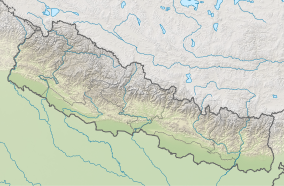 | |
| Location | Nepal |
| Coordinates | 28°47′N 83°58′E / 28.78°N 83.97°E |
| Area | 7,629 km2 (2,946 sq mi) |
| Established | 1992 |
| Governing body | Department of National Parks and Wildlife Conservation |
Annapurna Conservation Area is Nepal's largest protected area covering 7,629 km2 (2,946 sq mi) in the Annapurna range of the Himalayas. It ranges in elevation from 790 m (2,590 ft) to the peak of Annapurna I at 8,091 m (26,545 ft). The conservation area stretches across Manang, Mustang, Kaski, Myagdi, and Lamjung Districts.[1] Annapurna Conservation Area encompasses Annapurna Sanctuary and is known for several trekking routes including the Annapurna Circuit.
YouTube Encyclopedic
-
1/3Views:9015 8461 014
-
TRAVELING NEPAL: Ep 5 | Poon Hill Trek | DAY 2 | THE STAIRS OF DEATH
-
Nepal: Trekking in the Annapurna conservation area.
-
AROUND ANNAPURNA, NEPAL (Gopro hero 5 edition)
Transcription
History
The Annapurna Conservation Area was established in 1985 and gazetted in 1992. It is managed by the National Trust for Nature Conservation.[1]
Climate
Two climatic regions within a span of 120 km (75 mi) and an elevation of 1,000 to 8,000 m (3,300 to 26,200 ft) are distinguished.[1] Rainfall in the southern part of the Annapurnas is higher than in the rain shadow to the north of the peaks. Annual precipitation is highest during the Asian monsoon between June and September ranging from 5,032 mm (198.1 in) on the southern slopes at 2,950 m (9,680 ft) elevation to 1,099 mm (43.3 in) in rain shadow areas at 2,760 m (9,060 ft) elevation. Snow accumulates between 2,000 and 3,000 m (6,600 and 9,800 ft). In the winter of 1999–2000, areas above 3,000 m (9,800 ft) were snow-covered until the end of March, and until May above 4,400 m (14,400 ft). At this elevation, winter air temperatures range from −4.65 to −6.06 °C (23.63 to 21.09 °F).[2]
References
- ^ a b c Bhuju, U. R.; Shakya, P. R.; Basnet, T. B.; Shrestha, S. (2007). Nepal Biodiversity Resource Book. Protected Areas, Ramsar Sites, and World Heritage Sites (PDF). Kathmandu: International Centre for Integrated Mountain Development, Ministry of Environment, Science and Technology, in cooperation with United Nations Environment Programme, Regional Office for Asia and the Pacific. ISBN 978-92-9115-033-5.
- ^ Putkonen, J. K. (2004). "Continuous snow and rain data at 500 to 4400 m altitude near Annapurna, Nepal, 1999–2001". Arctic, Antarctic, and Alpine Research. 36 (2): 244–248. doi:10.1657/1523-0430(2004)036[0244:CSARDA]2.0.CO;2. S2CID 51226986.
External links
- BirdLife International. "Important Bird Areas factsheet: Annapurna Conservation Area".
- Department of National Parks and Wildlife Conservation, Nepal: Annapurna Conservation Area Archived 2019-06-18 at the Wayback Machine
| National parks | ||
|---|---|---|
| Wildlife reserves | ||
| Conservation areas | ||
| Hunting reserves | ||
| Ramsar sites | ||
| International | |
|---|---|
| National | |
This article about a location in the Kaski District of Nepal is a stub. You can help Wikipedia by expanding it. |