
23°5′57.53″N 120°13′37.79″E / 23.0993139°N 120.2271639°E
Anding
安定區 | |
|---|---|
| Anding District | |
 Sesame fields in Anding | |
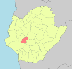 | |
 Anding Location in Taiwan | |
| Coordinates: 23°5′57.53″N 120°13′37.79″E / 23.0993139°N 120.2271639°E | |
| Country | |
| Special municipality | Tainan |
| Area | |
| • Total | 12.0734 sq mi (31.27 km2) |
| Elevation | 16 ft (5 m) |
| Population (January 2023) | |
| • Total | 29,914 |
| • Density | 2,483/sq mi (959/km2) |
| Time zone | UTC+8 (+8) |
| Website | web |

Anding District (Chinese: 安定區; pinyin: Āndìng Qū; Wade–Giles: An1-ting4 Ch'ü1; Pe̍h-ōe-jī: An-tēng khu) is a rural district of about 29,914 residents in Tainan, Taiwan, with an area of 31.27 square kilometers, or 12.0734 square miles. It is the 17th most populous district in Tainan, with a population density of 959 people per square kilometer, or 2,483 people per square mile.
YouTube Encyclopedic
-
1/1Views:2 796
-
台灣的老街應該長什麼樣子?【日常.新化】浸 旅人 x 勝曼咖啡 #台南新化
Transcription
History
During the Dutch colonial era the area was known as Bakloan[1] or Baccloan,[2][failed verification] with a rarer spelling of Baccaluang. The village was one of four main aboriginal villages near the Dutch base of Tayouan, with around 1,500 inhabitants.[3] It was located about 12 kilometres (7.5 mi) northeast of the Dutch base at Fort Zeelandia.
Republic of China
After the handover of Taiwan from Japan to the Republic of China in 1945, Anding was organized as a rural township of Tainan County. On 25 December 2010, Tainan County was merged with Tainan City and Anding was upgraded to a district of the city.
Administrative divisions
Anding district consists of Sulin, Sucuo, Anding, Baoxi, Anjia, Gangwei, Nanan, Guanliao, Zhongrong, Gangkou, Hailiao, Datong, Liujia, Gangnan, Zhongsa and Xinji Borough.[4]
Tourist attractions
- Changsing Temple
- Little Confucius Temple[5]
References
- ^ Campbell (1903), p. 538.
- ^ 臺南市政府區公所-安定區. tainan.gov.tw (in Chinese). Archived from the original on 2013-10-29. Retrieved 2014-05-25.
- ^ Andrade, Tonio (2005). "Chapter 3: Pax Hollandica". How Taiwan Became Chinese: Dutch, Spanish, and Han Colonization in the Seventeenth Century. Columbia University Press. § 3.
- ^ "Location of Boroughs". Anding District Office, Tainan City. 2010-12-25. Archived from the original on 2017-04-29. Retrieved 23 April 2018.
- ^ "Anding Township". Tainan County Government. 2009-10-26. Archived from the original on 2014-02-21. Retrieved 2014-05-25.
Cited works
- Campbell, William (1903). "Explanatory Notes". Formosa Under the Dutch: Described from Contemporary Records, with Explanatory Notes and A Bibliography of the Island. London: Kegan Paul. LCCN 04007338.
External links
This article about a location in Taiwan is a stub. You can help Wikipedia by expanding it. |