To install click the Add extension button. That's it.

The source code for the WIKI 2 extension is being checked by specialists of the Mozilla Foundation, Google, and Apple. You could also do it yourself at any point in time.

4,5
Kelly Slayton
Congratulations on this excellent venture… what a great idea!
Alexander Grigorievskiy
I use WIKI 2 every day and almost forgot how the original Wikipedia looks like.
Live Statistics
English Articles
Improved in 24 Hours
Added in 24 Hours
Languages
Recent
Show all languages
What we do. Every page goes through several hundred of perfecting techniques; in live mode. Quite the same Wikipedia. Just better.
.
Leo
Newton
Brights
Milds

Alto Alentejo (intermunicipal community)

From Wikipedia, the free encyclopedia

Alto Alentejo
Coordinates: 39°17′N 7°26′W / 39.29°N 7.43°W / 39.29; -7.43
Country Portugal
RegionAlentejo
Established2009
SeatPortalegre
Municipalities15
Area
 • Total6,084.34 km2 (2,349.18 sq mi)
Population
 (2011)
 • Total118,506
 • Density19/km2 (50/sq mi)
Time zoneUTC±00:00 (WET)
 • Summer (DST)UTC+01:00 (WEST)
Websitewww.cimaa.pt

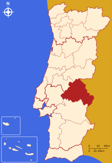
The Comunidade Intermunicipal do Alto Alentejo (Portuguese pronunciation: [ˈaltuɐlẽˈtɛʒu]; English: Upper Alentejo) is an administrative division in Portugal. It was created in 2009.[1] The seat of the intermunicipal community is Portalegre. Alto Alentejo is coterminous with the former Portalegre District. The population in 2011 was 118,506,[2] in an area of 6,084.34 km2.[3] Together with Alentejo Central it covers the area of the former Alto Alentejo Province. With Ponte de Sor the intermunicipal community also includes one municipality that lies in the area of the former Ribatejo Province.

Alto Alentejo is also a NUTS3 subregion of Alentejo Region, in Portugal. Since January 2015, the NUTS 3 subregion covers the same area as the intermunicipal community.[4]

Municipalities

The CIM Alto Alentejo is composed of 15 municipalities:[5]

Municipality Population (2011)[2] Area (km2)[3]
Alter do Chão 3,562 362.07
Arronches 3,165 314.65
Avis 4,571 605.97
Campo Maior 8,456 247.20
Castelo de Vide 3,407 264.91
Crato 3,708 398.07
Elvas 23,078 631.29
Fronteira 3,410 248.60
Gavião 4,132 294.59
Marvão 3,512 154.90
Monforte 3,329 420.25
Nisa 7,450 575.68
Ponte de Sor 16,722 839.71
Portalegre 24,930 447.14
Sousel 5,074 279.32
Total 118,506 6,084.34

References

  1. ^ CIM Alto Alentejo
  2. ^ a b Instituto Nacional de Estatística
  3. ^ a b "Áreas das freguesias, concelhos, distritos e país". Archived from the original on 2018-11-05. Retrieved 2018-11-05.
  4. ^ Adequação dos indicadores à nova organização territorial NUTS III / Entidades Intermunicipais, Instituto Nacional de Estatística, 18 March 2015
  5. ^ "Law nr. 75/2013" (PDF). Diário da República (in Portuguese). Assembly of the Republic (Portugal). Retrieved 18 August 2014.

External links

This page was last edited on 16 April 2024, at 01:20
Basis of this page is in Wikipedia. Text is available under the CC BY-SA 3.0 Unported License. Non-text media are available under their specified licenses. Wikipedia® is a registered trademark of the Wikimedia Foundation, Inc. WIKI 2 is an independent company and has no affiliation with Wikimedia Foundation.