
42°52′N 74°40′E / 42.867°N 74.667°E
Alamüdün
Аламүдүн району | |
|---|---|
 | |
| Country | Kyrgyzstan |
| Region | Chüy Region |
| Area | |
| • Total | 1,503 km2 (580 sq mi) |
| Population (2021)[1] | |
| • Total | 188,484 |
| • Density | 130/km2 (320/sq mi) |
| Time zone | UTC+6 |
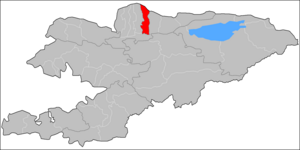
Alamüdün (Kyrgyz: Аламүдүн району) is a district of Chüy Region in northern Kyrgyzstan. Its area is 1,503 square kilometres (580 sq mi),[2] and its resident population was 188,484 in 2021.[1] Its administrative seat is Lebedinovka.[3] The district surrounds Bishkek, but does not include it, because the city forms a region-level unit of its own.[3]
YouTube Encyclopedic
-
1/1Views:3 108
-
Cengiz Aytmatov'un Dünyası (Chinghiz Aitmatov)
Transcription
Population
| Year | Pop. | ±% p.a. |
|---|---|---|
| 1970 | 88,455 | — |
| 1979 | 105,051 | +1.93% |
| 1989 | 116,325 | +1.02% |
| 1999 | 122,559 | +0.52% |
| 2009 | 148,032 | +1.91% |
| 2021 | 188,484 | +2.03% |
| Note: resident population; Sources:[2][1] | ||
Rural communities and villages
In total, Alamüdün District include 51 settlements in 17 rural communities (ayyl aymagy). Each rural community can consist of one or several villages. The rural communities and settlements in the Alamudun District are:[3][4]
- Ak-Döbö (seat: Kayyrma; incl. Moldovanovka)
- Ala-Archa (seat: Mramornoye; incl. Rassvet)
- Alamüdün (seat: Alamüdün; incl. Sadovoye)
- Arashan (seat: Arashan; incl. Tatyr)
- Baytik (seat: Baytik; incl. Archaly, Baygeldi, Bash-Kara-Suu and Kashka-Suu)
- Grozd (seat: Grozd; incl. At-Bashy, Birdik, Ekinchi Besh Jyldyk and Lesnoye)
- Kara-Jygach (seat: Kara-Jygach; incl. Bek-Too)
- Kök-Jar (seat: Kök-Jar)
- Lebedinovka (seat: Lebedinovka; incl. Vostok and Dachnoye)
- Lenin (seat: Lenin; incl. Konstantinovka and Mykan)
- Mayevka (seat: Mayevka)
- Oktyabr (seat: Oktyabr; incl. Lubyanoye and Chüy)
- Prigorodnoye (seat: Prigorodnoye; incl. Ozernoye, Stepnoye and Dostuk)
- Tash-Döbö (seat: Tash-Döbö; incl. Zarechnoye, Malinovka and Süymönkul Chokmorov)
- Tash-Moynok (seat: Koy-Tash; incl. Besh-Künggöy, Gornaya Mayevka, Kyzyl-Birdik, Podgornoye, Prokhladnoye and Tash-Moynok)
- Tömönkü Ala-Archa (seat: Tömönkü Ala-Archa)
- Vasilyevka (seat: Vinogradnoye; incl. Vasilyevka, Polevoye and Privolnoye)

Kayyrma
Moldovanovka
Mramornoe
Rassvet
Sadovoye
Vinogradnoye
Polevoye
Privolnoye
Grozd
At-Bashy
Birdik
Vtoraya Pyatiletka
Lesnoe
Vostok
Dachnoye
Konstantinovka
Lubyanoye
Chuyskoye
Ozernoye
Stepnoye
Dostuk
Tatyr
Kara-Jygach
Bek-Too
Archaly
Baygeldi
Bash-Karasu
Kashka-Suu
Zarechnoye
Malinovka
Gornaya Mayevka
Kyzyl Birdik
Prokhladnoye
Tash-Moynok
Settlements of the Alamudun District
References
- ^ a b c "Population of regions, districts, towns, urban-type settlements, rural communities and villages of Kyrgyz Republic" (XLS) (in Russian). National Statistics Committee of the Kyrgyz Republic. 2021. Archived from the original on 10 November 2021.
- ^ a b "2009 population and housing census of the Kyrgyz Republic: Chüy Region" (PDF) (in Russian). National Statistics Committee of the Kyrgyz Republic. 2010. pp. 13, 16.
- ^ a b c "Classification system of territorial units of the Kyrgyz Republic" (in Kyrgyz). National Statistics Committee of the Kyrgyz Republic. May 2021. pp. 67–69.
- ^ "List of rural communities of Kyrgyzstan". Archived from the original on 2010-02-09. Retrieved 2010-04-25.
| North Kyrgyzstan |
|  | ||||||||||
|---|---|---|---|---|---|---|---|---|---|---|---|---|
| South Kyrgyzstan |
| |||||||||||
Places adjacent to Alamüdün District | ||||||||||||||||
|---|---|---|---|---|---|---|---|---|---|---|---|---|---|---|---|---|
| ||||||||||||||||