
Abua–Odual
ABOLGA | |
|---|---|
| Nickname: Awe Abuan | |
| Motto: Land of Unity | |
 Abua–Odual  Abua–Odual | |
| Coordinates: 4°49′47″N 6°34′3″E / 4.82972°N 6.56750°E | |
| Country | Nigeria |
| State | Rivers State |
| Headquarters | Abua |
| Date created | 1 October 1900 |
| Government | |
| • Local Government Chairman | Daniel E. O. Daniel (PDP) |
| • Deputy Local Government Chairman | Igoma Laura Emnanuel (PDP) |
| • Local Government Council | Ward 1: Engoni Barigoma (PDP) Ward 2: Daniel Abia (PDP) W
Ward 4: Imaotu Owen (PDP) Ward 5: Abinoye Raymond Oyil (PDP) Ward 6: Mercy Igenewari (PDP) Ward 7: Peter Udubu (PDP) Ward 8: Ipeghan Egemu (PDP) Ward 9: Sokari Okpokikpoy (PDP) Ward 10: Enogho Ebogidi Maclean (PDP) Ward 11: Koginami Okpokpo (PDP) Ward 12: Solomon Geoffrey Okpokpo (PDP) Ward 13: Abigo Odi Izaboh (PDP) |
| Area | |
| • Land | 272 sq mi (704 km2) |
| Population (2006) | |
| • Total | 282,988 |
| Time zone | UTC+1 (WAT) |
 | |
Abua–Odual (also spelled as Abua/Odual) is a Local Government Area in Rivers State, Nigeria. Its headquarters is located in Ayama/Abua CentralAbua.
It has an area of 704 km2 and a population of 282,988 at the 2006 census. Abua consists of Otapha, Okpeden, Ogbo Abuan, and Emughan. Each has its own ruler and minimum of seven villages under it. Late Chief John Mark Miwori was a Justice of Peace in Emesu in 2007. The postal code of the area is 510102.[1]
References
- ^ "Post Offices- with map of LGA". NIPOST. Archived from the original on 7 October 2009. Retrieved 2009-10-20.
| LGAs | 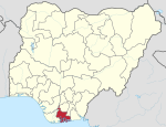 | |
|---|---|---|
This article about a location in Rivers State, Nigeria is a stub. You can help Wikipedia by expanding it. |