
 | |
| UTC time | 1980-07-29 14:58:40 |
|---|---|
| ISC event | 642643 |
| USGS-ANSS | ComCat |
| Local date | 29 July 1980 |
| Local time | 20:28:40 |
| Duration | 20 seconds |
| Magnitude | 6.6 Mw[1] |
| Depth | 15.0 km (9 mi)[1] |
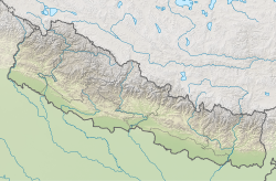
| Epicenter | 29°35′N 81°03′E / 29.58°N 81.05°E[1] |
| Fault | Main Himalayan Thrust[2] |
| Type | Reverse |
| Areas affected | Uttarakhand & Nepal |
| Total damage | $ 245 million[3]` |
| Max. intensity | VIII (Severe) |
| Foreshocks | 5.7 mb |
| Casualties | 200 dead, 5,600 injured |
The 1980 Nepal earthquake devastated the Nepal–India border region on the evening of July 29. The epicenter of the 6.6 Mw earthquake was located in Nepal, northwest of Khaptad National Park.[4] At least 200 people died and 5,600 were injured in the disaster. Extensive damage occurred on both sides of the border, amounting to 245 million USD (828.9 million in 2022).
Tectonic setting
The Himalaya is located at the convergent boundary where active convergence leads to continental collision. The India and Eurasian plates began colliding approximately 50 million years ago when the Tethys Ocean closed. The Main Himalayan Thrust (MHT), a decollement structure, defines the boundary between the Indian Plate and Eurasian Plate. The convergent zone also contains three other major faults; the Main Boundary Thrust (MBT), Main Central Thrust (MCT) and South Tibetan Detachment (STD). At the surface, the Main Himalayan Thrust propagates along the Main Frontal Thrust. These faults runs for approximately 2,300 km in an east-west direction, parallel to the southern foothills of the Lower Himalayan Range from Assam, through Nepal, and into Pakistan. This major thrust fault dips to the north, beneath the Himalaya at a shallow angle. It is the source of most of Himalayan earthquakes.[5][6]
Earthquakes on the convergent boundary are megathrust events that repeat every few centuries. Large Himalayan earthquakes including those in 1505, 1934 and 1950 with magnitudes of 8.0 to 8.9 were the result of rupturing the MHT. These events generated surface ruptures by breaching the surface via the Main Frontal Thrust. The Uttarakhand and west Nepal segment of the MHT was responsible for the Mw 7.8 1803 Garhwal earthquake as well as two smaller but deadly events in 1991 and 1999. Deadly earthquakes occurred in 1966, and an Mw 7.0 struck the same region in 1916.
Earthquake
The earthquake occurred as the result of shallow thrust faulting on the MHT boundary fault, between the MCT and the MBT. The rupture mechanism occurred on two separate fault planes; the latter corresponding to thrust faulting.[7] A small right-lateral strike-slip component was measured as well.[8]
Damage and casualties
The mainshock was preceded by a strong 5.7 mb foreshock almost three hours prior.[9] Severe shaking lasted 20 seconds during the mainshock. The death toll would have been higher if not for the foreshock which had residents on high alert, and driven them out of their homes.
A total of 13,258 homes were destroyed, making at least 30,000 homeless. The greatest damage was situated in a narrow zone between northwest Darchula and southeast Bajhang. An inspection after the earthquake found that tall buildings were the most damaged. Houses with heavy roofs made of slate were also found to be greatly affected. The report concluded that weak foundations and haphazard construction practices were responsible for the extensive damage observed.[10]
In the village of Moribagad, damage was minimal. The limited damage was, according to residents, because they followed the rules of their goddess. The rule stated that residents must not build a house with more than two floors, as a middle floor is forbidden. The next rule forbids slate roofs which were heavy, hence residents constructed lightweight thatch roofs.[10]
The Mahakali and Seti Zones suffered major impacts. Three districts in the zone; Bajhang, Baitadi, and Bajura were the most affected. Up to 40 people died in the districts and 2,000 were injured. An additional 5,000 families were left without homes.[11]
Several major towns in Darchula District were obliterated. At least 90 schools were totally destroyed in Bajhang. The Rastriya Samachar Samiti (RSS) reported 12 district official and 21 village buildings, as well as 65 temples were also destroyed. The cost of damage in the district was $ 10.3 million. Telecommunication services were affected, as did army barracks and police stations suffer damage. The earthquake occurred during the monsoon season which further affected communications and transport services in the aftermath due to landslides.[11]
See also
References
- ^ a b c ISC (2022), ISC-GEM Global Instrumental Earthquake Catalogue (1904-2018), Version 9.1, International Seismological Centre
- ^ Z. Ghazoui; S. Bertrand; K. Vanneste; Y. Yokoyama; J. Nomade; A. P. Gajurel; P. A. van der Beek (2019). "Potentially large post-1505 AD earthquakes in western Nepal revealed by a lake sediment record". Nature Communications. 10 (2258): 2258. Bibcode:2019NatCo..10.2258G. doi:10.1038/s41467-019-10093-4. PMC 6529449. PMID 31113962.
- ^ National Geophysical Data Center / World Data Service (NGDC/WDS) (1972), Significant Earthquake Database (Data Set), National Geophysical Data Center, NOAA, doi:10.7289/V5TD9V7K
- ^ "M 6.5 - 40 km NNE of Dipayal, Nepal". earthquake.usgs.gov. U.S. Geological Survey. Retrieved 9 January 2022.
- ^ Metcalfe, John (14 June 2016). "Study: Nepal Could Be Due for Another Major Earthquake". Bloomberg. Retrieved 12 Dec 2020.
- ^ Bilham, Roger (2019). "Himalayan earthquakes: a review of historical seismicity and early 21st century slip potential". Geological Society, London, Special Publications. 483 (1): 423–482. Bibcode:2019GSLSP.483..423B. doi:10.1144/SP483.16. Retrieved 23 April 2021.
- ^ Vinod Singh (1982). "Earthquake of July 1980 in Far Western Nepal". Journal of Nepal Geological Society. 2 (2).
- ^ Ichiro Nakanishi; Hiroo Kanamori (1984). "Source mechanisms of twenty-six large, shallow earthquake (M_S ≧ 6.5) during 1980 from P-wave first motion and long-period Rayleigh wave data" (PDF). Bulletin of the Seismological Society of America. 74 (3): 805–818. doi:10.1785/BSSA0740030805 (inactive 31 January 2024). ISSN 0037-1106.
{{cite journal}}: CS1 maint: DOI inactive as of January 2024 (link) - ^ "M 5.7 - 31 km ENE of Dipayal, Nepal". earthquake.usgs.gov. U.S. Geological Survey. Retrieved 9 January 2022.
- ^ a b Manandhar, Ramesh. "People's earthquake engineering in Nepal" (PDF).
{{cite journal}}: Cite journal requires|journal=(help) - ^ a b United States Agency for International Development (29 July 1980). "Disaster Case Report: NEPAL - Earthquake" (PDF). Washington D.C.: Office of Foreign Disaster Assistance.
External links
- The International Seismological Centre has a bibliography and/or authoritative data for this event.