
| 101 California Street | |
|---|---|
 In 2021 | |
 Location within San Francisco 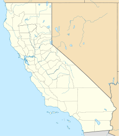 101 California Street (California)  101 California Street (the United States) | |
| Former names | Itel Building |
| General information | |
| Type | Commercial offices |
| Location | 101 California Street San Francisco, California |
| Coordinates | 37°47′34″N 122°23′53″W / 37.79285°N 122.39793°W |
| Construction started | 1979 |
| Completed | 1982 |
| Owner | Hines Interests Limited Partnership |
| Management | Hines Interests Limited Partnership |
| Height | |
| Roof | 183 m (600 ft) |
| Technical details | |
| Floor count | 48 |
| Floor area | 1,250,000 sq ft (116,000 m2) |
| Lifts/elevators | 32 |
| Design and construction | |
| Architect(s) | Philip Johnson / John Burgee Eli Attia Architects Kendall/Heaton Associates Inc. |
| Developer | Hines Interests Limited Partnership |
| Structural engineer | CBM Engineers |
| References | |
| [1][2][3][4] | |
101 California Street is a 48-story office skyscraper completed in 1982 in the Financial District of San Francisco, California. The 183 m (600 ft) tower, providing 1,250,000 sq ft (116,000 m2) of office space, is bounded by California, Davis, Front, and Pine Streets near Market Street.
YouTube Encyclopedic
-
1/5Views:19 5182 952787 124272 3533 381 344
-
Narrated Random Mediocre Drivelapse With Tangents: Touring part of San Francisco randomly by car
-
TOP 10 Tallest buildings in San Francisco
-
Los Angeles 1960s
-
Hands-only CPR Training
-
Ancient Mesopotamia 101 | National Geographic
Transcription
[Jazzy music] [Male narrator] Hello and welcome! Its been a while since I’ve done any drivelapses I don’t actually drive all that much, I mostly take public transit, and I haven’t had a lot of time lately But… here we go, I’m finally making one… So I hope you enjoy it I should say right up front, this is not one of those Russian drivelapses with the amazing accidents Its also not one of those videos where we’ll go around nitpicking all the little mistakes made by the other drivers although we will see a few bad drivers along the way This is not actually a planned drivelapse, I just started driving around totally randomly So this is a totally random drivelapse… I just drove wherever I felt like, often taking the path of least resistance depending upon the traffic So here’s the path I took This video almost didn’t happen because I screwed up a few things I set a a whole bunch of the settings on the camera totally wrong I didn’t mount the camera very well, so it jiggles around a bit and that caused some weird effects You’ll notice this weird thing where the video kind of shimmers and has that jello effect Kind of looks like when they’re trying to portray a flashback or something This is the result of the bad camera settings and the poor camera mounting, its not an earthquake or anything Let’s just pretend that it’s because you’re viewing a moment in the past through a time machine So this window into the past through the time machine looks a little blurry and shimmers a little I was going to throw away this footage, but then I watched it later and thought, you know, maybe I could make something out of this Because it is a somewhat interesting drive, so I took it as a challenge Because of all this, I’m calling this video: The “Random Mediocre Drivelapse” We’ll be taking a number of side trips along the way, “tangents” I call them So I’ll call it a “Random Mediocre Drivelapse with Tangents” And because I’ll be popping in and out every now and then with some narration and blabbing through most of it ah, let’s make it: “Narrated Random Mediocre Drivelapse with Tangents” The YouTube experts will be aghast at this title because you know you’re always supposed to make the video sound really fantastic so people will watch it They’d all say I should call it... [dramatic echoing] “My totally awesome and amazing drivelapse that you must see to believe” in order to get people to click on it But since this is a hobby for me, not a business, I don’t need to do stuff like that, I can do whatever I want [Jazzy background music starts] We’re starting out on Ninth Street in the South of Market neighborhood, heading north Coming up on the right we have a typical “SRO” hotel SRO stands for Single Room Occupancy In other words, a residential hotel where people pay by the day, week or month for a single room often with a shared bathroom at the end of the hall You see the most of these types of hotels in the Tenderloin, but they are in other places, too, such as here in SoMa I believe that the rent at this one is around $200 per week for one person in a single room And, there’s a Marijuana dispensary on the ground floor, so that’s convenient It’s interesting how this old building contrasts with the newly-built expensive high-rise condos directly behind it The building up ahead and slightly to the left is the Bill Graham Civic Auditorium named after famed concerto promoter Bill Graham, of course It holds about 7,000 people and was built in 1915 as part of the Panama–Pacific International Exposition They have a lot of concerts here They also have trouble with homeless people camping out around it, because of the location A while back they came up with a novel solution to that They started playing really obnoxious sounds and loud music through outdoor loudspeakers to discourage homeless people from hanging out there Kind of an interesting solution to that problem You can’t see from here, but City Hall is off to the left and the main public library is off to the right Up ahead to the left is a large 25-story building, the Phillip Burton Federal Building & United States Courthouse It has IRS, FBI and US Marshals offices, the US District Court for the Northern District of California and a lot of other federal offices As you might imagine, it has some security I went by to photograph it on a Sunday, when no one was around I was a little worried that I might get some flack from security for photographing But as it turned out I didn’t have any issues with security instead I had this guy here who seemed a little out of it, shall we say, and was constantly in my shots of the security entrance A few feet away, across the street, is Emperor Norton’s Boozeland I don’t actually know anything about this place, I just like the name, it has a great name Actually, it's a new place that recently re-opened, and I’ve heard some good things But I just like the name… Emperor Norton’s Boozeland By the way, we’re now in the Tenderloin Neighborhood which has a somewhat bad reputation Right here, we’re specifically in a sub-neighborhood called “Little Saigon” There’s a place off to the right by the UPS truck that is my favorite place to buy Vietnamese Sandwiches It's your classic hole in the wall with good food Most people get take-out, because the place is tiny and only has one table and it usually has a line of people going out the door The ladies that work in there, and they are all ladies for some reason, are really fast at making the sandwiches though so the line moves pretty fast This nondescript windowless building on the right is a PG&E building, I think there is just equipment inside there Along the side there is a place were people are known to lay out stuff on the sidewalk for sale sort of an impromptu flea market I’m told that the local homeless people call this “The wall” You find places like this around the Tenderloin where people try to sell stuff that they’ve found or scavenged or gotten somehow, I don’t know where they get it Sometimes I see what looks like someone’s last worldly possessions out for sale to get whatever money they can I don’t know if that’s true, but that’s what it looks like sometimes Gotta watch yourself at this corner, because they’ve got one of those red light cameras I see it flashing from time to time as I walk by, so it does seem to be operational Off to the right is one of the major adult theaters We won’t be going in there today, hope you don’t mind. Maybe we’ll visit there some other time… This corner here is one of those places where, every once in a while I’ll be walking by and there’ll be a woman pacing on the corner, cell phone out, and she’s just a little too unexpectedly friendly Or sometimes they’ll just give you that certain look and you know what’s going on Sometimes certain ones may look like women but look a little closer and you’ll see that’s not actually the case, they aren’t actually women But hey, you know, to each their own. Live and let live, that’s what I say. After we turn left, or west, onto California Street There’s a place here on the right called “Soda Popinski’s” Another case of a place I don’t actually know a lot about, but I just like the name… Soda Popinski’s... a great name! Here we encounter some Cable Cars It is a required by law that all videos of San Francisco have a Cable Car in them somewhere So we’ve now satisfied that requirement three times over [Cable car bell ringing] By the way, that’s a real cable car bell but in interests of full disclosure I actually recorded it somewhere else and substituted it in here for ‘atmosphere’ We’re now turning on to Van Ness Avenue. This is highway 101 north. Normally 101 is a freeway in most of California, but as it goes through San Francisco about 4 miles of it is just city streets There were plans at one time to have a whole network of freeways criss-crossing San Francisco Fortunately, due to something called the “Freeway revolt” in the late 1950’s and early 1960’s which involved neighborhood associations, the general public, and the SF supervisors all rising up against the department of highways and state government and therefore most of those proposed freeways were never built And most of the few that were built have since been torn down All these double-parkers on the right are because of a popular steakhouse over there We’re driving by at dinner time, so the valets are very busy Our light has already turned green for us but this impatient guy, who was held up by the two turning busses just blatantly runs his red light not really a very smart thing to do with a street as busy as Van Ness Here’s another view of this incident from another camera that was on the car has a wider angle of view and you can see just how blatant this was Van Ness Avenue was named after James Van Ness, San Francisco’s 7th mayor from 1855 to 1856 He left office under the terms of the Consolidation Act which was passed by the State Legislature This provided for the merger of city and county governments into one unit Ever since then, the city and county of San Francisco have been a single entity There are 27 other places in the U.S. where that same thing is true Here Highway 101 leaves Van Ness and turns left onto Lombard Street Most people are going to the left to follow 101 over to the Golden Gate Bridge, about 3 miles away but we’re going to continue down Van Ness Avenue We’re going to turn right onto Bay Street Van Ness continues for a couple more blocks ahead and then dead-ends at the bay, at Aquatic Park Aquatic Park is one of the places you go to watch July 4th Fireworks Fireworks in San Francisco are usually shot off over the bay, for safety reasons, obviously and they’re very often obscured by fog so they deliberately set them to explode lower than they would in most places Up ahead, you can actually see a little bit of the new span of the Bay Bridge and Treasure Island out in the Bay We’re now turning onto Hyde Street, which is the route of the Powell/Hyde Cable car You may notice the car shimmy back and forth a little here, the tires are actually slipping on the metal rails This hill is steep, but nothing for San Francisco It doesn’t even make it into the top 10 list of steepest streets in San Francisco This is about a 19% grade There are disputes as to which are the steepest streets but generally they’re in the range of 35-40% grade, so much steeper than this one Here we’re at the intersection with Lombard Street and off to the left is the so-called “world’s crookedest street” - Lombard Street but we’re not going there today, we’re gonna drive on by Hyde Street is named after George Hyde, who was alcalde of San Francisco in 1847 An “alcalde” is the traditional Spanish municipal magistrate. This was before San Francisco was part of the US At this point we’re currently going over top of the Broadway Street tunnel There’s a video elsewhere on my channel that includes that tunnel, so I suggest you check that out sometime Here you can see the GPS thinks I’m over on top of the roofs of the houses The GPS sometimes gets off a little within the city I think both tall buildings and the hills kind of throw it off It’ll get much worse when we’re among the tall buildings of downtown, later on in this video Off to the left is the “Hyde Out” bar. Another name that I like. Now back on California Street, we’re heading up to the top of Nob Hill Here we have yet another Cable Car Plus one of the many tour buses. Be sure to wave to the tourists! Next, we’re going to turn down Mason street, yet another steep hill It can be kind of interesting on these steep hills Depending on what type of car you have and how long the front is, sometimes you can’t really see what’s ahead of you and you just kinda have to take it on faith, go slow, and hope that there’s nothing in front of you Gonna have a little fun here, and go down the hill really fast [sound of tape rewinding] Okay, now that we’ve had our fun let’s back up and go down at a more reasonable speed [sound of tape rewinding] Mason Street is named after Colonel Richard B. Mason who was military governor of California at the time that gold was discovered He organized a workable government in California during two critical years during the wild times of the gold rush when not much help was coming from the federal government in Washington We’re skirting the edge of the Union Square area off to the left, a prime tourist area But only a couple of blocks off to the right is the Tenderloin neighborhood So this is an area where two very different neighborhoods meet and you can see quite a difference if you just walk a couple blocks in each direction We’re now turning onto Market Street, a major thoroughfare that cuts through the middle of San Francisco This part, however, is known as “mid-market” and is a section that has been very run down for quite some time They keep trying to revitalize it, only partially successfully so far Say hello to the people on the bus, there That’s the 21-Hayes that goes out to the edge of Golden Gate Park I was on a bus the other day and noticed that someone left me some chicken fried rice And you know, sometimes those bus rides can get just a little boring Off to the right is the old Hibernia Bank building This was an important building that was completed in 1892 famous for it’s grand architecture and housing one of the city’s first banks, and it survived the 1906 earthquake After the bank left, the building was used for a number of purposes, including even a police station But it has been vacant and neglected for over 20 years, and has become a haven for drug dealing and graffiti and things like that But recently it looks like it is going to finally be developed, possibly into a night club of some sort The GPS shows us wandering over toward U.N. Plaza We aren’t really, but since the GPS wants us to go there, let’s go take a look U.N. Plaza is one of the places where the Tenderloin neighborhood meets the run-down mid-market area that I mentioned earlier so it has kind of a checkered reputation A lot of homeless people hang out here and camp here and sometimes there have been problems with them using the fountain as a shower and/or toilet This is also one of those places with impromptu flea markets that I mentioned earlier I’ve heard it said that if you have something stolen this is one of the places where you should come to find it for sale It was designed as a monument for the United Nations because the original UN Charter was signed at the War Memorial Opera House, which is about two blocks west of here The tall monuments have the names of the member nations engraved on them Despite it’s problem with the homeless, various festivals and parades do take place here and there is a farmers market every Wednesday and Sunday, so it is not all terrible Well, let’s get back on track, regardless of what the GPS says We’re re-entering the Tenderloin neighborhood now And there goes a cop car. Not something unusual to see. Maybe we can cut over that way and see if there’s anything exciting going on that I can put into the video following at a safe distance of course so safe that he’s long gone, oh well Okay, off to the right there you can see a Tenderloin local hanging out pacing the corner, dressed a certain way I’ve seen her hanging out at this corner numerous times in the past You can draw your own conclusions as to what might or might not be going on there… We’re currently on Ellis Street, which is named after Alfred J. Ellis who was a member of the first California Constitutional Convention in 1849 which was part of the process of California becoming the 31st state He was a member of the Whig party, which disintegrated in the 1850’s and is no longer around There were four U.S. Presidents that were members of the Whig party, though I kind of wonder what Alfred J. Ellis would think of this street today. Now turning onto Polk Street And we have chanced upon that cop that we saw go by. But before we check that out, take note of this building straight ahead It is left over from the days when Van Ness Avenue, which is one block to the left of us, used to be “auto row” It was where all the car dealers were This was a Pierce-Arrow building, as you can see It is now a homeless shelter Pierce-Arrow was an auto manufacturer from 1901 to 1938, most well-known for expensive luxury cars There are still some auto dealers left on Van Ness, but not quite as much as there used to be. Looks like they have indeed detained someone there Much of Polk Street includes an area known as Polk Gulch It has a lot of bars, restaurants, and night life It tends to get rowdy around here on holidays such as St. Patrick’s day, and when there are significant sporting events True to form, the Polk Gulch area is often the final destination for a large portion of the SantaCon event that takes place each December Polk Street was named for James K. Polk, the 11th President of the United States. He was a Democrat, and defeated the Whig party candidate Polk Gulch goes on further, but I randomly decided to turn onto Clay street at this point Clay Street was named after Henry Clay, a Whig Senator from Kentucky who also served as Secretary of State So here we have another street named after a politician from the Whig Party Maybe I’ll have to rename this video to the “Whig Party Drivelapse”! Nice views of the Transamerica Pyramid there as we head towards Chinatown We’re now in Chinatown, about to cross Stockton Street. Stockton street is more of an everyday working street whereas the parallel Grant Avenue, which we’re going to come to soon, is the more touristy street Now turning onto Grant Avenue, one of the oldest streets in Chinatown It was originally called Dupont Avenue When San Francisco was rebuilt after the 1906 earthquake, it was renamed to Grant Avenue after President Ulysses S. Grant However, in Chinese, Grant Avenue is still written and said as “Dupont Avenue” Well, it’s a good thing I’m not hungry, otherwise we might have to pause this drivelapse while I go in and have some frog in hot and numbing spicy pot because everybody likes food that’s numbing I also like to eat live fish every once in a while, it’s only $28.95 but that numbing spicy pot is hard to beat Now turning onto Broadway, we’ll be leaving Chinatown and entering the North Beach neighborhood, also sometimes known as “Little Italy” This portion of Broadway is famous as a small so-called “red light” district with nightclubs and strip clubs North Beach got its name because a long time ago it used to actually be a beach on the northern end of the city However, as the bay has been filled in over the years, the city’s borders have been extended so it’s not a beach anymore but the name has stuck. San Francisco has been the scene for many movies, of course, and a number of San Francisco locations are famous because of it In this building off to the left used to be Enrico’s Italian Restaurant It is no longer there, having recently closed, although the sign is still there This has appeared in a number of movies, including Bullitt and the Dirty Harry movies I specifically remember a scene in the Dirty Harry movies where Dirty Harry meets one of his informants in this restaurant and they mention it by name, Enrico’s Okay, and here we have a really bad bus driver turning right in front of me against a red light You know, view-blocking gigantic buses are the natural enemy of anyone making a drivelapse video but at least this one, by being such a rude driver, gave me something to talk about, so what the heck And then, of course, after turning right in front of me, he’s going to turn left, of course, what else? You know, maybe I should turn this into one of those videos were we go around and document all the bad drivers… nah [no] As we turn here on Battery Street, we’re entering the Financial District It has the city’s largest concentration of corporate headquarters, law firms, insurance companies, real estate firms, banks, and financial institutions Battery Street got it’s name because a long time ago the Federal Government had a military battery here. Of course, it is long gone now On the right is the U.S. Customshouse, completed in 1911 It is a 6-story building, and not unusual for early buildings in San Francisco it’s foundation rests on timbers from the hull of a steamship that was abandoned during the gold rush days As we go around the corner onto Washington Street we can see an obviously newer addition to the U.S. Customshouse We’re driving right by one of San Francisco famous landmarks As you may have noticed, the GPS lags behind by a few seconds When the drivelapse continues, you’ll see that it actually thinks that we’re way up at the top going over the top of the pyramid The Transamerica Corporation is no longer here, but they still use it in their logo This building faced significant opposition when it was first proposed but over time has come to be appreciated as a favorite icon of San Francisco It has a beacon at the top that can shine in different colors, which is used for various significant events, such as holidays and sports victories Washington Street, as you might guess, was named after President George Washington Heading back across Chinatown, obviously Washington Street normally goes through here However it is currently closed due to construction of the new “Central Subway” — the T line This spot will be the Chinatown stop Construction on this subway started in 2010 and is supposed to be finished in 2019 It will be 1.7 miles in length, the majority underground The cost is projected to be over $1.5 billion As you can imagine, some people are a bit critical of that cost. We’re now on Stockton Street, named after Commodore Robert F. Stockton who was military governor of California for the first six months that California was part of the United States after the Mexican-American war in 1848 This is the Stockton Street Tunnel, which was completed in 1914 It is interesting that the tunnel for the new Central Subway, that we just talked about, is directly underneath this tunnel And this is the view from the top of the Stockton Street Tunnel looking back over Stockton Street — the route that we just came up Coming out the other end of the Tunnel, we’re square in the middle of the Union Square shopping area, no pun intended, a prime tourist area Turning right onto Sutter Street, named after John Sutter He arrived in 1839 and was quite an enterprising businessman with large land holdings, farms, and other businesses He was the Sutter who owned Sutter’s Mill, which is where gold was first discovered in 1848 and started the Gold Rush He tried to keep the discovery a secret, but failed, the news leaked out Sadly, his land was overrun with squatters, and he eventually lost his entire empire Now turning onto Powell Street, heading towards Union Square there off to the left At this point, as happens in San Francisco fairly frequently, we’ve encountered some sort of protest march I don’t know what they’re protesting, but they’re blocking traffic, so I turned left onto Post Street, with Union Square off to the right Post street is named after Gabriel Post, a merchant and state senator in the mid-1800’s I’m turning right again onto Grant Ave, to see if I can loop back around to Union Square This guy doing the illegal U-turn here is a cop in an unmarked car. I assume that has something to do with the protest march we just saw. And there goes a guitar player, on the way to somewhere or other… This constriction has been here for quite some time it is part of the construction for the new Central Subway it’s kind of annoying We’re now on Geary Street, a major street, and the construction has been creating this bottleneck here for quite some time One of the stops for the new subway will be here at Union Square Off to the left is Macy’s, and off to the right is Union Square Here’s a view of Union Square from Macy’s Union Square got its name because it was used for rallies for the Union Army during the civil war The tall monument commemorates Admiral George Dewey's victory at the Battle of Manila Bay during the Spanish American War It also commemorates U.S. President William McKinley The underground parking garage underneath was built in 1941 and is supposedly the world’s first underground parking structure, or so they claim There are many events that take place in Union Square, such as concerts and art shows There is the Christmas Tree lighting that takes place each year And in some years, SantaCon has shown up here, too Geary Street is named after John White Geary who was the first Postmaster of San Francisco and also the first mayor of San Francisco He was only in San Francisco for 3 years, but when he left he gave the city the land for Union Square Heading back through the Tenderloin here, continuing up Geary Street These red lanes to the right are supposed to be for buses & taxis only, but I think this is one of the most disregarded traffic laws ever Up here I made a rather embarrassing mistake I was trying to get through this intersection, around this ambulance The light was green, I thought I had enough time. Unfortunately, the light changed just as I went through. And as luck would have it, just as I started to go through all the traffic in front of me stopped leaving me stuck here in the crosswalk I don’t like it when people do that, and here I am doing it myself... Oh well, sorry everyone! Hmmm, guess I’ll have to put myself in that bad drivers compilation, won’t I? We’re about to cross Van Ness Avenue again and when we do we’ll be exiting the Tenderloin and entering the Cathedral Hill area Off to the right is the construction site of a new hospital There used to be a large hotel there that occupied the entire block I have another channel, called the “Hotel Demolition” channel, where I’ve been posting time-lapses and closeups of the demolition and I invite you to check out that channel if you like Here are a few scenes from that channel Hope you don’t mind a shameless plug for my other channel Cathedral Hill gets it name because of a number of churches that were built on this hill People have a propensity to build churches on hills Over time, those churches have become surrounded by other high-rise buildings in this case, residential buildings As we go over the top of Cathedral Hill, you can see the fog off to the west, waiting to come in You can barely see it from the car, but off to the left is the Chinese Consulate They have a lot of security because there are frequent protests here, for example about Tibet Here’s a protest a while ago that was about Vietnam, marching up over Cathedral Hill on their way to the Chinese Consulate You’ll notice that this was back when the hotel was still there Ahead and to the right is Japantown The tall monument you see there is The Peace Pagoda it's a five-tiered concrete stupa designed by Japanese architect Yoshiro Taniguchi and presented to San Francisco by the people of Osaka, Japan around 1968 A stupa is structure that usually contains buddhist relics They have a lot of events in this area such as the recent J-Pop festival, and you can find a video about that festival elsewhere on my channel We won’t be stopping at Japantown today We’re going to turn off of Geary Street Geary Street heads way out almost to the western edge of San Francisco almost to the Pacific Ocean We’re now turning onto Webster Street, which was named after Daniel Webster And, you guessed it, he was yet another Whig politician, a senator from Massachusetts Even though we’re about to turn onto the fancy-sounding Golden Gate Avenue this is not a particularly exciting or touristy neighborhood San Francisco has it’s everyday mundane parts, too No offense to the neighborhood The tall building ahead is the new headquarters of the San Francisco Public Utilities Commission In charge of providing water, power, and sewer service to SF One of “greenest” buildings you’ll find It includes an integrated hybrid solar array and wind turbine installation that generates about 7% of the building’s electricity needs It has onsite treatment and reclamation of its own wastewater, both gray and black, through a “Living Machine” system It has a rainwater harvesting system And the building was built with environmentally friendly and recycled materials To promote alternative transportation this 13-story building, which is home to 900 employees, has only 4 parking spaces And I wonder who gets those 4 spaces? Now we have our final questionable driving of this drivelapse This guy from the right pulls out in front after the light has changed in a busy street, blocking traffic, and stops, like a deer caught in the headlights and then, instead of going forward, he backs up slowly, continually blocking traffic Now lets see another view of this incident from the secondary camera The secondary camera doesn’t work very well in low light, which is why its the secondary camera I cleaned it up as best I could, but its still not the best quality, but you can see what’s going on So the light in my direction has already changed and this guy comes along and decides to make a right turn on red directly in front of traffic But that’s not the whole story If you look closely, you’ll see apparently at some point in the past he has run over a construction cone and is dragging it along and as he makes this turn it comes loose and he starts running over it which I guess maybe causes him to panic because he thought something’s going wrong or he ran over something, I don’t know Of course, I didn’t notice this when I was driving I only noticed this after I went back and reviewed the video So, yes, I could understand panicking if you get something caught underneath your car but this whole thing was precipitated by him running the red light in the first place, so… Anyway, there’s another item for the bad driver compilation which this drivelapse was not supposed to be but it did happen to capture quite a few, myself included Well, we’re nearing the end of our random drivelapse I thank you for sticking with me if you’re still here, I know this is a rather long video Doesn’t really fit the mold of your typical short YouTube videos designed for short attention spans, but oh well. You know, YouTube sometimes sends out these notifications, suggestions, tips They sent me this one [reading the notice] “In general, it seems like people are only watching part of your videos For tips on keeping viewers engaged, check the Creator Playbook” Well, gee thanks, YouTube for rubbing that in there, and implying that my videos aren’t exciting enough I guess I’m just not keeping you guys sufficiently entertained! Sorry about that! Well, that ends this drivelapse, my “Narrated Random Mediocre Drivelapse with Tangents” My first drivelapse in quite some time If you managed to stick it out all this time, hope you enjoyed it, and I’ll see you on the next one [Jazzy music for remainder of video] [Closed captions by Party of the Third Part] [Let me know if you found them useful, or have comments]
History
Singapore sovereign wealth fund bought 92% of the building from Nippon Life Insurance Company in 2012 for US$910 million.[5] Hines Interests Limited Partnership has a partial stake in the building.[5]
Description
The faceted cylindrical tower features a seven-story, glass-enclosed lobby and a granite plaza with flower beds and a fountain. During the holiday season, a platform with many oversized Christmas ornaments is added to the plaza. The building's entrance is very similar to that of 101 Park Avenue in New York City, and was also designed by Philip Johnson and John Burgee in 1982.
101 California is equipped with a total of thirty-two elevators, with twenty-two serving the tower; two serving floors 45 through 48; four serving the triangular annex building; two serving the garage; and two for freight.[6] The eight stairwells throughout the building are intended for emergency use only.[6]
1993 shooting
The building is the site of what has become known as the 101 California Street shootings, a mass murder which occurred there in 1993. On July 1, Gian Luigi Ferri, a disgruntled client of the law firm Pettit & Martin, entered their offices on the 34th floor and killed eight people and wounded six before killing himself. The event was a catalyst in the passage of the Violent Crime Control and Law Enforcement Act of 1994, a drive initiated by California Senator Dianne Feinstein to ban "assault weapons".[7] A terraced garden in the plaza in front of the building is now dedicated to the victims.
Notable tenants
- Booz & Company
- CBRE Group
- Beazley
- Susquehanna International Group
- Merrill Lynch
- Venable LLP
- Cooley LLP
- Deutsche Bank
- Morgan Stanley
- Winston & Strawn
- The Blackstone Group
- Business Wire
- Invesco
- Jefferies Group
- Grant Thornton LLP
- Chime
Gallery

-
 Tower street view
 -
 The seven-story, glass-enclosed lobby atrium
 -
 Plaza's terraced gardens
 -
 Tower from Market Street
See also
References
- ^ "101 California Street". CTBUH Skyscraper Center.
- ^ "Emporis building ID 118907". Emporis. Archived from the original on March 6, 2016.
- ^ "101 California Street". SkyscraperPage.
- ^ 101 California Street at Structurae
- ^ a b Andrew Nelson (2021-09-23). "Number 13: 101 California Street, Financial District, San Francisco". San Francisco YIMBY. Retrieved 2021-09-29.
- ^ a b Property Management Office (2010). "101 California Tenant Manual" (PDF). Hines. Hines Interests Limited Partnership: 5, 6. Archived from the original (.PDF) on 2011-07-15. Retrieved 2010-05-12.
- ^ Harriet Chiang (1 July 2003). "10 Years After: 101 California Massacre Victims Helped Toughen Gun Laws". The San Francisco Chronicle. Retrieved 2010-02-20.
Further reading
- Woodbridge, Sally B. (1992). San Francisco Architecture (Second ed.). San Francisco: Chronicle Books. pp. 35. ISBN 0-87701-897-9.
External links
- 101 California property website
- 101 California Archived 2009-11-30 at the Wayback Machine at Hines Interests Limited Partnership