
Yakutiye | |
|---|---|
District and municipality | |
 | |
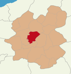 Map showing Yakutiye District in Erzurum Province | |
 Yakutiye Location in Turkey | |
| Coordinates: 39°54′18″N 41°16′23″E / 39.90500°N 41.27306°E | |
| Country | Turkey |
| Province | Erzurum |
| Government | |
| • Mayor | Mahmut Uçar (AKP) |
| Area | 945 km2 (365 sq mi) |
| Population (2022)[1] | 190,373 |
| • Density | 200/km2 (520/sq mi) |
| Time zone | TRT (UTC+3) |
| Area code | 0442 |
| Climate | Dfb |
| Website | www |
Yakutiye is a municipality and district of Erzurum Province, Turkey.[2] Its area is 945 km2,[3] and its population is 190,373 (2022).[1] It covers the central and northern part of the urban area of Erzurum. The district was created from part of the former central district of Erzurum in 2008.[4]
YouTube Encyclopedic
-
1/3Views:3 7651 064487
-
Ahırım Şahane-Yakutiye-Erzurum...
-
Yakutiye Medresesi Tarihe Yolculuk 4K UHD Erzurum
-
Yakutiye Araştırma Hastanesi Kalp Merkezi
Transcription
Geography
Aygır Lake is one of the lakes of Yakutiye district. It is located on Dumlu Mountain in the north.[5]
Composition
There are 44 neighbourhoods in Yakutiye District:[6]
- Akdağ
- Aktoprak
- Altınbulak
- Altıntepe
- Arıbahçe
- Çayırca
- Çayırtepe
- Çiftlik
- Dadaşköy
- Değirmenler
- Dumlu
- Gökçeyamaç
- Gülpınar
- Güngörmez
- Güzelova
- Güzelyayla
- İbrahimhakkı
- Karagöbek
- Karasu
- Kazımkarabekirpaşa
- Kırkgöze
- Kırmızıtaş
- Köse Mehmet
- Köşkköy
- Kurtuluş
- Lala Paşa
- Mülk
- Muratgeldi
- Muratpaşa
- Ömer Nasuhi Bilmen
- Ortadüzü
- Rabia Ana
- Şenyurt
- Soğukçermik
- Söğütyanı
- Şükrüpaşa
- Umudum
- Üniversite
- Uzunyayla
- Yazıpınar
- Yerlisu
- Yeşildere
- Yeşilova
- Yeşilyayla
References
- ^ a b "Address-based population registration system (ADNKS) results dated 31 December 2022, Favorite Reports" (XLS). TÜİK. Retrieved 12 July 2023.
- ^ Büyükşehir İlçe Belediyesi, Turkey Civil Administration Departments Inventory. Retrieved 12 July 2023.
- ^ "İl ve İlçe Yüz ölçümleri". General Directorate of Mapping. Retrieved 12 July 2023.
- ^ Kanun No. 5747, Resmî Gazete, 22 March 2008.
- ^ "Aygır Gölü Kapalı Devre Kamera Sistemiyle Gözetlenecek". erzurum.ktb.gov.tr (in Turkish). Retrieved 2023-10-04.
- ^ Mahalle, Turkey Civil Administration Departments Inventory. Retrieved 12 July 2023.
External links
Yakutiye in Erzurum Province of Turkey | |||||||||||||||||||||||||||
|---|---|---|---|---|---|---|---|---|---|---|---|---|---|---|---|---|---|---|---|---|---|---|---|---|---|---|---|
| Districts |   | ||||||||||||||||||||||||||
|
Metropolitan municipalities are bolded. | |||||||||||||||||||||||||||