
Villaflores Municipality | |
|---|---|
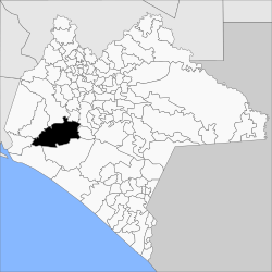 | |
 Villaflores Municipality Location in Mexico | |
| Coordinates: 15°46′N 92°16′W / 15.767°N 92.267°W | |
| Country | |
| State | Chiapas |
| Area | |
| • Total | 476 sq mi (1,232 km2) |
| Population (2010) | |
| • Total | 98,618 |
Villaflores Municipality is a municipality in the Mexican state of Chiapas in southern Mexico, and the name of its largest settlement and seat of the municipal government. Situated in the Sierra Madre de Chiapas range, the municipality has an area of approximately 1232 km2 at an average elevation of 540m above mean sea level. [1]
As of 2010, the municipality had a total population of 98,618.[2]
As of 2010, the city of Villaflores had a population of 37,237.[2] Other than the city of Villaflores, the municipality had 1,588 localities, the largest of which (with 2010 populations in parentheses) were: Jesús María Garza (6,724), Cristóbal Obregón (4,664), Guadalupe Victoria (Lázaro Cárdenas) (3,583), Benito Juárez (3,567), Cuauhtémoc (3,084), Nuevo México (3,014), Doctor Domingo Chanona (2,962), Villa Hidalgo (2,502), classified as urban, and Roblada Grande (1,729), Joaquín Miguel Gutiérrez (1,663), Francisco Villa (1,360), Libertad Melchor Ocampo (1,324), Agrónomos Mexicanos (1,202), Dieciséis de Septiembre (1,177), Ignacio Zaragoza (1,055), and Calzada Larga (1,049), classified as rural.[2]
Notes
- ^ INAFED (2005)
- ^ a b c "Villaflores". Catálogo de Localidades. Secretaría de Desarrollo Social (SEDESOL). Retrieved 2014-04-23.
References
- INAFED (Instituto Nacional para el Federalismo y el Desarrollo Municipal) (2005). "Villaflores, Estado de Chiapas". Enciclopedia de los Municipios de México (in Spanish) (online version at E-Local ed.). INAFED, Secretaría de Gobernación, Estado de Chiapas. Archived from the original on 2007-09-30. Retrieved 2008-07-07.
- INEGI (Instituto Nacional de Estadística, Geografía e Informática) (2006). "Chiapas: Población total por municipio, edad desplegada y grupos quinquenales de edad según sexo" (PDF). II Conteo de Población y Vivienda 2005. Resultados definitivos. Tabulados básicos (in Spanish). INEGI. Retrieved 2008-07-08.
External links
- H.Ayuntamiento de Villaflores, official website of the municipal authority (in Spanish)

This article about a location in the Mexican state of Chiapas is a stub. You can help Wikipedia by expanding it. |