
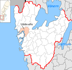
Uddevalla Municipality
Uddevalla kommun | |
|---|---|
 | |
 Coat of arms | |
 | |
| Coordinates: 58°21′N 11°55′E / 58.350°N 11.917°E | |
| Country | Sweden |
| County | Västra Götaland County |
| Seat | Uddevalla |
| Area | |
| • Total | 733.03 km2 (283.02 sq mi) |
| • Land | 637.69 km2 (246.21 sq mi) |
| • Water | 95.34 km2 (36.81 sq mi) |
| Area as of 1 January 2014. | |
| Population (31 December 2021)[2] | |
| • Total | 57,122 |
| • Density | 78/km2 (200/sq mi) |
| Time zone | UTC+1 (CET) |
| • Summer (DST) | UTC+2 (CEST) |
| ISO 3166 code | SE |
| Province | Bohuslän |
| Municipal code | 1485 |
| Website | www.uddevalla.se |
Uddevalla Municipality (Swedish: Uddevalla kommun) is a municipality in Västra Götaland County in western Sweden. Its seat is located in the city of Uddevalla.
The present municipality was created in 1971 when the City of Uddevalla (which had absorbed the rural municipality Bäve in 1945) was amalgamated with the surrounding municipalities Forshälla, Lane-Ryr, Ljungskile, Skredsvik and parts of Skaftö.
YouTube Encyclopedic
-
1/3Views:3 0765 905613
-
Uddevalla, Here I am
-
Bohuslän 2009 part 36: Uddevalla - Ljungskile
-
Bike trip to Norway 2008 (15): Färgelanda - Uddevalla
Transcription
Localities
Demographics
This is a demographic table based on Uddevalla Municipality's electoral districts in the 2022 Swedish general election sourced from SVT's election platform, in turn taken from SCB official statistics.[3]
In total there were 57,031 residents, including 43,062 Swedish citizens of voting age.[3] 45.7% voted for the left coalition and 52.3% for the right coalition.
| Location | Residents | Citizen adults |
Left vote | Right vote | Employed | Swedish parents |
Foreign heritage |
Income SEK |
Degree |
|---|---|---|---|---|---|---|---|---|---|
| % | % | ||||||||
| Ammenäs-Sund | 1,871 | 1,402 | 34.4 | 64.9 | 89 | 91 | 9 | 33,368 | 53 |
| Berg-Simmersröd | 1,620 | 1,217 | 45.5 | 52.7 | 84 | 90 | 10 | 27,348 | 60 |
| Bleket-S Dalaberg | 1,838 | 1,339 | 56.8 | 40.3 | 81 | 61 | 39 | 24,846 | 37 |
| Bokenäs-Dragsmark | 1,572 | 1,252 | 43.3 | 55.7 | 86 | 92 | 8 | 27,543 | 40 |
| Boxhult-N Unnaröd | 1,807 | 1,373 | 54.1 | 44.7 | 78 | 70 | 30 | 24,075 | 41 |
| Dalaberg-N Hovhult | 1,819 | 917 | 63.9 | 17.6 | 46 | 16 | 84 | 10,604 | 20 |
| Dramsvik-Forshälla | 1,630 | 1,255 | 38.2 | 61.0 | 88 | 93 | 7 | 30,000 | 41 |
| Fasseröd | 1,541 | 1,182 | 48.5 | 51.0 | 87 | 77 | 23 | 28,581 | 44 |
| Hedegärde-Vännerberg | 1,928 | 1,378 | 48.4 | 49.1 | 77 | 76 | 24 | 24,936 | 39 |
| Helenedal-N Uddevalla | 1,733 | 1,214 | 58.4 | 38.6 | 73 | 57 | 43 | 23,865 | 37 |
| Hovhult | 1,707 | 1,152 | 54.7 | 38.0 | 65 | 47 | 53 | 18,997 | 28 |
| Håljuteberget | 1,597 | 1,354 | 49.6 | 48.7 | 73 | 76 | 24 | 23,104 | 38 |
| Hälle-Skafteröd | 1,570 | 1,191 | 47.8 | 50.2 | 87 | 88 | 12 | 27,048 | 61 |
| Högås-Sundsandvik | 1,660 | 1,267 | 41.7 | 57.6 | 89 | 90 | 10 | 28,927 | 39 |
| Hönseberget | 1,622 | 1,295 | 46.9 | 50.7 | 71 | 72 | 28 | 21,374 | 33 |
| Kampenhof-Strömstadsv. | 1,310 | 1,125 | 47.4 | 50.6 | 75 | 69 | 31 | 23,292 | 31 |
| Kapelle | 1,887 | 1,484 | 45.5 | 53.2 | 83 | 87 | 13 | 27,938 | 44 |
| Karlsruhe-Elseberg | 1,639 | 1,235 | 47.0 | 50.7 | 76 | 73 | 27 | 24,716 | 37 |
| Kissleberg-Smedseröd | 1,776 | 1,290 | 43.0 | 56.6 | 87 | 87 | 13 | 28,903 | 43 |
| Kurveröd | 1,390 | 1,034 | 45.5 | 53.6 | 86 | 91 | 9 | 30,069 | 48 |
| Källdal-Misteröd | 2,154 | 1,558 | 37.7 | 61.6 | 89 | 89 | 11 | 32,633 | 51 |
| Lane-Ryr | 1,601 | 1,218 | 34.3 | 64.8 | 88 | 94 | 6 | 28,722 | 30 |
| Lyckorna-Grinneröd | 1,939 | 1,523 | 35.6 | 63.0 | 85 | 92 | 8 | 29,729 | 51 |
| Ridhuset-Folkets park | 1,644 | 1,452 | 49.3 | 49.9 | 79 | 81 | 19 | 22,754 | 35 |
| Skogslyckan | 1,600 | 1,105 | 51.2 | 44.2 | 61 | 54 | 46 | 17,028 | 26 |
| Skredsvik-Hogstorp | 1,709 | 1,285 | 37.9 | 61.0 | 87 | 89 | 11 | 28,700 | 34 |
| Stenbacken-Karlsberg | 1,577 | 1,247 | 41.5 | 57.1 | 78 | 80 | 20 | 24,614 | 39 |
| Tureborg-Vadbacken | 2,005 | 1,155 | 59.6 | 33.0 | 55 | 34 | 66 | 14,960 | 30 |
| Ulvesund-Resteröd | 1,682 | 1,279 | 48.1 | 50.1 | 83 | 87 | 13 | 27,697 | 52 |
| Unneröd-Ramneröd | 1,452 | 1,146 | 51.8 | 46.4 | 68 | 70 | 30 | 20,141 | 31 |
| Utby-Lanesund | 1,762 | 1,421 | 38.7 | 60.7 | 87 | 92 | 8 | 30,989 | 45 |
| Walkesborg-Bohusgården | 1,668 | 1,403 | 48.4 | 50.1 | 81 | 79 | 21 | 24,187 | 38 |
| Äsperöd-Ängebacken | 1,436 | 1,174 | 43.0 | 56.0 | 84 | 84 | 16 | 26,289 | 33 |
| Österberget | 1,285 | 1,140 | 45.7 | 53.0 | 84 | 85 | 15 | 26,342 | 41 |
| Source: SVT[3] | |||||||||
References
- ^ "Statistiska centralbyrån, Kommunarealer den 1 januari 2014" (in Swedish). Statistics Sweden. 2014-01-01. Archived from the original (Microsoft Excel) on 2016-09-27. Retrieved 2014-04-18.
- ^ "Folkmängd i riket, län och kommuner 31 december 2021" (in Swedish). Statistics Sweden. February 22, 2022. Retrieved February 22, 2022.
- ^ a b c "Valresultat 2022 för Uddevalla i riksdagsvalet" (in Swedish). SVT. 11 September 2022. Retrieved 3 February 2024.
External links
 Media related to Uddevalla Municipality at Wikimedia Commons
- Uddevalla Municipality - Official site
Places adjacent to Uddevalla Municipality | ||||||||||||||||
|---|---|---|---|---|---|---|---|---|---|---|---|---|---|---|---|---|
| ||||||||||||||||
| International | |
|---|---|
| National | |
| Geographic | |