
Triesen | |
|---|---|
 Chapel Saint Mamerten | |
|
Flag  Coat of arms | |
Location of Triesen  | |
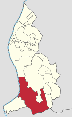 Triesen in Liechtenstein | |
| Coordinates: 47°6′N 9°32′E / 47.100°N 9.533°E | |
| Country | |
| Electoral district | Oberland |
| Villages | Lawena, Valüna |
| Area | |
| • Total | 26.47 km2 (10.22 sq mi) |
| Elevation | 512 m (1,680 ft) |
| Population (31-12-2019)[1] | |
| • Total | 5,275 |
| • Density | 200/km2 (520/sq mi) |
| Time zone | UTC+1 (CET) |
| • Summer (DST) | CEST |
| Postal code | 9495 |
| Area code | 7002 |
| ISO 3166 code | LI-09 |
| Website | www.triesen.li |
Triesen (German pronunciation: [ˈtʁiːzn̩] ⓘ) is the third largest municipality in Liechtenstein. It contains several historic churches dating from the fifteenth century. It also has a weaving mill from 1863 that is considered a historical monument. The population is around 5,275.
YouTube Encyclopedic
-
1/3Views:3193782 985
-
120504 Weiterführende Schulen Triesen
-
Triesen in Liechtenstein April 2012
-
Driving through Liechtenstein 6 - Vaduz to Triesen
Transcription
Geography
The municipality includes the highest point of Liechtenstein, the Grauspitz, at 2,599 metres (8,527 feet) above sea level. It is located between Vaduz, Triesenberg and Balzers.
History
The settlements of Triesen, as the state archaeologists have found during excavations, were destroyed in natural disasters. The detailed picture of the place Triesen shows that all settlement phases were terminated by the forces of nature. It has been demonstrated that the settlements of the Bronze Age and the Iron Age were repeatedly destroyed by floods and landslides.
The coat of arms of the municipality Triesen consists of a shield with three superimposed silver scythes on a blue background.
Tourist attractions
Attractions in the Triesen area include:
- Die Pfarrkirche St. Gallus, built in 1455 and rebuilt in 1994, a square hall church
- Die St.-Mamerta-Kapelle, the oldest chapel in the country, built in the 9th or early 10th century
- Die Marienkapelle, a Romanesque building from the early 13th century
- Das Kosthaus, an 1873-built working-class house
- Kulturzentrum Gasometer, the Cultural Centre, with art exhibitions and other events
- The Lawena Museum of electricity at Lawena Power Station[2]
Notable people
- Franz Burgmeier (born 1982 in Triesen) retired footballer, who last played as a midfielder for FC Vaduz
- Ursula Konzett (born 1959 in Triesen) a former Alpine skier
Gallery
-
 Parish church Sankt Gallus
 -
 Cultural Centre Gasometer
References
- ^ https://www.llv.li/files/as/bevolkerungsstatistik-30-juni-2017.pdf[bare URL PDF]
- ^ "The Lawena Museum". Liechtenstein Tourism. Retrieved 2 December 2016.
External links
| International | |
|---|---|
| National | |
| Geographic | |
| Other | |