
Tizi Ouzou
Tizi Wezzu تيزي وزو ⵟⵉⵣⵉ ⵡⵣⵣⵓ | |
|---|---|
 | |
| Nickname: "The Capital Of Djurdjura" | |
 | |
 Tizi Ouzou | |
| Coordinates: 36°43′N 4°3′E / 36.717°N 4.050°E | |
| Country | |
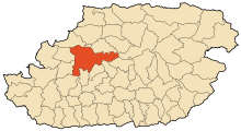
| Province | Tizi Ouzou Province |
| District | Tizi Ouzou District |
| Area | |
| • Total | 102.36 km2 (39.52 sq mi) |
| Population (2008 census) | |
| • Total | 135,088[1] |
| Time zone | UTC+1 (CET) |
| Postal code | 15000 |
| Climate | Csa |
| Website | www |
Tizi Ouzou or Thizi Wezzu (Arabic: تيزي وزو, Kabyle: Tizi Wezzu) is a city in north central Algeria, and capital of Tizi Ouzou Province and Tizi Ouzou District. It is among the largest cities in Algeria. It is the second most populous city in the Kabylia region after Béjaïa.
History
Foundation
Tizi Ouzou was founded in 1856, after the successful expedition of France against Kabyle tribes.[2]
Etymology
The name Tizi Ouzou is made up of two Kabyle words: Tizi meaning col, and Ouzou (from Azzu) meaning Genisteae. The full name of the locality therefore means "the col of the Genisteae".[3]
Friction
Islamists looted, and burned to the ground, a Pentecostal church on 9 January 2010. The pastor was quoted as saying that worshipers fled when local police left a gang of local rioters unchecked.[4]
Geography
This city is located in the heart of Kabylie. It is 102.36 square kilometres (39.52 sq mi) in area. Tizi Ouzou is located in the valley of Assif N Sébaou. It is surrounded by mountains. The city is at an altitude of 200 metres (660 ft). It is bounded on the north by Mount Belloua which rises to 850 metres (2,790 ft) above sea level. A portion of the old city of Tizi Ouzou (known as the High City) backed the east slopes of the mountain. At the top of the mountain Belloua lies the village of Redjaouna. The latter is attached to the town of Tizi Ouzou.[citation needed]
Climate
Tizi Ouzou experiences a hot Mediterranean climate (Köppen climate classification Csa).
| Climate data for Tizi Ouzou (1991–2020) | |||||||||||||
|---|---|---|---|---|---|---|---|---|---|---|---|---|---|
| Month | Jan | Feb | Mar | Apr | May | Jun | Jul | Aug | Sep | Oct | Nov | Dec | Year |
| Record high °C (°F) | 24.1 (75.4) |
30.0 (86.0) |
34.4 (93.9) |
37.8 (100.0) |
41.0 (105.8) |
44.4 (111.9) |
47.2 (117.0) |
46.5 (115.7) |
43.0 (109.4) |
40.5 (104.9) |
31.9 (89.4) |
27.0 (80.6) |
47.2 (117.0) |
| Mean daily maximum °C (°F) | 15.5 (59.9) |
16.5 (61.7) |
19.4 (66.9) |
21.9 (71.4) |
26.2 (79.2) |
31.7 (89.1) |
35.9 (96.6) |
36.2 (97.2) |
31.4 (88.5) |
26.8 (80.2) |
20.2 (68.4) |
16.4 (61.5) |
24.8 (76.6) |
| Daily mean °C (°F) | 10.9 (51.6) |
11.5 (52.7) |
14.0 (57.2) |
16.3 (61.3) |
20.1 (68.2) |
24.8 (76.6) |
28.6 (83.5) |
29.0 (84.2) |
25.1 (77.2) |
21.0 (69.8) |
15.5 (59.9) |
12.1 (53.8) |
19.1 (66.4) |
| Mean daily minimum °C (°F) | 6.3 (43.3) |
6.5 (43.7) |
8.6 (47.5) |
10.6 (51.1) |
14.0 (57.2) |
18.0 (64.4) |
21.3 (70.3) |
21.9 (71.4) |
18.9 (66.0) |
15.2 (59.4) |
10.8 (51.4) |
7.7 (45.9) |
13.3 (55.9) |
| Record low °C (°F) | −3.0 (26.6) |
−0.6 (30.9) |
0.0 (32.0) |
1.7 (35.1) |
3.5 (38.3) |
8.1 (46.6) |
13.5 (56.3) |
15.5 (59.9) |
11.0 (51.8) |
6.4 (43.5) |
1.2 (34.2) |
0.3 (32.5) |
−3.0 (26.6) |
| Average precipitation mm (inches) | 124.4 (4.90) |
92.6 (3.65) |
81.6 (3.21) |
79.6 (3.13) |
55.9 (2.20) |
10.7 (0.42) |
2.4 (0.09) |
5.5 (0.22) |
37.8 (1.49) |
65.2 (2.57) |
113.6 (4.47) |
120.0 (4.72) |
789.3 (31.07) |
| Average precipitation days (≥ 1.0 mm) | 10.5 | 9.7 | 8.3 | 7.5 | 5.2 | 1.8 | 0.6 | 1.5 | 4.6 | 6.4 | 10.1 | 9.9 | 76.1 |
| Source: NOAA[5] | |||||||||||||
Demographics
There are 135,088 people in 2008.[6]
Education
Mouloud Mammeri University of Tizi-Ouzou is the local university. There are three campuses: Campus Hasnaoua I, Campus Hasnaoua II, and Campus Tamda. [7]
Sport
The local professional football team is JS Kabylie that is considered one of the most historical clubs in Algeria.
Economy
Agriculture (dairy industry) and some factories brick factories, pharmaceutical factories (Novo Nordisk).
Notable people
- Mohamed Belhocine, Algerian medical scientist, professor of internal medicine and epidemiology
- Hamza Bendelladj, Algerian cyber-criminal
- Faiza Lalam, Africa's first woman neurosurgeon
- Issad Rebrab, Algerian billionaire businessman
- Youcef Dris, writer and journalist
References
- ^ Recensement 2008 de la population algérienne, wilaya de Tizi Ouzou, sur le site de l'ONS Archived 2018-07-23 at the Wayback Machine.
- ^ Crescenzo, Jean de (2005). Chroniques Tizi-ouziennes (in French). Lulu.com. ISBN 978-2-9525841-0-4. Archived from the original on 2024-05-21. Retrieved 2023-10-30.
- ^ Foudil Cheriguen, Toponymie algérienne des lieux habités (les noms composés), Alger, Épigraphe, 1993, p. 155-156
- ^ "Protestant Church Burned in Algeria". New York Times. New York, New York. The Associated Press. 11 January 2010.
- ^ "Tizi Ouzou Climate Normals 1991–2020". World Meteorological Organization Climatological Standard Normals (1991–2020). National Oceanic and Atmospheric Administration. Archived from the original on 28 September 2023. Retrieved 28 September 2023.
- ^ Recensement 2008 de la population algérienne, wilaya de Tizi Ouzou, sur le site de l'ONS Archived 2018-07-23 at the Wayback Machine.
- ^ "Accueil > Université > Album photos Archived 2015-09-28 at the Wayback Machine." Mouloud Mammeri University of Tizi-Ouzou. Retrieved on 28 September 2015.
External sources
- Jonathan Oaks: Algeria. Bradt Travel Guides 2008, ISBN 978-1-84162-232-3, p. 110 (restricted online version (Google Books))
- "Geographical information on Tizi Ouzou, Algeria". Falling Rain Genomics, Inc. Retrieved 27 April 2008.
36°43′N 4°03′E / 36.717°N 4.050°E


| International | |
|---|---|
| National | |
| Other | |