Tamalous
تمالوس | |
|---|---|
Commune and town | |
 | |
 | |
| Coordinates: 36°50′10″N 6°38′30″E / 36.83611°N 6.64167°E | |
| Country | |
| Province | Skikda Province |
| Area | |
| • Total | 142.12 sq mi (368.09 km2) |
| Population (2008) | |
| • Total | 51,262 |
| Time zone | UTC+1 (CET) |
| Postal code | 21005 |
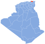
Tamalous (Arabic: تمالوس, romanized: Tamālūs) is a town and commune in Skikda Province in north-eastern Algeria. According to the 2008 census it has a population of 23,728.[1]
YouTube Encyclopedic
-
1/1Views:600
-
Les Tamalous et les Tapamals font Mafate
Transcription
Geography
Climate
The climate is warm and temperate in Tamalous. There is more rainfall in the winter than in the summer. The Köppen-Geiger climate classification is Csa. The average annual temperature is 62.7 °F (17.1 °C). The annual rainfall is 25.66 inches (652 mm).[2]
| Climate data for Tamalous, Skikda (1991-2021 normals) | |||||||||||||
|---|---|---|---|---|---|---|---|---|---|---|---|---|---|
| Month | Jan | Feb | Mar | Apr | May | Jun | Jul | Aug | Sep | Oct | Nov | Dec | Year |
| Average high °F (°C) | 56.8 (13.8) |
57.3 (14.1) |
62.7 (17.1) |
67.4 (19.7) |
73.9 (23.3) |
82.7 (28.2) |
89.7 (32.1) |
90 (32) |
82.4 (28.0) |
76.3 (24.6) |
65.1 (18.4) |
58.8 (14.9) |
71.9 (22.2) |
| Daily mean °F (°C) | 48.7 (9.3) |
48.9 (9.4) |
53.5 (11.9) |
58.1 (14.5) |
64.5 (18.1) |
72.7 (22.6) |
78.7 (25.9) |
79 (26) |
73.1 (22.8) |
67 (19) |
57 (14) |
50.9 (10.5) |
62.7 (17.0) |
| Average low °F (°C) | 41.5 (5.3) |
41.1 (5.1) |
44.8 (7.1) |
49 (9) |
55 (13) |
62.4 (16.9) |
68 (20) |
69.1 (20.6) |
65.1 (18.4) |
59.1 (15.1) |
49.9 (9.9) |
44 (7) |
54.1 (12.3) |
| Average precipitation inches (mm) | 3.3 (84) |
3.0 (77) |
2.9 (73) |
2.6 (66) |
2.0 (50) |
0.5 (13) |
0.2 (4) |
0.6 (16) |
1.6 (41) |
2.4 (61) |
3.2 (81) |
3.4 (86) |
25.7 (652) |
| Average precipitation days | 9 | 8 | 8 | 8 | 5 | 2 | 1 | 3 | 6 | 7 | 9 | 8 | 74 |
| Average relative humidity (%) | 80 | 78 | 77 | 76 | 73 | 64 | 58 | 60 | 68 | 72 | 76 | 79 | 72 |
| Mean daily sunshine hours | 6.3 | 6.9 | 8.0 | 9.2 | 10.5 | 12.0 | 12.4 | 11.3 | 9.6 | 8.4 | 7.0 | 6.3 | 9.0 |
| Source: climate-data.org[2] | |||||||||||||
Demographics
| Year | 1998 | 2008 |
|---|---|---|
| Population | 16,017 | 23,728 |
References
- ^ a b "Tamalous (Tamalous, Skikda, Algeria) - Population Statistics, Charts, Map, Location, Weather and Web Information". www.citypopulation.de. Archived from the original on 20 June 2019. Retrieved 20 June 2022.
- ^ a b "Tamalous climate: Average Temperature, weather by month, Tamalous weather averages - Climate-Data.org". en.climate-data.org. Archived from the original on 20 June 2022. Retrieved 20 June 2022.


