
Tama
多摩区 | |
|---|---|
| Tama Ward | |
 Tama Ward Office | |
 Flag | |
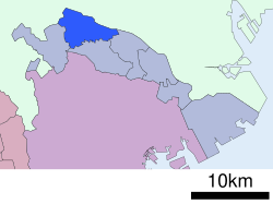 Location of Tama in Kanagawa Prefecture | |
 Tama | |
| Coordinates: 35°37′11″N 139°33′43″E / 35.61972°N 139.56194°E | |
| Country | Japan |
| Region | Kantō |
| Prefecture | Kanagawa |
| City | Kawasaki |
| Established | April 1, 1972 |
| Area | |
| • Total | 20.49 km2 (7.91 sq mi) |
| Population (March 2010) | |
| • Total | 211,221 |
| • Density | 10,310/km2 (26,700/sq mi) |
| Time zone | UTC+9 (Japan Standard Time) |
| - Tree | Flowering Dogwood, Nashi Pear |
| - Flower | Viola, Peach |
| Address | 1775-1 Noborito, Tama-ku Kawasaki-shi, Kanagawa-ken 214-8570 |
| Website | www |
Tama-ku (多摩区) is one of the seven wards of the city of Kawasaki in Kanagawa Prefecture, Japan. As of 2010, the ward has an estimated population of 211,221 and a population density of 10,310 persons per km2. The total area is 20.49 km2.
YouTube Encyclopedic
-
1/5Views:5 048741670988770
-
Japan Walk [Walking Tour] japan walking tour - Kanagawa Kawasaki Tama River Japan 0007 (1080p/60fps)
-
中野島 駅のレトロな時計台 川崎市多摩区 南武線 "Nakanoshima" kawasaki Japan【City Walk:日本街歩き】 _Local Filma_
-
”Ikuta Kawasaki Japan” -明治大学生でにぎわう街- 生田 川崎 神奈川【 Night rain Walk:日本街歩き】 _Local Filma_
-
Meiji University a private university with campuses in Tokyo and Kawasaki
-
桜満開の二ヶ領用水と渋川(住吉ざくら) ~宿河原・久地円筒分水・中原 Kawasaki City Spring
Transcription
Geography
Tama Ward is located in eastern Kanagawa Prefecture, in the far northeastern corner of the city of Kawasaki, bordering on Tokyo. It is bordered to the north by the Tama River
Surrounding municipalities
- Takatsu-ku, Kawasaki
- Miyamae-ku, Kawasaki
- Asao-ku, Kawasaki
- Setagaya-ku, Tokyo
- Chōfu, Tokyo
- Komae, Tokyo
- Inagi, Tokyo
History
The area around present-day Tama Ward has been inhabited for thousands of years. Archaeologists have found kofun along the banks of the Tama River and at other locations in the Ward. Under the Nara period Ritsuryō system, it was divided between Tachibana District, Tama District and Tsutsuki District in Musashi Province. By the Heian period it was part of a shōen controlled by the Inage clan. By the Kamakura period, it was controlled by their descendants, the Ozawa clan, and in the Muromachi period by the Terao clan. During the Sengoku period, the area was a contested territory between the Uesugi clan and the Later Hōjō clan from Odawara, who emerged in control by 1530. The area was devastated by flooding when the Tama River shifted course to the north in 1590. After the defeat of the Hōjō at the Battle of Odawara, the territory came under the control of Tokugawa Ieyasu. It was administered as tenryō territory controlled directly by the Tokugawa shogunate, but administered through various hatamoto. From 1725, the 52 villages of the area were a designated zone for Falconry by the Tokugawa shōguns, but suffered from repeated natural disasters: an earthquake in 1782, floods in 1786, famine in 1787, floods in 1790, 1791 and 1809 and earthquake in 1855.
After the Meiji Restoration, the area was transferred to the new Kanagawa Prefecture, and divided into several villages within Tachibana District and Tsuzuki District, Kanagawa on April 1, 1889. These areas were annexed by the neighboring city of Kawasaki from 1938 to 1939. The area became Tama Ward with the division of the city of Kawasaki into wards from April 1972. In July 1982, Asao Ward was separated from Tama Ward. A new Ward Office was completed in 1997.
Economy
Tama Ward is largely a regional commercial center and bedroom community for central Kawasaki and Tokyo. Several factories producing chemical, glass, and electronics are located in the ward, and there is some residual agriculture (primarily horticulture and market vegetables).
Transportation
Rail
- JR East - Nambu Line
- Keiō Corporation – Keiō Sagamihara Line
- Odakyu Electric Railway – Odakyū Odawara Line
Highways
Prefecture roads
- Kanagawa Prefectural Road 3
- Kanagawa Prefectural Road 9
- Kanagawa Prefectural Road 13
- Kanagawa Prefectural Road 124
Local attractions


- Nihon Minka-en Museum
- Taro Okamoto Museum of Art
- Yomiuriland
- Fujiko F. Fujio Museum[1]
Education
Tertiary:
- Senshu University – Ikuta campus
- Meiji University – Ikuta campus
- Japan Women's University – Nishiikuta campus
Municipal junior high schools:[2]
Municipal elementary schools:[3]
Private primary and secondary
Notable people from Tama Ward
- Koji Miyoshi, Football player
- Shigefumi Matsuzawa, politician
- Hikaru Nishida, actress
- Yūji Oda, actor
- Takayuki Ohira, engineer, inventor
References
- ^ "Fujiko·F·Fujio Museum, in Kawasaki-city | 川崎市 藤子・F・不二雄ミュージアム".
- ^ "多摩区の中学校一覧". Kawasaki Combined Education Center. Retrieved 2022-12-27.
- ^ "多摩区の小学校一覧". Kawasaki Combined Education Center. Retrieved 2022-12-27.
External links
| Yokohama |
| |||
|---|---|---|---|---|
| Kawasaki |
| |||
| Sagamihara |
| |||
| Core city | ||||
| Special cities | ||||
| Cities | ||||
| Districts | ||||
| International | |
|---|---|
| National | |
| Geographic | |