
Shirosato
城里町 | |
|---|---|
 Shirosato town hall | |
 Flag  Seal | |
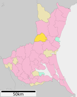 Location of Shirosato in Ibaraki Prefecture | |
 Shirosato | |
| Coordinates: 36°28′45.2″N 140°22′34.4″E / 36.479222°N 140.376222°E | |
| Country | Japan |
| Region | Kantō |
| Prefecture | Ibaraki |
| District | Higashiibaraki |
| Area | |
| • Total | 161.80 km2 (62.47 sq mi) |
| Population (September 2020) | |
| • Total | 18,044 |
| • Density | 110/km2 (290/sq mi) |
| Time zone | UTC+9 (Japan Standard Time) |
| - Tree | Castanopsis sieboldii |
| - Flower | Lilium auratum |
| - Bird | Japanese bush warbler |
| Phone number | 029-288-3111 |
| Address | 1428-25 Ishizuka, Shirosato-machi, Higashiibaraki-gun, Ibaraki-ken 311-4391 |
| Website | Official website |

Shirosato (城里町, Shirosato-machi) is a town located in Ibaraki Prefecture, Japan. As of 1 July 2020[update], the town had an estimated population of 18,128 in 7214 households and a population density of 112 persons per km2. The percentage of the population aged over 65 was 37.6%.[1] The total area of the town is 161.80 square kilometres (62.47 sq mi).
Geography
Located in central-west Ibaraki Prefecture, Shinsato is bordered by Tochigi Prefecture to the west. The Naka River passes through the town.
Surrounding municipalities
Tochigi Prefecture
Climate
Shirosato has a Humid continental climate (Köppen Cfa) characterized by warm summers and cold winters with heavy snowfall. The average annual temperature in Shirosato is 13.6 °C. The average annual rainfall is 1390 mm with September as the wettest month. The temperatures are highest on average in August, at around 25.2 °C, and lowest in January, at around 2.8 °C.[2]
Demographics
Per Japanese census data,[3] the population of Shirosato has declined in recent decades.
| Year | Pop. | ±% |
|---|---|---|
| 1920 | 19,684 | — |
| 1930 | 21,052 | +6.9% |
| 1940 | 21,228 | +0.8% |
| 1950 | 28,010 | +31.9% |
| 1960 | 24,646 | −12.0% |
| 1970 | 21,176 | −14.1% |
| 1980 | 20,461 | −3.4% |
| 1990 | 20,721 | +1.3% |
| 2000 | 23,007 | +11.0% |
| 2010 | 21,491 | −6.6% |
| 2020 | 18,097 | −15.8% |
History
Shirosato was formed on February 1, 2005, from the merger of the town of Jōhoku, the village of Katsura, both from Higashiibaraki District, and the village of Nanakai, from Nishiibaraki District.[4]
Government
Shirosato has a mayor-council form of government with a directly elected mayor and a unicameral town council of 14 members. Shirosato, together with city of Mito, contributes seven members to the Ibaraki Prefectural Assembly. In terms of national politics, the city is part of Ibaraki 1st district of the lower house of the Diet of Japan.
Economy
The economy of Shirosato is primarily agricultural.
Education
Shirosato has five public elementary schools and two public middle schools operated by the town government, and one public high school operated by the Ibaraki Prefectural Board of Education.
Transportation
Railway
- Shirosato does not have any passenger train service.
Highway
Noted people from Shirosato
- Akihiro Ohata, politician
References
- ^ "Ibaraki prefectural official statistics" (in Japanese). Japan.
- ^ Shirosato climate data
- ^ Shirosato population statistics
- ^ 茨城県. "いばらきの市町村合併". 茨城県 (in Japanese). Retrieved 2024-02-09.
External links
![]() Media related to Shirosato, Ibaraki at Wikimedia Commons
Media related to Shirosato, Ibaraki at Wikimedia Commons
- Official Website (in Japanese)
| Core city | ||
|---|---|---|
| Special city | ||
| Cities | ||
| Districts | ||
| International | |
|---|---|
| National | |