
Senafe
ሰንዓፈ صنعفى | |
|---|---|
 | |
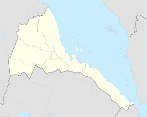 Senafe Location in Eritrea | |
| Coordinates: 14°42′N 39°25′E / 14.700°N 39.417°E | |
| Country | |
| Region | Debub. جنوب |
| District | Senafe District |
| Elevation | 2,446 m (8,025 ft) |
| Population | |
| • Total | 45,000[citation needed] |
| Climate | BSk |
Senafe (Arabic: صنعفى, Tigrinya: ሰንዓፈ) is a market town in southern Eritrea, on the edge of the Eritrean highlands ሶይራ. The surrounding area is inhabited by the Saho people and the Tigrinya people, its well known by its cultural and religious historical background.
Senafe is known for the ruins of Metera (also known as Balaw Kalaw), Qohayto to the south, and for Kaskase to the north. The soil is derived from volcanic ignimbrite,[1] and Senafe sits on the southeastern edge of a twenty kilometer wide caldera.
YouTube Encyclopedic
-
1/2Views:6 64818 288
-
Copy of Patrol Footage Op Eclipse Senafe, Eritrea 2001
-
Patrol Footage Op Eclipse Senafe, Eritrea 2001
Transcription
History
The original name for Saanafè was Hakir. Local tradition states that the name was changed by a man named Abdullah from Sana'a in Yemen; he settled in the Awdie district of Hakir, and upon marrying a local woman he was quoted as saying "Sana-fen" which means in Arabic "where is Sana'a" he was relating to his hometown; thus the town was named Sanafe; his descendants form a tribe and are also known as Saanafè.
An early record of Sanafe is on the Egyptus Novello map, published in 1454. This map shows Sanafe at the edge of Tigray, connected to two routes, one leading west to Axum, the other south to Lake Ashangi.[2] According to James Bruce, the party of Jesuits which included the Catholic patriarch Afonso Mendes and Fr. Jerónimo Lobo, passed through Senafe in 1625, having entered the Horn of Africa by way of Beilul and having crossed the Danikil Desert.[3]
Senafe is mentioned in an 1794-5 land grant (1787 E.C.) from the Ethiopian Emperor Tekle Giyorgis to Ras Wolde Selassie.[4]
During his reconnaissance work for the 1868 British Expedition to Abyssinia (expedition against Emperor Tewodros II), Clements Markham visited Senafe, finding it situated "at the foot of the grand mass of sandstone rock about half a mile north-west of the camp, called Amba-Adana." The town itself consisted "of about a dozen houses built of rough stones and mud, with flat roofs branches being placed in rows across the beams, and covered with mud. Broken jars plastered into the roof, serve as chimneys." He estimated the population to be around 240 inhabitants.[5][6]

During Italian rule, the town grew notably. The modern town suffered extensive destruction during the Eritrean War of Independence and the Eritrean–Ethiopian War.[7]
Climate
The prevailing climate in Senafe is known as a steppe climate.
| Climate data for Senafe | |||||||||||||
|---|---|---|---|---|---|---|---|---|---|---|---|---|---|
| Month | Jan | Feb | Mar | Apr | May | Jun | Jul | Aug | Sep | Oct | Nov | Dec | Year |
| Mean daily maximum °C (°F) | 24.0 (75.2) |
25.2 (77.4) |
26.5 (79.7) |
26.7 (80.1) |
27.1 (80.8) |
26.7 (80.1) |
22.3 (72.1) |
22.7 (72.9) |
25.2 (77.4) |
24.6 (76.3) |
23.5 (74.3) |
23.1 (73.6) |
24.8 (76.7) |
| Mean daily minimum °C (°F) | 7.6 (45.7) |
8.6 (47.5) |
10.3 (50.5) |
11.4 (52.5) |
11.9 (53.4) |
11.5 (52.7) |
11.2 (52.2) |
11.9 (53.4) |
10.4 (50.7) |
9.5 (49.1) |
8.3 (46.9) |
7.0 (44.6) |
10.0 (49.9) |
| Average rainfall mm (inches) | 4 (0.2) |
7 (0.3) |
25 (1.0) |
59 (2.3) |
41 (1.6) |
31 (1.2) |
158 (6.2) |
135 (5.3) |
21 (0.8) |
10 (0.4) |
20 (0.8) |
4 (0.2) |
515 (20.3) |
| Source: Climate-Data.org, altitude: 2446m [8] | |||||||||||||
Notes and references
- ^ Zanettin, Bruno; Bellieni, Giuliano; Visentin, Eleonora Justin (2006). "Stratigraphy and evolution of the trachy-rhyolitic volcanism of the Senafe area (Eastern Eritrean Plateau)". Journal of African Earth Sciences. 45 (4/5): 478–488. doi:10.1016/j.jafrearsci.2006.04.004.
- ^ Richard Pankhurst, The Ethiopian Borderlands (Larenceville: Red Sea, 1997), p. 92
- ^ Bruce, ''Travels to Discover the Source of the Nile (1805 edition), vol. 3, p. 362
- ^ Richard Pankhurst, History of Ethiopian Towns: From the Middle Ages to the Early Nineteenth Century (Wiesbaden: Franz Steiner Verlag, 1982), vol. 1 p. 231.
- ^ C. R. Markham, "Geographical Results of the Abyssinian Expedition", Journal of the Royal Geographical Society, 38 (1868), p. 21
- ^ Pankhurst, Richard (1982). History of Ethiopian towns from the mid 19th century to 1935. Steiner. p. 116.
- ^ Okubaghergis, Biyan Ghebreyesus. (2020) "The Impact of the Eritrean-Ethiopian Border on the Borderland Communities (2000-2018): A case Study of Senafe and Tserona." PHD thesis, University of Cagliari. Requires subscription.
- ^ "Climate: Senafe - Climate graph, Temperature graph, Climate table". Climate-Data.org. Retrieved 25 September 2014.
14°42′N 39°25′E / 14.700°N 39.417°E