
Saint Peter
Saint Pierre du Bois | |
|---|---|
 Flag | |
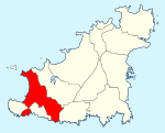 Location of Saint Pierre Du Bois in Guernsey | |
| Coordinates: 49°26′28″N 2°38′28″W / 49.44111°N 2.64111°W | |
| Crown Dependency | Guernsey, Channel Islands |
| Government | |
| • Electoral district | West |
| Area | |
| • Total | 6.2 km2 (2.4 sq mi) |
| Population (2019) | |
| • Total | 2,036 |
| • Density | 330/km2 (850/sq mi) |
| Time zone | GMT |
| • Summer (DST) | UTC+01 |
St Peter's (Guernesiais: Saint Pierre), known officially as Saint Pierre du Bois (English: "St. Peter in the Wood"), is a parish in Guernsey. It is the centre for the Guernsey Western Parishes which includes Torteval, St Saviour's and the Forest.
The old Guernesiais nickname for people from Saint Pierre was etcherbaots which means beetles.
The postal code for street addresses in this parish begins with GY7.
St Peter's won the Britain in Bloom small coastal prize in 2015.[1] and a gold medal in the 2016 Champion of Champions competition.[2]
YouTube Encyclopedic
-
1/5Views:1 15430 9094 33166 30764 298
-
Guernsey - a great cruise destination
-
St Peter Port - Guernsey!
-
St. Peter Port, Guernsey, Channel Islands
-
Guernsey Travel Guide - Things to do, visiting Guernsey in the Channel Islands
-
GUERNSEY: Exploring beautiful ST. PETER PORT 😲 (Channel Islands), let's go!
Transcription
Geography
The parish is located in the West of the Island and has borders with the parishes of Torteval, St. Saviour's, Forest and St. Andrew's.
The parish is mainly countryside with a small village in the centre. The parish church is one of the most unusual in the islands as it is built at the bottom of a small valley and the interior of the church is not flat but diagonal in appearance.
Features
|
The features of the parish include:
|
The parish of the Vale hosts:

|
Politics
Residents of Saint Peter vote in the Island wide voting for deputies, the last election was the 2020 Guernsey general election.
Notable people
- Sampson Avard, the leader of a band of Mormon vigilantes called the Danites, which existed in Missouri during the period of the 1838 Mormon War.
- Harry Lewis, also known as W2S and is a member of the Sidemen.
References
- ^ "St Peter's wins class in national Britain in Bloom". Guernsey press.
- ^ "RHS Britain in Bloom 2016 UK Finals Full Results". RHS Britain in Bloom.
- ^ "St Peter Parish Memorial, Guernsey". Great War CI.
- ^ a b c d e Dillon, Paddy. Channel Island Walks. Cicerone Press Limited, 1999. ISBN 9781852842888.
- ^ "PROTECTED BUILDINGS". Environment - Guernsey government.
- ^ "Channel Islands Marine Conservation Society Recommended beaches". thebeachguide.co.uk. Retrieved 24 May 2017.
- ^ "Silbe". Visit Guernsey.
- ^ "Colin Best nature reserve". La Société Guernesiaise.
- ^ "La Claire Mare". La Société Guernesiaise.
- ^ "Guernsey Abreuvoirs". La Société Guernesiaise.
External links
Bailiwick of Guernsey articles | ||||||
|---|---|---|---|---|---|---|
| History |
|  | ||||
| Geography |
| |||||
| Education |
| |||||
| Politics | ||||||
| Economy |
| |||||
| Culture |
| |||||
| International | |
|---|---|
| National | |