
Petersville | |
|---|---|
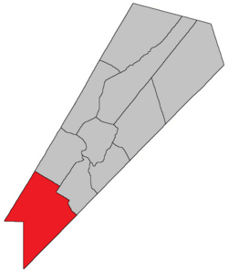 Location within Queens County, New Brunswick. | |
| Country | |
| Province | |
| County | Queens County |
| Erected | 1838 |
| Area | |
| • Land | 589.95 km2 (227.78 sq mi) |
| Population (2021)[1] | |
| • Total | 710 |
| • Density | 1.2/km2 (3/sq mi) |
| • Change 2016-2021 | |
| • Dwellings | 323 |
| Time zone | UTC-4 (AST) |
| • Summer (DST) | UTC-3 (ADT) |
Petersville is a geographic parish in Queens County, New Brunswick, Canada.[2]
Prior to the 2023 governance reform, for governance purposes it was divided between CFB Gagetown and the local service districts of Wirral-Enniskillen and the parish of Petersville.[3] Wirral-Enniskillen was part of Capital Region Service Commission (RSC11) and Petersville Parish was part of the Fundy Regional Service Commission (FRSC).[4]
YouTube Encyclopedic
-
1/1Views:2 064
-
slow snowplows ahead
Transcription
Origin of name
William Francis Ganong states that the parish was named in honour of Harry Peters, then Speaker of the House of Assembly.[5] Peters' tenure as Speaker actually ended in 1827 but he continued to serve as MLA until 1843. Harry's brother Charles Jeffery Peters was Attorney General of New Brunswick when the parish was erected.
History
Petersville was erected in 1838 from Gagetown and Hampstead Parishes.[6]
Much of the parish was expropriated in 1953 for the creation of CFB Gagetown.
Boundaries
Petersville Parish is bounded:[2][7][8]
- on the northeast and east within CFB Gagetown[a] by a line beginning at the prolongation of the southwestern line of a grant to Thomas T. Hewlett at the corner of Lawfield and Kerr Roads in Summer Hill, then southwesterly following Lawfield Road to the westernmost corner of a grant to Henry Appleby, then southeasterly along the prolongation of the northeastern line of a grant to Sylvanus Haviland to its easternmost corner, then southwest to the Yorkshire Road, then along Yorkshire Road to the Kings County line;
- on the southeast by the Kings County line;
- on the southwest by the Charlotte County line;
- on the northwest by the Sunbury County line.
Communities
Communities at least partly within the parish.[7][8][9] italics indicate a community expropriated for CFB Gagetown
- Armstrong Corner
- Bayard
- Blakely
- Clarendon
- Clones
- Cootes Hill
- Dunns Corner
- Enniskillen
- Ferris
- Fowlers Corners
- Headline
- Loisville
- Olinville
- Petersville
- South Clones
- Summer Hill
- Vincent
- Welsford
- West Jerusalem
- Wirral
- Wirral Station
Bodies of water
Bodies of water[b] at least partly within the parish.[7][8][9]
- River George
- West Branch Musquash River
- Brittain Stream
- Crystal Stream
- Cunningham Creek
- more than fifteen officially named lakes
Other notable places
Parks, historic sites, and other noteworthy places at least partly within the parish.[7][8][9]
- CFB Gagetown
- Lepreau River Wildlife Management Area[10]
- Loch Alva Protected Natural Area[11]
Demographics
Population
|
LanguageMother tongue (2016)[14]
|
Access Routes
Highways and numbered routes that run through the parish, including external routes that start or finish at the parish limits:[15]
Notes
References
- ^ a b "Census Profile". Statistics Canada. 26 October 2022. Retrieved 30 October 2022.
- ^ a b "Chapter T-3 Territorial Division Act". Government of New Brunswick. Retrieved 13 November 2020.
- ^ "New Brunswick Regulation 84-168 under the Municipalities Act (O.C. 84-582)". Government of New Brunswick. Retrieved 19 July 2020.
- ^ "Communities in each of the 12 Regional Service Commissions (RSC) / Les communautés dans chacune des 12 Commissions de services régionaux (CSR)" (PDF), Government of New Brunswick, July 2017, retrieved 2 February 2021
- ^ Ganong, William F. (1896). A Monograph of the Place-Nomenclature of the Province of New Brunswick. Royal Society of Canada. p. 261. Retrieved 17 March 2021.
- ^ "1 Vic. c. 35 An Act to erect a part of the Parishes of Gagetown and Hampstead, in Queen's County, into a separate and distinct Town or Parish.". Acts of the General Assembly of Her Majesty's Province of New Brunswick, Passed in the Year 1838. Fredericton: Government of New Brunswick. 1838. p. 78. Retrieved 27 March 2021.
- ^ a b c d "No. 138". Provincial Archives of New Brunswick. Department of Natural Resources and Energy Development. Retrieved 19 June 2021. Remainder of parish on maps 147–149, 155, 156, and 163 at same site.
- ^ a b c d "428" (PDF). Transportation and Infrastructure. Government of New Brunswick. Retrieved 19 June 2021. Remainder of parish on mapbooks 429, 443–445, 458–460, 471, and 472 at same site.
- ^ a b c "Search the Canadian Geographical Names Database (CGNDB)". Government of Canada. Retrieved 7 July 2021.
- ^ "New Brunswick Regulation 94-43 under the Fish and Wildlife Act (O.C. 94-231)". Government of New Brunswick. 5 June 2006. Retrieved 8 July 2021.
- ^ "Explore New Brunswick's Protected Natural Areas". GeoNB. Retrieved 2 July 2021.
- ^ Statistics Canada: 2001, 2006 census
- ^ 2011 Statistics Canada Census Profile: Petersville Parish, New Brunswick
- ^ a b "Census Profile, 2016 Census: Petersville, Parish [Census subdivision], New Brunswick". Statistics Canada. Retrieved 27 September 2019.
- ^ Atlantic Canada Back Road Atlas ISBN 978-1-55368-618-7
External links
Places adjacent to Petersville Parish, New Brunswick | |
|---|---|
Subdivisions of New Brunswick | |
|---|---|
| Cities | |
| Towns |
|
| Villages | |
| Regional municipality | |
| Rural communities | |
| Rural districts |
|
| Other administrative divisions | |
45°32′15″N 66°21′24″W / 45.537618°N 66.356735°W