
Ouargla Province
ولاية ورقلة | |
|---|---|
 Map of Algeria highlighting Ouargla | |
| Coordinates: 31°57′N 5°19′E / 31.950°N 5.317°E | |
| Country | |
| Capital | Ouargla |
| Area | |
| • Total | 211,980 km2 (81,850 sq mi) |
| Population (2008)[1] | |
| • Total | 552,539 |
| • Density | 2.6/km2 (6.8/sq mi) |
| Time zone | UTC+01 (CET) |
| Area Code | +213 32 |
| ISO 3166 code | DZ-30 |
| Districts | 6 |
| Municipalities | 10 |
Ouargla or Warqla (Arabic: ولاية ورقلة) is a province (wilaya) in eastern Algeria. Its capital is Ouargla. Other localities include Hassi Ben Abdellah and Hassi Messaoud. It borders Ouled Djellal Province, El M'Ghair Province Touggourt Province, and El Oued Province to the north, Tunisia to the east, In Salah Province and Illizi Province to the south, and El Menia Province, Ghardaia Province and Djelfa Province to the west. It contains the Issaouane Erg desert.
History
In the past Ouargla was the center of trading of gold and slaves,[citation needed] as well as being an important center of Ibadi Islam. However, the Ibadis have left for the M'zab valley.
In 1984 Illizi Province was carved out of its territory.
In 2019, Touggourt Province was carved out of its territory.
Administrative divisions
The province is divided into 6 districts (daïras), which are further divided into 10 communes or municipalities.[2]
Districts
| District | Commune | Arabic |
|---|---|---|
| El Borma District | El Borma | اﻟﺒﺮﻣﺔ |
| El Hadjira District | El Allia | اﻟﻌﺎﻟﻴﺔ |
| El Hadjira | اﻟﺤﺠﻴﺮة | |
| Hassi Messaoud District | Hassi Messaoud | حاسي مسعود |
| N'Goussa District | N'Goussa | ﻧﻘﻮﺳﺔ |
| Ouargla District | Ouargla | ورقلة |
| Rouissat | اﻟﺮوﻳﺴﺎت | |
| Sidi Khouïled District | Aïn Beida | ﻋﻴﻦ اﻟﺒﻴﻀﺎء |
| Hassi Ben Abdellah | ﺣﺎﺳﻲ ﺑﻦ ﻋﺒﺪ اﷲ | |
| Sidi Khouiled | ﺳﻴﺪي ﺧﻮﻳﻠﺪ |
Geology
The region lies within the Algerian Triassic Sedimentary basin containing numerous oil and gas fields, including the Alrar gas field.[3] Production is from Triassic sandstones with Andesitic seals and the Gothlandian shale as a source rock.[4] Major fields include the Hassi R'Mel gas field, Haoud-Berkaolu, Ben-Kahla, and the Guellala.[4]
References
- ^ Office National des Statistiques, Recensement General de la Population et de l’Habitat 2008 Archived 2008-07-24 at the Wayback Machine Preliminary results of the 2008 population census. Accessed on 2008-07-02.
- ^ "Official website of the province of Ouargla - state" (in Arabic). Archived from the original on 16 February 2013. Retrieved 25 February 2013.
- ^ Hamouda, A., 1980, Petroleum Potential-Ouargla Region Triassic Basin, Algeria, in Giant Oil and Gas Fields of the Decade: 1968-1978, AAPG Memoir 30, Halbouty, M.T., editor, Tulsa: American Association of Petroleum Geologists, ISBN 0891813063, p. 539
- ^ a b Hamouda, A., 1980, Petroleum Potential-Ouargla Region Triassic Basin, Algeria, in Giant Oil and Gas Fields of the Decade: 1968-1978, AAPG Memoir 30, Halbouty, M.T., editor, Tulsa: American Association of Petroleum Geologists, ISBN 0891813063, p. 540
Capital: Ouargla | ||
| Ouargla District | 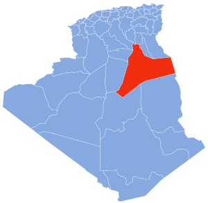 | |
| El Borma District | ||
| El Hadjira District | ||
| Hassi Messaoud District | ||
| Mégarine District | ||
| N'Goussa District | ||
| Sidi Khouïled District | ||
| Taïbet District | ||
| Témacine District | ||
| Touggourt District | ||
|  | |
| International | |
|---|---|
| National | |
| Geographic | |
| Other | |