
Mouhoun | |
|---|---|
Province | |
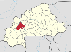 Location in Burkina Faso | |
 Provincial map of its departments | |
| Country | |
| Region | Boucle du Mouhoun |
| Capital | Dédougou |
| Area | |
| • Province | 2,571 sq mi (6,659 km2) |
| Population (2019 census)[1] | |
| • Province | 391,325 |
| • Density | 150/sq mi (59/km2) |
| • Urban | 63,617 |
| Time zone | UTC+0 (GMT 0) |
Mouhoun ([mu.un], "Black Volta") is one of the 45 provinces of Burkina Faso. It is in the Boucle du Mouhoun region. The capital of Mouhoun is Dédougou.
Education
In 2011, the province had 210 primary schools and 34 secondary schools.[2]
Healthcare
In 2011, the province had 27 health and social promotion centers (Centres de santé et de promotion sociale), 7 doctors and 151 nurses.[3]
Demographics
Most people in the province live in rural areas; 260,295 Burkinabé live in the countryside with only 37,793 people residing in urban areas. There are 148,732 men living in Mouhoun Province and 149,356 women (2006 census).[4]
Departments
Mouhoun is divided into 7 departments:
| Departments | Capitals | Population (Census 2006)[4] |
|---|---|---|
| Bondokuy Department | Bondokuy | 51,174 |
| Dédougou Department | Dédougou | 86,324 |
| Douroula Department | Douroula | 12,806 |
| Kona Department | Kona | 19,585 |
| Ouarkoye Department | Ouarkoye | 38,938 |
| Safané Department | Safané | 49,383 |
| Tchériba Department | Tchériba | 39,778 |
See also
References
- ^ Citypopulation.de Population of provinces in Boucle du Mouhoun Region
- ^ "La région du Boucle du Mouhoun en chiffres" (PDF). Institut National de la Statistique et de la Démographie (INSD). 2011. p. 6. Archived from the original (PDF) on 2012-11-13.
- ^ "La région du Boucle du Mouhoun en chiffres" (PDF). Institut National de la Statistique et de la Démographie (INSD). 2011. p. 6. Archived from the original (PDF) on 2012-11-13.
- ^ a b "National 2006 census preliminary results" (PDF). Archived from the original (PDF) on 2015-07-21. Retrieved 2008-05-27.
12°27′N 3°28′W / 12.450°N 3.467°W
| National | |
|---|---|
| Geographic | |
This Mouhoun Province location article is a stub. You can help Wikipedia by expanding it. |