
S11 E13 Morishita Station 森下駅 | |||||||||||||||||||||
|---|---|---|---|---|---|---|---|---|---|---|---|---|---|---|---|---|---|---|---|---|---|
 A5 entrance to Morishita Station, 2017 | |||||||||||||||||||||
| General information | |||||||||||||||||||||
| Location | Morishita 1-13-10 (Shinjuku Line) Morishita 2-17-17 (Oedo Line) Kōtō City, Tokyo (東京都江東区森下1-13-10 (Shinjuku Line) 東京都江東区森下2-17-17 (Ōedo Line)) Japan | ||||||||||||||||||||
| Operated by | |||||||||||||||||||||
| Line(s) | |||||||||||||||||||||
| Platforms | 2 island platforms (1 for each line) | ||||||||||||||||||||
| Tracks | 4 (2 for each line) | ||||||||||||||||||||
| Construction | |||||||||||||||||||||
| Structure type | Underground | ||||||||||||||||||||
| Other information | |||||||||||||||||||||
| Station code | S-11 (Shinjuku Line) E-13 (Ōedo Line) | ||||||||||||||||||||
| History | |||||||||||||||||||||
| Opened | 21 December 1978 | ||||||||||||||||||||
| Passengers | |||||||||||||||||||||
| [1][2] | 121,571 daily | ||||||||||||||||||||
| Services | |||||||||||||||||||||
| |||||||||||||||||||||
| Location | |||||||||||||||||||||
 Morishita Station Location within Special wards of Tokyo  Morishita Station Morishita Station (Tokyo Bay and Bōsō Peninsula) 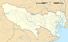 Morishita Station Morishita Station (Tokyo)  Morishita Station Morishita Station (Japan) | |||||||||||||||||||||
Morishita Station (森下駅, Morishita-eki) is a subway station in Kōtō, Tokyo, Japan, operated by Toei Subway. Its station numbers are S-11 (Shinjuku Line) and E-13 (Ōedo Line).
YouTube Encyclopedic
-
1/5Views:8611 1941 0152 2981 527
-
森下 Tokyo Evening Walking ✨4K Morishita Shopping Streets Japan🎧HQ Binaural (江東区・墨田区) 睡眠用・東京散歩
-
Tokyo Drive [4K] Urayasu to Morishita Japan (POV) ASMR Driving 2021 Japanese Scenery - Travel World
-
4K a-Walk in Tokyo Suitengumae Sta. to Morishita Sta. (AM) 東京 水天宮前駅〜森下駅までアルク (早朝)
-
【4K】Walk on Kiyosumishirakawa-Morishita in Tokyo(東京の清澄白河から森下へ散歩)【2020】
-
Tokyo Drive 2021 [4K] Morishita to Kagurazaka (POV) ASMR Driving in Japan | Travel World
Transcription
Lines
Morishita Station is served by the following two lines.
Platforms
Morishita Station consists of two island platforms (one for each line), each served by two tracks.
| 1 | S Shinjuku Line | for Bakuro-yokoyama, Kudanshita, and Shinjuku KO Keio Line for Sasazuka and Hashimoto |
| 2 | S Shinjuku Line | for Motoyawata |
| 3 | E Ōedo Line | for Ryogoku and Iidabashi |
| 4 | E Ōedo Line | for Daimon and Roppongi |
-
 Shinjuku Line platforms
 -
 Oedo Line platforms
History
The station opened on December 21, 1978; service on the Ōedo Line began on December 12, 2000.
Surrounding area
The station is located underneath the intersection of Tokyo Metropolitan Routes 50 (Shin-Ōhashi-dōri) and 463 (Kiyosumi-dōri). The area is typically shitamachi, with a mix of mid-rise office buildings, apartment buildings, and homes. Being close to Ryōgoku, many sumōbeya are located in the vicinity.
Connecting bus service
Toei Bus: Morishita-Ekimae
- Mon 33: for Kameido Station
- Kyūkō 06: for National Museum of Emerging Science and Innovation
- Kin 11: for Kinshichō Station, Shinozaki Station
References
- ^ "Morishita Station information" (in Japanese). Tokyo Metropolitan Bureau of Transportation. Archived from the original on 2006-10-08. Retrieved 24 February 2010.
- ^ "Morishita Station information" (in Japanese). Tokyo Metropolitan Bureau of Transportation. Archived from the original on 2006-10-08. Retrieved 24 February 2010.
External links
- Tokyo Metropolitan Bureau of Transportation: Morishita Station (Shinjuku Line) (in Japanese)
- Tokyo Metropolitan Bureau of Transportation: Morishita Station (Ōedo Line) (in Japanese)
| Districts |
|  | ||||
|---|---|---|---|---|---|---|
| Education | ||||||
| Major stations |
| |||||
| Landmarks | ||||||
35°41′17″N 139°47′54″E / 35.688007°N 139.798235°E