
Leeuwarderadeel
Ljouwerteradiel | |
|---|---|
 Wind mill in Leeuwarderadeel | |
 Flag  Coat of arms | |
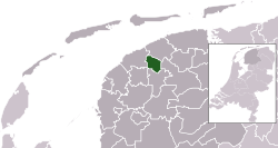 Location in Friesland | |
| Coordinates: 53°16′N 5°46′E / 53.267°N 5.767°E | |
| Country | Netherlands |
| Province | Friesland |
| Merged | 2018 |
| Area | |
| • Total | 41.46 km2 (16.01 sq mi) |
| • Land | 40.91 km2 (15.80 sq mi) |
| • Water | 0.55 km2 (0.21 sq mi) |
| Elevation | 1 m (3 ft) |
| Highest elevation | 1.7 m (5.6 ft) |
| Lowest elevation | 0.6 m (2.0 ft) |
| Population (January 2021)[3] | |
| • Total | data missing |
| Time zone | UTC+1 (CET) |
| • Summer (DST) | UTC+2 (CEST) |
| Postcode | 9050–9057 9071–9072 |
| Area code | 0518, 058 |
| Website | www |
Leeuwarderadeel (Dutch: [leːˈʋɑrdəraːˌdeːl] ⓘ; West Frisian: Ljouwerteradiel) is a former municipality in the northern Netherlands. Its capital was Stiens.
YouTube Encyclopedic
-
1/3Views:1 29227 8782 171
-
Dorpsfilm Britsum1967
-
WHAT is Happening with Inflation? - Ken McElroy LIVE!
-
Dorpsfilm Jelsum en Cornjum Koarnjum 1965
Transcription
History
On 1 January 2018 it merged with the municipality of Leeuwarden.
Population centres
Topography

Dutch Topographic map of the municipality of Leeuwarderadeel, June 2015.
Bartlehiem
The hamlet of Bartlehiem is partially in Leeuwarderadeel partially in Ferwerderadiel and partially in Tytsjerksteradiel.
References
- ^ "Kerncijfers wijken en buurten 2020" [Key figures for neighbourhoods 2020]. StatLine (in Dutch). CBS. 24 July 2020. Retrieved 19 September 2020.
- ^ "Postcodetool for 9051AR". Actueel Hoogtebestand Nederland (in Dutch). Het Waterschapshuis. Retrieved 19 September 2013.
- ^ "Bevolkingsontwikkeling; regio per maand" [Population growth; regions per month]. CBS Statline (in Dutch). CBS. 1 January 2021. Retrieved 2 January 2022.
External links
 Media related to Leeuwarderadeel at Wikimedia Commons
- Official website
Places adjacent to Leeuwarderadeel | ||||||||||||||||
|---|---|---|---|---|---|---|---|---|---|---|---|---|---|---|---|---|
| ||||||||||||||||
| International | |
|---|---|
| National | |
| Geographic | |
This Friesland location article is a stub. You can help Wikipedia by expanding it. |