
Karow | |
|---|---|
 aerial view of the quarter | |
Location of Karow in Pankow and Berlin 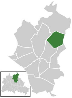 | |
 Karow  Karow | |
| Coordinates: 52°36′52″N 13°28′11″E / 52.61444°N 13.46972°E | |
| Country | Germany |
| State | Berlin |
| City | Berlin |
| Borough | Pankow |
| Founded | 1375 |
| Area | |
| • Total | 6.65 km2 (2.57 sq mi) |
| Elevation | 60 m (200 ft) |
| Population (2023-12-31)[1] | |
| • Total | 20,196 |
| • Density | 3,000/km2 (7,900/sq mi) |
| Time zone | UTC+01:00 (CET) |
| • Summer (DST) | UTC+02:00 (CEST) |
| Postal codes | 13125 |
| Vehicle registration | B |
| Website | Official website |
Karow (German pronunciation: [ˈkaːʁoː] )[2] is a German locality (Ortsteil) within the Berlin borough (Bezirk) of Pankow. Until 2001 it was part of the former Weißensee borough.
History

The locality was first mentioned in 1375 with the name of Kare.[3] Autonomous Prussian municipality of the former Niederbarnim district, Karow was incorporated into Berlin in 1920, with the "Greater Berlin Act".
Geography
Overview
Located in the north-eastern suburb of Berlin, it borders with the localities of Buch, Französisch Buchholz, Blankenburg and Stadtrandsiedlung Malchow. It also borders, on the east, with the Brandenburger town of Ahrensfelde, in the district of Barnim. Part of its territory, close to the natural reserve Karower Teiche (in Buchholz) is included in Barnim Nature Park.[4]
Subdivision
Karow counts 1 zone (Ortslage):
- Stadtrandsiedlung Buch
Transport
The locality is served by the S-Bahn station of Karow, on the line S2. This station is also the endpoint of a local railway, the Heidekrautbahn.
The Berliner beltway (A10, known as "Berliner Ring") crosses Karow and separates it from Buch. An exit serving the quarter (n.3 "Bucher Straße") is located on the short motorway A114.
Photogallery
-
 The old centre "Alt-Karow"
 -
 Berlin-Karow station building
 -
 View of the Karower Teiche
References
- ^ "Einwohnerinnen und Einwohner im Land Berlin am 31. Dezember 2023". Amt für Statistik Berlin-Brandenburg. February 2024.
- ^ Duden Aussprachewörterbuch (6 ed.). Mannheim: Bibliographisches Institut & F.A. Brockhaus AG. 2005. ISBN 3-411-04066-1.
- ^ (in German) Historical chronicles about Karow Archived 24 April 2010 at the Wayback Machine
- ^ Infos on the NPB official website. Click on "Naturpark", then click on "Region"
Literature
- Martin Eckart Pfannschmidt: "Geschichte der Berliner Vororte Buch und Karow", Berlin 1927
External links
![]() Media related to Karow at Wikimedia Commons
Media related to Karow at Wikimedia Commons
- (in German) Karow official site
- (in German) Site about Alt-Karow
| International | |
|---|---|
| National | |