
Kỳ Anh district
Huyện Kỳ Anh | |
|---|---|
 Hoành Sơn Range as seen from Hà Tĩnh | |
|
Seal | |
| Country | |
| Region | North Central Coast |
| Province | Hà Tĩnh |
| Capital | Kỳ Anh |
| Area | |
| • Total | 294.062 sq mi (761.617 km2) |
| Population (2015) | |
| • Total | 120,518 |
| • Density | 420/sq mi (161/km2) |
| Time zone | UTC+07:00 (Indochina Time) |
Kỳ Anh is a rural district of Hà Tĩnh province in the North Central Coast region of Vietnam. As of 2015 the district had a population of 120,518.[1] The district covers an area of 1,058 km². The district capital lies at Kỳ Anh.[1]
From 16 May 2015, Ky Anh District separated into two administrative units: Ky Anh Town and Ky Anh District (new).
Climate
| Climate data for Kỳ Anh | |||||||||||||
|---|---|---|---|---|---|---|---|---|---|---|---|---|---|
| Month | Jan | Feb | Mar | Apr | May | Jun | Jul | Aug | Sep | Oct | Nov | Dec | Year |
| Record high °C (°F) | 33.6 (92.5) |
35.6 (96.1) |
38.0 (100.4) |
38.8 (101.8) |
40.5 (104.9) |
40.4 (104.7) |
39.9 (103.8) |
39.2 (102.6) |
39.0 (102.2) |
35.2 (95.4) |
34.0 (93.2) |
31.8 (89.2) |
40.5 (104.9) |
| Mean daily maximum °C (°F) | 20.7 (69.3) |
21.4 (70.5) |
24.1 (75.4) |
28.6 (83.5) |
32.2 (90.0) |
33.9 (93.0) |
33.9 (93.0) |
32.9 (91.2) |
30.6 (87.1) |
27.9 (82.2) |
24.9 (76.8) |
21.6 (70.9) |
27.7 (81.9) |
| Daily mean °C (°F) | 17.9 (64.2) |
18.8 (65.8) |
21.1 (70.0) |
24.8 (76.6) |
28.1 (82.6) |
29.9 (85.8) |
29.9 (85.8) |
28.9 (84.0) |
27.0 (80.6) |
24.7 (76.5) |
21.9 (71.4) |
18.9 (66.0) |
24.3 (75.7) |
| Mean daily minimum °C (°F) | 15.9 (60.6) |
16.9 (62.4) |
19.0 (66.2) |
22.2 (72.0) |
25.2 (77.4) |
27.1 (80.8) |
27.1 (80.8) |
26.2 (79.2) |
24.5 (76.1) |
22.4 (72.3) |
19.8 (67.6) |
16.9 (62.4) |
21.9 (71.4) |
| Record low °C (°F) | 6.0 (42.8) |
8.1 (46.6) |
7.4 (45.3) |
13.2 (55.8) |
14.8 (58.6) |
19.9 (67.8) |
22.2 (72.0) |
22.1 (71.8) |
17.3 (63.1) |
15.2 (59.4) |
11.2 (52.2) |
6.9 (44.4) |
6.0 (42.8) |
| Average precipitation mm (inches) | 110.9 (4.37) |
69.5 (2.74) |
64.3 (2.53) |
64.1 (2.52) |
150.3 (5.92) |
118.1 (4.65) |
105.9 (4.17) |
234.2 (9.22) |
554.1 (21.81) |
747.8 (29.44) |
408.6 (16.09) |
202.8 (7.98) |
2,817.5 (110.93) |
| Average rainy days | 15.7 | 14.2 | 13.3 | 10.0 | 10.5 | 7.3 | 7.1 | 11.0 | 15.7 | 18.9 | 17.8 | 16.2 | 157.7 |
| Average relative humidity (%) | 90.5 | 91.6 | 90.4 | 87.1 | 80.0 | 73.1 | 71.4 | 77.1 | 84.9 | 87.5 | 87.5 | 87.8 | 84.0 |
| Mean monthly sunshine hours | 68.9 | 60.2 | 86.6 | 147.5 | 218.9 | 219.0 | 227.3 | 190.6 | 153.4 | 118.0 | 80.1 | 64.3 | 1,636.8 |
| Source: Vietnam Institute for Building Science and Technology[2] | |||||||||||||
References
- ^ a b "Districts of Vietnam". Statoids. Retrieved March 20, 2009.
- ^ "Vietnam Institute for Building Science and Technology" (PDF). Retrieved 16 August 2023.
| Thanh Hóa province | 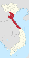 | |
|---|---|---|
| Nghệ An province | ||
| Hà Tĩnh province | ||
| Quảng Bình province |
| |
| Quảng Trị province | ||
| Thừa Thiên Huế province |
| |
※ denotes provincial seat. | ||
18°07′35″N 106°15′27″E / 18.1264°N 106.2575°E
This article about a location in Hà Tĩnh Province, Vietnam is a stub. You can help Wikipedia by expanding it. |