
Jiribam district | |
|---|---|
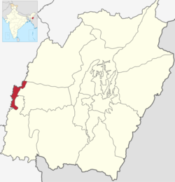 Location in Manipur | |
| Country | |
| State | Manipur |
| Established | 2016 |
| Headquarters | Jiribam |
| Area | |
| • Total | 232 km2 (90 sq mi) |
| Population | |
| • Total | 43,838 |
| • Density | 190/km2 (490/sq mi) |
| Language(s) | |
| • Official | Meitei (officially called Manipuri)[a][1] |
| • Spoken | Bengali • Hmar • Other tribal languages |
| Time zone | UTC+05:30 (IST) |
| Major highways | NH-37 |
Jiribam District (Meitei pronunciation: /jee-ree-baam/[b]) is a district in the state of Manipur, India. It was created in December 2016 from the Imphal East district.[2]
YouTube Encyclopedic
-
1/2Views:69 29484 081
-
Imphal - Jiribam, Manipur (NH 37)
-
Jiribam Imphal railway project all stations | Imphal station | Khonsang station | Rani gaidinliu
Transcription
Administrative divisions
The following are the sub-divisions in Jiribam district:
- Jiribam
- Borobekra
Jiribam district as a whole is one state assembly constituency - the Jiribam Assembly constituency.[3]
Demographics
At the time of the 2011 census, the district had a population of 42,838. Jiribam had a sex ratio of 945 females per 1000 males and a literacy rate of 63.11%. 16.75% of the population lived in urban areas. Scheduled Castes and Scheduled Tribes made up 16.94% and 12.52% of the population respectively.[5]
At the time of the 2011 census, 50.79% of the population spoke Bengali, 30.51% Manipuri, 8.04% Hmar, 2.66% Bishnupuriya, 1.63% Hindi, 1.46% Kabui and 1.11% Kuki as their first language.[6]
As it lies in the Barak Valley, Jiribam has a similar demographic composition to neighbouring Lakhipur in Cachar, Assam.
See also
Notes
- ^ Meitei language (officially known as Manipuri language) is the official language of Manipur. Other regional languages of different places in Manipur may either be predominantly spoken or not in their respective places but "Meitei" is always officially used.
- ^ Meitei language (officially known as Manipuri language) is the official language of Manipur. Other regional languages of different places in Manipur may either be predominantly spoken or not in their respective places but "Meitei" is always officially used.[1]
References
- ^ a b "Report of the Commissioner for linguistic minorities: 47th report (July 2008 to June 2010)" (PDF). Commissioner for Linguistic Minorities, Ministry of Minority Affairs, Government of India. p. 78. Archived from the original (PDF) on 13 May 2012. Retrieved 16 February 2012.
- ^ "Creation of new districts could be game-changer in Manipur polls | opinion". Hindustan Times. Retrieved 30 June 2017.
- ^ "Jiribham assembly seat".
- ^ "Table C-01 Population by religious community: Manipur". Census of India. Registrar General and Census Commissioner of India. 2011.
- ^ "District Census Hand Book - Imphal East" (PDF). Census of India. Registrar General and Census Commissioner of India.
- ^ a b "Table C-16 Population by mother tongue: Manipur". Census of India. Registrar General and Census Commissioner of India. 2011.
External links