
Hopi Reservation
Hopitutskwa (Hopi) | |
|---|---|
 Seal | |
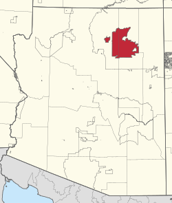 Location in Arizona | |
| Tribe | Hopi |
| Country | United States |
| State | Arizona |
| Counties | Coconino Navajo |
| Established | December 16, 1882 |
| Constitution | December 19, 1936 |
| Capital | Kykotsmovi (de facto)[citation needed] |
| Subdivisions | |
| Government | |
| • Body | Hopi Tribal Council |
| • Chairman | Timothy Nuvangyaoma |
| • Vice Chairman | Alfred Lomahquahu Jr. |
| Area | |
| • Total | 6,557.262 km2 (2,531.773 sq mi) |
| Population (2017)[1] | |
| • Total | 9,268 |
| • Density | 1.4/km2 (3.7/sq mi) |
| Time zone | Mountain: UTC −7 (no DST) |
| Website | hopi-nsn.gov |


The Hopi Reservation (Hopi: Hopitutskwa) is a Native American reservation for the Hopi and Arizona Tewa people, surrounded entirely by the Navajo Nation, in Navajo and Coconino counties in northeastern Arizona, United States.[2][3][4][5] The site has a land area of 2,531.773 sq mi (6,557.262 km2) and, as of the 2020 census had a population of 7,791.[6]
The two nations formerly shared the Navajo–Hopi Joint Use Area until the Navajo–Hopi Land Settlement Act created an artificial boundary through the area. The partition of this area, commonly known as Big Mountain, by acts of Congress in 1974 and 1996, has resulted in continuing controversy.[7][8]
The system of villages unites three mesas in the Pueblo style traditionally used by the Hopi. Walpi is the oldest village on First Mesa, having been established in 1690 after the villages at the foot of mesa Koechaptevela were abandoned for fear of Spanish reprisal after the 1680 Pueblo Revolt. The Tewa people live on First Mesa. Hopi also occupy the Second Mesa and Third Mesa.[9] The community of Winslow West is off-reservation trust land of the Hopi tribe.[citation needed]
The Hopi Tribal Council is the local governing body consisting of elected officials from the various reservation villages. Its powers were given to it under the Hopi Tribal Constitution.[10]
The Hopi consider their life on the reservation (in particular, the traditional clan residence, the spiritual life of the kivas on the mesa, and their dependence on corn) an integral and critically sustaining part of the "fourth world".[citation needed][clarification needed] Hopi High School is the secondary education institute for reservation residents. [citation needed] Hopi Radio, a station with a mix of traditional Hopi and typical American programming is run for the reservation[11] and provides internships for Hopi High School.[citation needed]
YouTube Encyclopedic
-
1/5Views:563 45934 08117 45258 543139 716
-
Native American reservations explained
-
Ruby Chimerica on the Hopi Reservation, Arizona
-
Ruby Chimerica Makes Piki Bread
-
"Hopi Dry Farming" Ahkima's Field Hopi Reservation
-
Hopi Indians Dance for Theodore Roosevelt at [Walpi, Ariz.] 1913
Transcription
Communities

- Keams Canyon
- Lower and Upper Moenkopi
- Polacca
- Winslow West
- Yuuwelo Paaki (Spider Mound)
- New Oraibi (Kiqotsmovi, Kykotsmovi)
First Mesa
- Waalpi (Walpi)
- Hanoki (Hano or Tewa)
- Sitsomovi (Sichomovi)
Second Mesa
- Songoopavi (Shongopavi)
- Musangnuvi (Mishongnovi)
- Sipawlavi (Shipaulovi)
Third Mesa
Time zone

The Hopi Reservation lies within the Mountain Time Zone, like most of Arizona, but unlike the surrounding Navajo Nation, it does not observe daylight saving time.[12]
Aerial views
Aerial views looking north along the central three of the reservation's five major washes,[13] from west to east:
-
 Dinnebito Wash, with Third Mesa in the distance
 -
 Oraibi Wash and Indian Route 2
 -
 Polacca Wash, crossed by Arizona Route 87, with First Mesa and Second Mesa visible in the distance
See also
References
- ^ 2013-2017 American Community Survey 5-Year Estimates. "My Tribal Area". United States Census Bureau.
{{cite web}}: CS1 maint: numeric names: authors list (link) - ^ "Hopi Tribe Transportation Partnership". Arizona: Official Website of State of Arizona. Retrieved May 28, 2024.
- ^ "Hopi Tribe of Arizona | Native American Advancement, Initiatives, and Research". naair.arizona.edu. Retrieved 2024-05-28.
- ^ TucsonSentinel.com; Smith, Dylan. "Hopi Reservation quarantines over neighboring Navajo coronavirus outbreak". TucsonSentinel.com. Retrieved 2024-05-28.
- ^ Hopkins, Mary; Koyiyumptewa, Stuart B.; Hedquist, Saul L.; Ferguson, T.J.; Colwell, Chip (2017). "3 Hopisinmuy Wu'ya'mat Hisat Yang Tupqa'va Yeesiwngwu (Hopi Ancestors Lived in These Canyons)". Legacies of Space and Intangible Heritage: Archaeology, Ethnohistory, and the Politics of Cultural Continuity in the Americas. Boulder, CO: University Press of Colorado. p. 33. ISBN 9781607325710.
- ^ "Census profile: Hopi Reservation". Census Reporter. Retrieved 2024-05-28.
- ^ "Short History of Big Mountain–Black Mesa". Archived from the original on 11 August 2014. Retrieved 5 Aug 2013.
- ^ "Navajo–Hopi Long Land Dispute". Retrieved 5 Aug 2013.
- ^ De Mente, Boye; DeMent, Demetra (2010). Visitor's Guide to Arizona's Indian Reservations (1st ed.). Phoenix Books. p. 69. ISBN 9780914778141.
- ^ "Constitution and By-laws of the Hopi Tribe Arizona" (PDF). University of Arizona. Retrieved May 28, 2024.
- ^ Dukepoo, Cara (March 1, 2013). "The Electronic Drum: Community Radio's Role in Indigenous Language Revitalization". Cultural Survival. 37: 22–23 – via ISSUU.
- ^ "No DST in Most of Arizona". www.timeanddate.com. Retrieved 2024-05-29.
- ^ Lionel Puhuyesva, James A. Duffield, and Max Taylor. "Wetland Program Development via the Clean Water Act, Hopi Reservation, Arizona" (PDF). Coconino Plateau Water Advisory Council. Retrieved 27 June 2019.
{{cite web}}: CS1 maint: multiple names: authors list (link)
External links
See also: Indigenous peoples of Arizona |
Municipalities and communities of Coconino County, Arizona, United States | ||
|---|---|---|
| Cities |  | |
| Towns | ||
| CDPs |
| |
| Populated places | ||
| Indian reservations | ||
| Ghost towns | ||
| Footnotes | ‡This populated place also has portions in an adjacent county or counties | |

35°54′42″N 110°36′56″W / 35.91167°N 110.61556°W
| International | |
|---|---|
| National | |
| Other | |