
| Heidrun oil field | |
|---|---|
 | |
 | |
| Country | Norway |
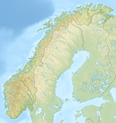
| Region | Norwegian Sea |
| Location | Haltenbanken |
| Blocks | 6507/8, 6707/7 |
| Offshore/onshore | offshore |
| Coordinates | 65°19′33″N 7°19′3″E / 65.32583°N 7.31750°E |
| Operator | Equinor |
| Field history | |
| Discovery | 1985 |
| Production | |
| Current production of oil | 140,000 barrels per day (~7.0×10⁶ t/a) |
| Current production of gas | 3×10⁶ m3/d (110×106 cu ft/d) |
| Recoverable gas | 42.6×10⁹ m3 (1.50×10¹² cu ft) |
| Producing formations | Garn, Ile, Tilje and Åre Formations of Early and Middle Jurassic age |

The Heidrun oil field is an oil and gas field discovered in 1985 in the Norwegian sector of the Norwegian Sea, named after the goat Heiðrún from Norse mythology.
The field lies 175 kilometres (109 mi) north of Kristiansund. It has produced oil and gas since October 1995. In 2013, it produced 65,000 bbl of oil per day and 760 million cubic meters of natural gas.[1] The crude oil is characterized as being naphthenic with 25.0 API (0.9043 g/cm3), 0.52% sulfur, and a high TAN (Total Acid Number) of 2.90.
The Heidrun field is located on Haltenbanken in the Norwegian Sea at a depth of 350 metres (1,150 ft). The field has been developed with gas and water injection, using a floating concrete tension leg platform, installed over a subsea template with 58 well slots.[2] The northern part of the field is developed with subsea facilities.
YouTube Encyclopedic
-
1/3Views:25 137354533
-
Heidrun TLP
-
Heidrun 13 11 2014
-
Casingvær Heidrun
Transcription
Geology
The Cimmerian structure is a southwest-plunging horst block on the southwest flank of the Nordland ridge formed in the Late Jurassic-Early Cretaceous.[2] Production is from Jurassic Fangst Group sandstones with the Upper Jurassic Spekk Formation shales being the petroleum source and Cretaceous shales forming the seal.[2]
References
- ^ Offshore Technology
- ^ a b c Whitley, P.K. (1992). "The Geology of Heidrun: A Giant Oil and Gas Field on the Mid-Norwegian Shelf". Giant Oil and Gas Fields of the Decade, 1978-1988. 54. American Association of Petroleum Geologists: 383–406. ISBN 0891813330.
External links
- Heidrun Facts and Interactive map
- Heidrun field development Information on Heidrun platform
- Heidrun Field Map & Images
Resources in Norway | ||
|---|---|---|
| Oil |  | |
| Natural gas | ||
This Norway location article is a stub. You can help Wikipedia by expanding it. |
This article about an oil field is a stub. You can help Wikipedia by expanding it. |
This article about a natural gas field is a stub. You can help Wikipedia by expanding it. |