
| Fotu La | |
|---|---|
| Hindi: fōtu lā | |
 Fotu La | |
| Elevation | 4,108 m (13,478 ft) |
| Traversed by | Srinagar-Leh highway |
| Location | Ladakh, India |
| Range | Himalaya, Ladakh Range |
| Coordinates | 34°17′21″N 76°42′05″E / 34.2892°N 76.7015°E |
 Location of Fotu La in Ladakh 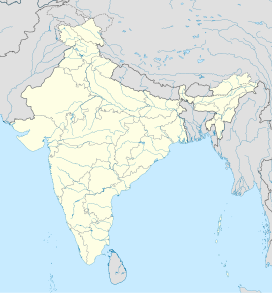 Fotu La (India) | |
Fotu La (Hindi: fōtu lā) or Fatu La is a mountain pass on the Srinagar-Leh highway in the Zanskar Range of the Himalayas[1] in India.[2] At an elevation of 4,108 metres (13,478 ft), it is the highest point on the highway, surpassing the famed Zoji La.
Fotu La is one of two high mountain passes between Leh and Kargil, the other being Namika La.[1]
Moving eastwards, the highway begins to descend towards the Lamayuru after Fotu La. There is a Prasar Bharati television relay station serving Lamayuru located on the pass.
YouTube Encyclopedic
-
1/5Views:1 2025 7603 1541 602123 370
-
Ride to Namikla Fotula and Lamayur on motorcycle | Himalayan Hymns Ep 5 | Steps Together
-
26. Himalayas - India | Zojila Pass, Kargil to Leh Ladakh, Fotu La | Round the World on a Fireblade
-
Ladakh Ride | Day 3 | Kargil to Leh | Namik La | Fotu La | Lamayuri | Travel with BBB
-
Fotu La Pass(www.xpdo.in)
-
World longest tunnel | World’s longest high-altitude tunnel | Shinku la tunnel
Transcription
References
- ^ a b Hilary Keating (July–August 1993). "The Road to Leh". Saudi Aramco World. 44 (4). Houston, Texas: Aramco Services Company: 8–17. ISSN 1530-5821. Archived from the original on 28 September 2012. Retrieved 29 June 2009.
- ^ GeoNames. "Fotu La Pass". Retrieved 17 June 2009.
| State symbols | |||||||||||||||||||
|---|---|---|---|---|---|---|---|---|---|---|---|---|---|---|---|---|---|---|---|
| History |
| ||||||||||||||||||
| Administration | |||||||||||||||||||
| Geography |
| ||||||||||||||||||
| Human settlements | |||||||||||||||||||
| Culture |
| ||||||||||||||||||
| Tourism and wildlife |
| ||||||||||||||||||
| Transport |
| ||||||||||||||||||
| Infrastructure |
| ||||||||||||||||||
| See also |
| ||||||||||||||||||
This Ladakh, India location article is a stub. You can help Wikipedia by expanding it. |