

Size of this PNG preview of this SVG file: 589 × 600 pixels. Other resolutions: 236 × 240 pixels | 471 × 480 pixels | 754 × 768 pixels | 1,005 × 1,024 pixels | 2,011 × 2,048 pixels | 1,241 × 1,264 pixels.
Original file (SVG file, nominally 1,241 × 1,264 pixels, file size: 545 KB)
| This is a file from the Wikimedia Commons. Information from its description page there is shown below. Commons is a freely licensed media file repository. You can help. |
Summary
.svg)
.svg)
.svg)
.svg)
.svg)
.svg)
.svg)

-en.svg)

.svg)
.svg)
.svg)

_(US48).svg)
_(small_islands_magnified)_(-mini_map_-rivers).svg)
.svg)
_(extra_close)_(US48).svg)
.svg)
_(zoom).svg)

.svg)


_(UNMIK).svg)
.svg)
_(disputed_hatched).svg)
_(claimed_and_disputed_hatched).svg)
.svg)
.svg)
_(%2Ball_claims_hatched).svg)

.svg)
_(shade).svg)
_(shade)_(special_marker).svg)
_(-mini_map).svg)
_(-mini_map).svg)
_(-mini_map).svg)


.svg)

.svg)
_svg)
.svg)
Licensing
This file is licensed under the Creative Commons Attribution-Share Alike 3.0 Unported license.
- You are free:
- to share – to copy, distribute and transmit the work
- to remix – to adapt the work
- Under the following conditions:
- attribution – You must give appropriate credit, provide a link to the license, and indicate if changes were made. You may do so in any reasonable manner, but not in any way that suggests the licensor endorses you or your use.
- share alike – If you remix, transform, or build upon the material, you must distribute your contributions under the same or compatible license as the original.
References
Official territory and governorate borders
- http://www.krso.net/Default.aspx?page=article&id=1142
- http://www.economist.com/images/20070908/CMA980.gif
Claimed territory
- http://www.aina.org/reports/pcok.pdf (page 13)
- http://www.economist.com/images/20070908/CMA980.gif
- http://photos1.blogger.com/blogger/6564/131/1600/Kurdistan_july05_claimed-767346.jpg
- http://images.fastcompany.com/magazine/144/feature-84-Kurdistan-OilMap-pop.jpg
- http://news.bbcimg.co.uk/media/images/76876000/gif/_76876578_iraq_kurdistan_624.gif
File history
Click on a date/time to view the file as it appeared at that time.
.svg&dir=prev)
.svg&offset=20170928132057)
.svg&offset=&limit=20)
.svg&offset=&limit=50)
.svg&offset=&limit=100)
.svg&offset=&limit=250)
.svg&offset=&limit=500)
| Date/Time | Thumbnail | Dimensions | User | Comment | |
|---|---|---|---|---|---|
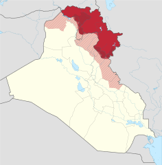
| current | 23:01, 19 July 2018 | | 1,241 × 1,264 (545 KB) | Rob984 | dashed official KRG border on the basis that it's disputed by Baghdad. |
| 19:05, 19 July 2018 |  | 1,241 × 1,264 (548 KB) | Rob984 | Also Iraqi forces took Khanaqin in October as well | |
| 18:12, 19 July 2018 |  | 1,241 × 1,264 (549 KB) | Rob984 | The town of Makhmur was taken over by Iraqi forces last year. Also the frontier in Kirkuk likely corresponds to the 2003 green line, not the administrative border, since Iraq only requested the Kurdish forces withdraw to the green line. | |
| 22:34, 26 January 2018 |  | 1,241 × 1,264 (549 KB) | 0ali1 | Update 26/01/2018, minor fixes | |
| 23:55, 24 October 2017 |  | 1,241 × 1,264 (549 KB) | Rob984 | Federal government has reassumed control over most (if not all) of the Kirkuk province. | |
| 16:03, 24 October 2017 |  | 1,241 × 1,264 (549 KB) | Rob984 | Scaled back changes around Machmur. Peshmerga have not withdrawn from the town, despite earlier reports suggesting so. | |
| 12:26, 20 October 2017 |  | 1,241 × 1,264 (549 KB) | Rob984 | Update following Peshmerga withdrawal from a number of areas. Note Kurdish militias (eg PKK, YBS, etc.) have not withdrew from all areas, but they are not under KRG control. Approximate area, will need to be updated. | |
| 20:20, 12 October 2017 |  | 1,241 × 1,264 (555 KB) | Spesh531 | Update now that ISIS is no longer on the Iraqi Kurdish-Iraqi proper border | |
| 14:28, 28 September 2017 |  | 1,241 × 1,264 (555 KB) | Rob984 | another minor fix | |
| 13:20, 28 September 2017 |  | 1,241 × 1,264 (555 KB) | Rob984 | minor fix |
File usage
The following pages on the English Wikipedia use this file (pages on other projects are not listed):
Global file usage
The following other wikis use this file:
- Usage on als.wikipedia.org
- Usage on ar.wikipedia.org
- Usage on arz.wikipedia.org
- Usage on azb.wikipedia.org
- Usage on az.wikipedia.org
- Usage on ba.wikipedia.org
- Usage on bcl.wikipedia.org
- Usage on be-tarask.wikipedia.org
- Usage on be.wikipedia.org
- Usage on bg.wikipedia.org
- Usage on bn.wikipedia.org
- Usage on br.wikipedia.org
- Usage on bs.wikipedia.org
- Usage on ceb.wikipedia.org
- Usage on ckb.wikipedia.org
- Usage on cs.wikipedia.org
- Usage on cy.wikipedia.org
- Usage on da.wikipedia.org
- Usage on de.wikipedia.org
- Usage on diq.wikipedia.org
- Usage on el.wikipedia.org
- Usage on el.wikivoyage.org
- Usage on eo.wikipedia.org
- Usage on es.wikipedia.org
- Usage on et.wikipedia.org
- Usage on fa.wikipedia.org
View more global usage of this file.
.svg)
.svg)