

Size of this PNG preview of this SVG file: 668 × 600 pixels. Other resolutions: 267 × 240 pixels | 535 × 480 pixels | 856 × 768 pixels | 1,141 × 1,024 pixels | 2,281 × 2,048 pixels | 2,786 × 2,501 pixels.
Original file (SVG file, nominally 2,786 × 2,501 pixels, file size: 264 KB)
| This is a file from the Wikimedia Commons. Information from its description page there is shown below. Commons is a freely licensed media file repository. You can help. |
| Description |
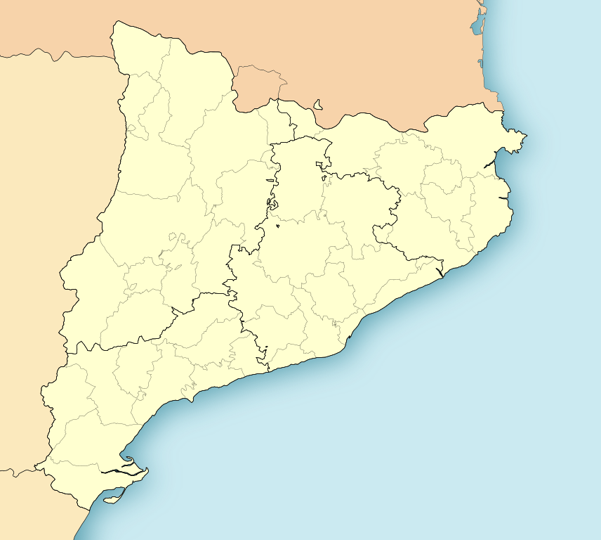
Location map of Catalonia. Equirectangular projection, N/S stretching 130 %. Geographic limits of the map: * N: 42.99° N * S: 40.405° N * W: 0.55° O * E: 4.02° O
|
||
| Date | (UTC) | ||
| Source | |||
| Author |
|
||
| Permission (Reusing this file) |
I, the copyright holder of this work, hereby publish it under the following license:
|
||
| Other versions |
Derivative works of this file: Mapa Sender GR 2.png |
| This is a retouched picture, which means that it has been digitally altered from its original version. Modifications: harmonisation couleur. The original can be viewed here: CatalunyaLoc.svg:
|
Original upload log
This image is a derivative work of the following images:
- File:CatalunyaLoc.svg licensed with PD-self
- 2008-04-27T09:34:23Z HansenBCN 3300x2500 (466651 Bytes) Sombreado de agua descentrado y borde superior eliminado
- 2008-04-26T14:38:41Z HansenBCN 3300x2500 (463617 Bytes) Bordes
- 2008-04-26T14:32:01Z HansenBCN 3300x2500 (463380 Bytes) == Summary == {{Information |Description=Catalonia Location Map |Source=self-made |Date=26/april/2008 |Author= [[User:HansenBCN|HansenBCN]] |Permission= |other_versions=[Image:CatalunyaLoc.png|50px] }} == [[Commons:Copyright
Uploaded with derivativeFX
File history
Click on a date/time to view the file as it appeared at that time.
| Date/Time | Thumbnail | Dimensions | User | Comment | |
|---|---|---|---|---|---|
| current | 12:49, 17 November 2021 | | 2,786 × 2,501 (264 KB) | Jmarchn | better framing |
| 11:24, 19 May 2010 |  | 3,300 × 2,500 (345 KB) | Miguillen | color borde frontera | |
| 11:18, 19 May 2010 |  | 3,300 × 2,500 (337 KB) | Miguillen | recuadro y bordes de costa | |
| 15:53, 17 May 2010 |  | 3,300 × 2,500 (311 KB) | Xfigpower | {{Information |Description={{ca|Mapa de localització de Catalunya}} Projecció equirrectangular, N/S estirada 130%. Límits geogràfics del mapa: * N: 42.99° N * S: 40.405° N * W: 0.55° O * E: 4.02° O {{en|Location map of [[:e |
File usage
More than 100 pages use this file. The following list shows the first 100 pages that use this file only. A full list is available.
- Aitona
- Almacelles
- Amposta
- Arbeca
- Arenys de Mar
- Ascó
- Balaguer
- Banyoles
- Barcelona
- Bassella
- Battle of Almenar
- Bellpuig
- Benissanet
- Berga
- Besalú
- Blanes
- Bot, Tarragona
- Cadaqués
- Cala d'Aiguablava
- Calonge
- Cambrils
- Camprodon
- Can Masdeu
- Cardona, Spain
- Castellbisbal
- Castelldefels
- Castle of Púbol
- Cerdanyola del Vallès
- Cervera
- Cornellà de Llobregat
- Cornudella de Montsant
- El Prat de Llobregat
- El Vendrell
- Els Alamús
- Empúries
- Esplugues de Llobregat
- Falset, Tarragona
- Flix
- Gandesa
- Garcia, Tarragona
- Ginestar
- Girona
- Girona–Costa Brava Airport
- Granollers
- L'Ametlla de Mar
- L'Estartit
- La Pobla de Segur
- Les Borges Blanques
- Llafranc
- Lloret de Mar
- Llívia
- Malgrat de Mar
- Manlleu
- Maçanet de la Selva
- Miravet
- Molins de Rei
- Mollerussa
- Mollet del Vallès
- Montblanc, Tarragona
- Montgat
- Mossos d'Esquadra
- Móra d'Ebre
- Móra la Nova
- Olot
- Palamós
- Peralada
- Pineda de Mar
- Poblet Abbey
- Ponts, Lleida
- Portbou
- Pratdip
- Puigcerdà
- Rasquera
- Reus Airport
- Riba-roja d'Ebre
- Ripoll
- Riudoms
- Salt, Girona
- Sant Adrià de Besòs
- Sant Boi de Llobregat
- Sant Cugat del Vallès
- Sant Esteve Sesrovires
- Sant Jaume d'Enveja
- Sant Pere de Ribes
- Santa Coloma de Farners
- Santa Susanna, Catalonia
- Sitges
- Sora, Barcelona
- Sort, Lleida
- Talarn
- Tamariu
- Taüll
- Tivissa
- Tordera
- Torelló
- Tortosa
- Tossa de Mar
- Tremp
- Tàrrega
- Vic, Spain
View more links to this file.
Global file usage
The following other wikis use this file:
- Usage on ar.wikipedia.org
- Usage on arz.wikipedia.org
- Usage on ast.wikipedia.org
- Usage on azb.wikipedia.org
- لریدا
- ال مری
- لا پبلا د مافومت
- پرادس
- لا آلدئا
- بیلانبا د پرادس
- منت-رال
- توریو
- تابرتت
- ساوس، کامایرا و یامپایس
- کالدس د مالابیا
- مونتانیلا
- لوسپیتالد د یوبروات
- لا آمپیا
- ال پرات د یبرقات
- آمپستا
- ریبا-رخا د ابره
- یوسا
- منتملو
- پاسسانانت
- برقا
- آسکو
- سانت خاومه د انبخا
- بایفقنا د ریوکرب
- سانتا ماریا د کرکو
- ریپی
- لا سو دورجل
- تاراقونا
- سانتا کلما د کرالت
- ردا د بارا
- لا پبلا د منترنس
- تسسا د مار
- دلتبره
- ریوداورا
- سانتا کلما د قرامنت
- لا پبلا د ماسسالوکا
- هرتا د سانت خئان
- آلتافویا
- پنتیلس
- تردمبارا
- یرت د مار
- کابرا دل کامپ
- اویاسترت
View more global usage of this file.