
_jpg)
Size of this preview: 800 × 530 pixels. Other resolutions: 320 × 212 pixels | 640 × 424 pixels | 1,024 × 678 pixels | 1,280 × 848 pixels | 3,032 × 2,008 pixels.
Original file (3,032 × 2,008 pixels, file size: 1.17 MB, MIME type: image/jpeg)
| This is a file from the Wikimedia Commons. Information from its description page there is shown below. Commons is a freely licensed media file repository. You can help. |
.jpg)
Summary
| Description |
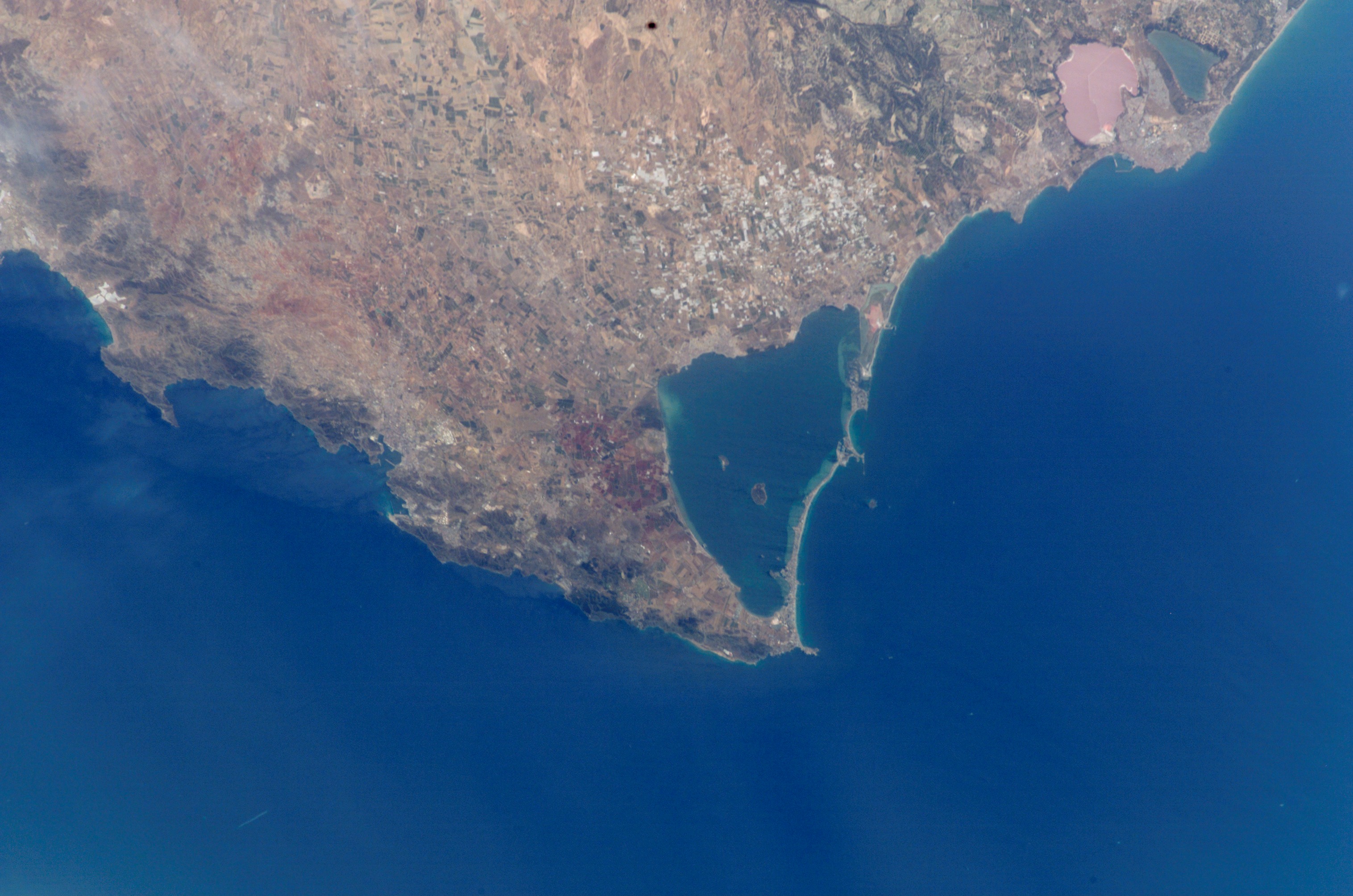
Photo of Mar Menor as seen from International Space Station
|
||
| Date | Taken in 2002 | ||
| Source |
|
||
| Author | Image Science & Analysis Laboratory, of the NASA Johnson Space Center. | ||
| Permission (Reusing this file) |
See above. | ||
| Other versions | Derivative works of this file: La Manga del Mar Menor.jpg |
| Object location | | View this and other nearby images on: OpenStreetMap |
|---|
.jpg¶ms=037.700000_N_-000.850000_E_globe:Earth_class:object_type:object_region:ES_heading:337.50_scale:50000&language=en)
NASA location info: * Center Point Latitude: 37.5 * Center Point Longitude: -1.0 (Negative numbers indicate south for latitude and west for longitude)
File history
Click on a date/time to view the file as it appeared at that time.
| Date/Time | Thumbnail | Dimensions | User | Comment | |
|---|---|---|---|---|---|
| current | 18:34, 29 January 2012 | | 3,032 × 2,008 (1.17 MB) | Saibo | cut off caption ("ISS005E05534"). --- lossless jpeg editing: jpegtran -copy all -crop 3032x2008+0+0 Cartagena\,_Mar_Menor\,_i_Cap_de_Pals_\(foto_satèl·lit\).jpg > out.jpg |
| 16:44, 31 October 2005 |  | 3,032 × 2,064 (1.17 MB) | Martorell | {{PD-USGov-NASA}} {{AstronautPhoto|mission=ISS005|roll=E|frame=5534}} * Center Point Latitude: 37.5 * Center Point Longitude: -1.0 (Negative numbers indicate south for latitude and west for longitude) Category:Satellite photos |
File usage
The following pages on the English Wikipedia use this file (pages on other projects are not listed):
Global file usage
The following other wikis use this file:
- Usage on ast.wikipedia.org
- Usage on ca.wikipedia.org
- Usage on ceb.wikipedia.org
- Usage on cs.wikipedia.org
- Usage on de.wikipedia.org
- Usage on en.wikivoyage.org
- Usage on es.wikipedia.org
- Usage on es.wikivoyage.org
- Usage on eu.wikipedia.org
- Usage on fr.wikipedia.org
- Usage on gl.wikipedia.org
- Usage on it.wikipedia.org
- Usage on ja.wikipedia.org
- Usage on ka.wikipedia.org
- Usage on la.wikipedia.org
- Usage on lt.wiktionary.org
- Usage on nl.wikipedia.org
- Usage on nn.wikipedia.org
- Usage on no.wikipedia.org
- Usage on oc.wikipedia.org
- Usage on pl.wikipedia.org
- Usage on pt.wikipedia.org
- Usage on ru.wikipedia.org
- Usage on sr.wikipedia.org
- Usage on sv.wikipedia.org
- Usage on uk.wikipedia.org
- Usage on www.wikidata.org
.jpg)