

Size of this preview: 635 × 600 pixels. Other resolutions: 254 × 240 pixels | 508 × 480 pixels | 813 × 768 pixels | 1,084 × 1,024 pixels | 1,525 × 1,440 pixels.
Original file (1,525 × 1,440 pixels, file size: 522 KB, MIME type: image/jpeg)
| This is a file from the Wikimedia Commons. Information from its description page there is shown below. Commons is a freely licensed media file repository. You can help. |

|
This map image could be re-created using vector graphics as an SVG file. This has several advantages; see Commons:Media for cleanup for more information. If an SVG form of this image is available, please upload it and afterwards replace this template with
{{vector version available|new image name}}.
It is recommended to name the SVG file “Africa relief location map.svg”—then the template Vector version available (or Vva) does not need the new image name parameter. |


Summary
| Description |
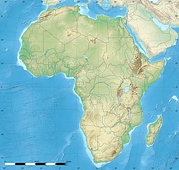
Blank physical map of political Africa, for geo-location purposes. Borders as in July 2011.
Lambert azimutal equal-area projection, WGS84 datum
|
||
| Date | |||
| Source |
Based upon File:Africa_map_blank.svg created by myself
|
||
| Author | Eric Gaba (Sting - fr:Sting) | ||
| Permission (Reusing this file) |
|
||
| Other versions |
|


| Camera location | | View this and other nearby images on: OpenStreetMap |
|---|
Licensing
Eric Gaba, Wikimedia Commons user Sting, the copyright holder of this work, hereby publishes it under the following licenses:

|
Permission is granted to copy, distribute and/or modify this document under the terms of the GNU Free Documentation License, Version 1.2 or any later version published by the Free Software Foundation; with no Invariant Sections, no Front-Cover Texts, and no Back-Cover Texts. A copy of the license is included in the section entitled GNU Free Documentation License. |
This file is licensed under the Creative Commons Attribution-Share Alike 3.0 Unported license.
Attribution: Eric Gaba, Wikimedia Commons user Sting
- You are free:
- to share – to copy, distribute and transmit the work
- to remix – to adapt the work
- Under the following conditions:
- attribution – You must give appropriate credit, provide a link to the license, and indicate if changes were made. You may do so in any reasonable manner, but not in any way that suggests the licensor endorses you or your use.
- share alike – If you remix, transform, or build upon the material, you must distribute your contributions under the same or compatible license as the original.
You may select the license of your choice.
File history
Click on a date/time to view the file as it appeared at that time.
| Date/Time | Thumbnail | Dimensions | User | Comment | |
|---|---|---|---|---|---|
| current | 12:27, 18 July 2022 | | 1,525 × 1,440 (522 KB) | M.Bitton | Reverted to version as of 21:54, 5 May 2022 (UTC): per COM:OVERWRITE |
| 11:29, 18 July 2022 |  | 1,627 × 1,536 (472 KB) | Jacob300 | Reverted to version as of 15:02, 5 May 2022 (UTC) | |
| 21:54, 5 May 2022 |  | 1,525 × 1,440 (522 KB) | M.Bitton | Reverted to version as of 19:03, 14 July 2011 (UTC): per COM:OVERWRITE | |
| 15:02, 5 May 2022 |  | 1,627 × 1,536 (472 KB) | Jacob300 | Reverted to version as of 17:16, 9 January 2022 (UTC) | |
| 18:23, 9 January 2022 |  | 1,525 × 1,440 (522 KB) | M.Bitton | Reverted to version as of 19:03, 14 July 2011 (UTC): per COM:OVERWRITE | |
| 17:16, 9 January 2022 |  | 1,627 × 1,536 (472 KB) | Jacob300 | Reverted to version as of 01:08, 19 October 2021 (UTC) | |
| 23:16, 19 October 2021 |  | 1,525 × 1,440 (522 KB) | M.Bitton | Reverted to version as of 19:03, 14 July 2011 (UTC): per COM:OVERWRITE | |
| 01:08, 19 October 2021 |  | 1,627 × 1,536 (472 KB) | Gebagebo | Added dotted line to indicate Somaliland | |
| 19:03, 14 July 2011 |  | 1,525 × 1,440 (522 KB) | Sting | Sudan/South Sudan 07-2011 border update | |
| 13:31, 19 July 2010 |  | 1,525 × 1,440 (424 KB) | Sting | Color profile |
File usage
More than 100 pages use this file. The following list shows the first 100 pages that use this file only. A full list is available.
- Abuja
- Accra
- Addis Ababa
- African Great Lakes
- Agadir
- Alexandria
- Algiers
- Antananarivo
- Asmara
- Axum
- Bangui
- Banjul
- Beledweyne
- Bissau
- Brazzaville
- Bukoba
- Cairo
- Casablanca
- Chief Dawid Stuurman International Airport
- Conakry
- Dakar
- Dakhla, Western Sahara
- El Jadida
- Entebbe raid
- Essaouira
- Ethiopian Airlines Flight 961
- Freetown
- Gaborone
- Gitega
- Giza
- Great Pyramid of Giza
- Gulf of Guinea
- Huambo
- Kakamega
- Kampala
- Kenitra
- Kigali
- Kilimanjaro International Airport
- King Phalo Airport
- Kinshasa
- Kisumu
- Ksar el-Kebir
- La Güera
- Lake Albert (Africa)
- Lake Bangweulu
- Lake Baringo
- Lake Bosumtwi
- Lake Chad
- Lake Edward
- Lake Kivu
- Lake Makgadikgadi
- Lake Malawi
- Lake Mweru
- Lake Mweru Wantipa
- Lake Ngami
- Lake Nyos
- Lake Tanganyika
- Lake Turkana
- Lake Victoria
- Las Anod
- Libreville
- Lilongwe
- Luanda
- Luxor
- Malabo
- Marrakesh
- Massawa
- Meknes
- Mogadishu
- Mohammedia
- Mombasa
- Monrovia
- Mount Elgon
- Mount Kilimanjaro
- Mozambique Channel
- N'Djamena
- Nairobi
- Niamey
- Nouakchott
- Obock
- Oran
- Ouagadougou
- Oujda
- Pemba Island
- Periplus of the Erythraean Sea
- Pietermaritzburg
- Praia
- Rabat
- Richat Structure
- Rift Valley lakes
- Serengeti National Park
- Stellenbosch
- Straits of Tiran
- Suez
- São Tomé
- Tamale, Ghana
- Tangier
- The Rumble in the Jungle
- Tiznit
- Tripoli, Libya
View more links to this file.
Global file usage
The following other wikis use this file:
- Usage on als.wikipedia.org
- Usage on ar.wikipedia.org
- Usage on ast.wikipedia.org
- Usage on av.wikipedia.org
- Usage on azb.wikipedia.org
- قاهیره
- مانروویا
- داکار
- بیسائو
- کینشاسا
- آنتاناناریوو
- آکرا
- موشی (شهر)
- تانقا، تانزانیا
- عنابه
- لوساکا
- اقصر
- کاکامقا، کنیا
- الجزیره
- موروقورو
- هرجیسا
- نیامی
- تونس (شهر)
- وهران، الجزاییر
- العیون
- آبوجا
- کامپالا
- یائونده
- دارالسلام (تانزانیا)
- رباط (مراکش)
- لوآندا
- انجامنا
- موقادیشو
- لیبرویل
- دودوما
- باقامویو
- امتوارا
- لیندی
- سانقی
View more global usage of this file.