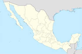
El Llano | |
|---|---|
 Municipality location in Aguascalientes | |
| Coordinates: 21°55′N 101°58′W / 21.917°N 101.967°W | |
| Country | Mexico |
| State | Aguascalientes |
| Municipal seat | Palo Alto |
| Area | |
| • Total | 509.77 km2 (196.82 sq mi) |
| Population (2015) | |
| • Total | 20,245 |
| • Density | 40/km2 (100/sq mi) |
El Llano is a municipality in the Mexican state of Aguascalientes. It stands at 21°55′N 101°58′W / 21.917°N 101.967°W.
As of 2010, the municipality had a total population of 18,828,[1] up from 17,115 in 2005.
The municipality had 244 localities, the largest of which (with 2010 populations in parentheses) were: the municipal seat of Palo Alto (5,399), classified as urban, and Los Conos (1,108), Ojo de Agua de Crucitas (1,078), and Santa Rosa (El Huizache) (1,050), classified as rural.[1]
Demographics
| Year | Pop. | ±% |
|---|---|---|
| 2010 | 18,828 | — |
| 2015 | 20,245 | +7.5% |
| 2020 | 20,853 | +3.0% |
| [2][3][4][5] | ||
References
- ^ a b "El Llano". Catálogo de Localidades. Secretaría de Desarrollo Social (SEDESOL). Archived from the original on 24 February 2018. Retrieved 23 April 2014.
- ^ "Localidades y su población por municipio según tamaño de localidad" (PDF) (in Spanish). INEGI. Archived from the original (PDF) on 31 August 2018. Retrieved 15 July 2017.
- ^ "Número de habitantes". INEGI (National Institute of Statistics and Geography). Archived from the original on 2 July 2017. Retrieved 15 July 2017.
- ^ "Tabulados de la Encuesta Intercensal 2015" (xls) (in Spanish). INEGI. Archived from the original on 31 December 2017. Retrieved 15 July 2017.
- ^ "INEGI. Censo de Población y Vivienda 2020. Tabulados del Cuestionario Básico – Aguascalientes" [INEGI. 2020 Population and Housing Census. Basic Questionnaire Tabulations – Aguascalientes] (Excel) (in Spanish). INEGI. 2020. pp. 1–4. Archived from the original on 28 January 2021. Retrieved 27 January 2021.
External links


