
| Drongan | |
|---|---|
 Drongan seen on approach to Prestwick Airport | |
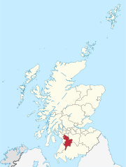
 Drongan Location within East Ayrshire | |
| Population | 3,060 (mid-2020 est.)[1] |
| OS grid reference | NS445184 |
| Council area | |
| Lieutenancy area | |
| Country | Scotland |
| Sovereign state | United Kingdom |
| Post town | AYR |
| Postcode district | KA6 |
| Dialling code | 01292 |
| Police | Scotland |
| Fire | Scottish |
| Ambulance | Scottish |
| UK Parliament | |
| Scottish Parliament | |
Drongan is a former mining village in East Ayrshire, some 8 miles (13 km) east of Ayr and west of Cumnock. It had a population of 4686 in 2011.[2]
YouTube Encyclopedic
-
1/2Views:2 021941
-
DRONGAN--SINCLAIRSTON SCOTLAND 2018
-
Road Trips in Scotland - Irvine to Drongan
Transcription
History
The earliest references to Drongan lands are to be found in documents dating to the 14th century. In the 1390s, these lands were granted to the Craufurds, whose stronghold for 250 years was Drongan Castle. The remains of the castle can be seen on Drongan Mains Farm. The estate passed from the Craufurds to the Cunninghames, then to the Earls of Stair. About 1760, the Drongan Estate was purchased by the Smith family – who built Drongan House, set up a pottery near Coalhall and introduced pioneering agricultural improvements.
The village of Drongan (originally known as Taiglum) grew up near the early coal mine and by 1900 consisted of 65 houses and a few shops. These rows at Taiglum were demolished in the 1930s and the inhabitants were housed in new housing schemes. In 1946, it was proposed that Drongan should be developed as a "new town" and families from various small mining communities were also re-housed there.
Like many other villages in this part of East Ayrshire, Drongan saw prosperity when the Killoch and Barony pit mines were operational.
The Drongan Centre, opened in 2002, provides health, Local Authority and police services within a modern purpose-built facility and received funding from the Scottish Executive Health Department's Primary and Community Premises Modernisation Fund.
A small loch known as Loch Shield was located near Drongan House and Lochmark Farm, its waters once helping to power the nearby Mill of Shield.
See also
References
- ^ "Mid-2020 Population Estimates for Settlements and Localities in Scotland". National Records of Scotland. 31 March 2022. Retrieved 31 March 2022.
- ^ https://www.scotlandscensus.gov.uk/ods-analyser/jsf/tableView/tableView.xhtml[dead link]
External links
 Media related to Drongan at Wikimedia Commons
- Video footage and narration - Free Church of Stair
- YouTube video of the Witch's Rocking Stone on the Craigs o'Kyle
- YouTube video of the King's Steps on the Water of Coyle
| Authority control databases: National |
|---|
This East Ayrshire location article is a stub. You can help Wikipedia by expanding it. |