
Borough of Slough | |
|---|---|
| |
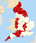
 Slough shown within Berkshire | |
| Sovereign state | United Kingdom |
| Constituent country | England |
| Region | South East England |
| Commuter Belts | London Commuter Belt |
| Ceremonial county | Berkshire |
| Constituencies | Slough |
| Seat | Slough |
| Area | |
| • Total | 21 sq mi (54 km2) |
| • Rank | 276th |
| Population (2022) | |
| • Total | 159,182 |
| • Rank | Ranked 129th |
| • Density | 7,600/sq mi (2,900/km2) |
| Ethnicity (2021) | |
| • Ethnic groups | |
| Religion (2021) | |
| • Religion | List
|
| Time zone | UTC+0 (Greenwich Mean Time) |
| • Summer (DST) | UTC+1 (British Summer Time) |
| Postcode | SL1-3, SL60-95 (Non-geographic) |
| Area code | SL |
| ONS code | 00EH (ONS) E06000039 (GSS) |
| Website | www |


The Borough of Slough is a unitary authority with borough status in the ceremonial county of Berkshire, Southern England. The borough is centred around the town of Slough and includes Langley. It forms an urban area with parts of Buckinghamshire and extends to the villages of Burnham, Farnham Royal, George Green, and Iver. Part of the district's area was in Buckinghamshire prior to the district's formation and in Middlesex until 1965.[2]
History
The borough was formed on 1 April 1974 under the Local Government Act 1972 from the Municipal Borough of Slough and parts of the parishes of Burnham and Wexham of which were formerly in Eton Rural District in Buckinghamshire.[3] On 1 April 1995 the parish of Colnbrook with Poyle was transferred to Slough.[4]
Geography
The borough borders the counties of Buckinghamshire (the unitary authority of the same name), Greater London (Hillingdon) and Surrey (Spelthorne), as well as the Royal Borough of Windsor and Maidenhead (also in Berkshire). Notable settlements nearby including London, Reading and High Wycombe. The nearest airport is Heathrow Airport, which is located roughly 7 miles (11 km) to the south-east. The borough has good links to London and other towns and cities with its main connecting road being the M4 motorway. It is also served by six railway stations: Taplow, Burnham, Slough, Langley, Iver and West Drayton. The district contains the unparished area of Slough and the civil parish of Colnbrook with Poyle.[5] The parishes of Britwell and Wexham Court were scheduled for abolition in April 2019, but after an appeal by the parish councils and a judicial review the order was quashed and the parishes remain unchanged.[6][7]
Council and cabinet
| 2021 Slough Borough Council election[8][9] | ||||||||||
|---|---|---|---|---|---|---|---|---|---|---|
| Party | This election | Full council | This election | |||||||
| Seats | Net | Seats % | Other | Total | Total % | Votes | Votes % | +/− | ||
| Labour | 11 | 78.6 | 23 | 34 | 81.0 | 17,227 | 57.6 | -1.4 | ||
| Conservative | 2 | 14.3 | 3 | 5 | 11.9 | 9,072 | 30.3 | +1.9 | ||
| Independent | 1 | 7.1 | 2 | 3 | 7.1 | 1,987 | 6.6 | +0.4 | ||
| Liberal Democrats | 0 | 0.0 | 0 | 0 | 0.0 | 939 | 3.1 | -0.6 | ||
| Green | 0 | 0.0 | 0 | 0 | 0.0 | 635 | 2.1 | +0.3 | ||
| Heritage | 0 | 0.0 | 0 | 0 | 0.0 | 66 | 0.2 | New | ||
Wards
The borough comprises 15 wards:
References
- ^ a b UK Census (2021). "2021 Census Area Profile – Slough Local Authority (E06000039)". Nomis. Office for National Statistics. Retrieved 5 January 2024.
- ^ "Slough, town and unitary authority, Berkshire, England, United Kingdom". Encyclopædia Britannica. Retrieved 15 May 2022.
- ^ "The English Non-metropolitan Districts (Definition) Order 1972". legislation.gov.uk. Retrieved 15 May 2022.
- ^ "The Berkshire, Buckinghamshire and Surrey (County Boundaries) Order 1994". legislation.gov.uk. Retrieved 16 May 2022.
- ^ "Slough". Ordnance Survey. Retrieved 15 May 2022.
- ^ "The Slough Borough Council (Reorganisation of Community Governance) Order 2019" (PDF). Local Government Boundary Commission for England. Retrieved 13 May 2019.
- ^ "Community Governance Review 2018, Judicial review". Slough Borough Council.
- ^ "Slough scoreboard". BBC. Retrieved 26 June 2021.
- ^ "2021 Local borough election". Slough Borough Council. Retrieved 26 June 2021.
- "Slough (Unitary District, Slough, United Kingdom) - Population Statistics, Charts, Map and Location". www.citypopulation.de. Retrieved 14 May 2022.
- "Slough Borough Council: Explanatory Memorandum". GOV.UK. Retrieved 14 May 2022.
- "The M4 Motorway (Junctions 3 to 12) (Smart Motorway) Development Consent Order 2016". legislation.gov.uk. Retrieved 14 May 2022.
- Bagley, James (12 March 2022). "Slough council's debt almost hit a shocking billion pounds". BerkshireLive. Retrieved 14 May 2022.
- "Potential £479m blackhole forces council to spike council tax to maximum allowed". Slough Observer. Retrieved 14 May 2022.
External links
 Slough travel guide from Wikivoyage
- Slough Borough Council
- Slough History Online

| International | |
|---|---|
| National | |