
Benderloch
| |
|---|---|
 St Modan's Church, Benderloch, October 2014 | |
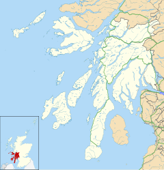 Benderloch Location within Argyll and Bute | |
| OS grid reference | NM903388 |
| Council area | |
| Lieutenancy area | |
| Country | Scotland |
| Sovereign state | United Kingdom |
| Post town | OBAN |
| Postcode district | PA37 |
| Police | Scotland |
| Fire | Scottish |
| Ambulance | Scottish |
| UK Parliament | |
| Scottish Parliament | |
Benderloch (Scottish Gaelic: Meadarloch, pronounced [ˈmet̪əɾl̪ˠɔx]) is a village in Argyll and Bute, Scotland. The name is derived from Beinn eadar dà loch, meaning "mountain between two lochs".[1]
Benderloch lies on the A828 road[2] in the coastal parish of Ardchattan, Argyll, Scotland. It grew up as the railway line from Ballachulish to Connel was completed in the early part of the 1900s, between the older locations of Selma and Craigneuk. It is marked on 1900s Ordnance Survey maps as New Selma.[3] Its railway station closed in 1966. Benderloch has a village shop (the renowned "Pink Shop"), garage, caravan and leisure store, cafe and a forest walk up to a viewpoint on the summit of Beinn Lora. Benderloch forms part of the Lynn of Lorn National Scenic Area, one of forty in Scotland.[4]
YouTube Encyclopedic
-
1/2Views:1 040700
-
Tralee Bay, Benderloch, Scotland - Aerial views around Tralee
-
Woolfest Benderloch 2010
Transcription
References
- ^ Iain Mac an Tàilleir (2003). "Placenames" (PDF). Pàrlamaid na h-Alba. Archived from the original (pdf) on 23 September 2011. Retrieved 23 July 2010.
- ^ OS Explorer Map 376 "Oban & North Lorn" published 29 January 2007 ISBN 978-0-319-23898-1
- ^ "Georeferenced Maps - Map images - National Library of Scotland". maps.nls.uk.
- ^ "National Scenic Areas" Archived 2017-03-11 at the Wayback Machine. SNH. Retrieved 30 Mar 2011.
External links
This Argyll and Bute location article is a stub. You can help Wikipedia by expanding it. |