
Bakool
Bokool | |
|---|---|
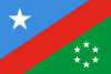 Flag  Coat of arms | |
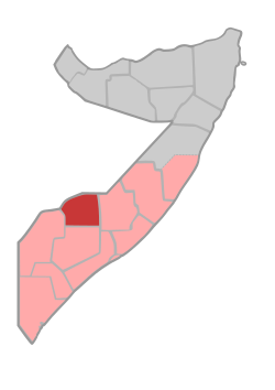 Location in Somalia. | |
| Coordinates: 4°20′47″N 43°32′59″E / 4.34639°N 43.54972°E | |
| Country | |
| Regional State | |
| Capital | Huddur |
| Area | |
| • Total | 54,962 km2 (21,221 sq mi) |
| Population (2019[1]) | |
| • Total | 1,156,400 |
| • Density | 21/km2 (54/sq mi) |
| 1,234,456 | |
| Time zone | UTC+3 (EAT) |
| Area code | Bakool |
| HDI (2021) | 0.295[2] low · 14th of 18 |
Bakool (Somali: Bakool, Maay: Bokool, Arabic: بكول) is a region (gobol) in southwestern Somalia.[3]
YouTube Encyclopedic
-
1/3Views:1 001359655
-
SUBAC QUR'AAN IYO RER XUDUR GOBALKA BAKOOL 2019
-
Howlgalo Ciidamada Somaliya ay ku sameeyeen Degmada Waajid ee Gobalka Bakool
-
Aadan Madoowe iyo sareedo oo ku fashilmay arntii Bakool
Transcription
Overview
It is bordered by the Somali regions of Hiiraan, Bay and Gedo.
Bakool, like Gedo and Bay, as well as most parts of the Jubbada Dhexe (Middle Juba) region, used to be a part of the old Upper Region, which was subdivided in the mid-1980s. It has its capital at Hudur.
In March 2014, Somali Armed Forces assisted by an Ethiopian battalion with AMISOM re-captured the Bakool province's capital Hudur from the Al-Shabaab militant group.[4] The offensive was part of an intensified military operation by the allied forces to remove the insurgent group from the remaining areas in southern Somalia under its control.[5]
Districts
The Bakool region consists of five districts:[6][a]
Major towns
Notes
- ^ Some sources list Rabdhure, others Yed
References
- ^ "Somalia: Subdivision and cities". www.citypopulation.de. Retrieved 2024-02-14.
- ^ "Sub-national HDI - Area Database - Global Data Lab". hdi.globaldatalab.org. Retrieved 2018-09-13.
- ^ "Somalia". The World Factbook. Langley, Virginia: Central Intelligence Agency. Retrieved 6 December 2013.
- ^ "Somalia: Federal Govt, Ethiopian forces liberate strategic town of Hudur". Garowe Online. 7 March 2014. Archived from the original on 8 March 2014. Retrieved 8 March 2014.
- ^ "Somalia: Federal Govt, AMISOM troops clash with Al Shabaab". Garowe Online. 11 March 2014. Archived from the original on 11 March 2014. Retrieved 11 March 2014.
- ^ "Regions, districts, and their populations: Somalia 2005 (Draft)" (PDF). Archived from the original (PDF) on 2017-07-28.
External links

This Somalia location article is a stub. You can help Wikipedia by expanding it. |