
Bahi District | |
|---|---|
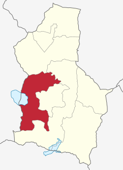 Bahi District of Dodoma Region. | |
| Coordinates: 05°57′10″S 35°18′43″E / 5.95278°S 35.31194°E | |
| Country | |
| Region | Dodoma Region |
| Area | |
| • Total | 5,630 km2 (2,170 sq mi) |
| Population (2022) | |
| • Total | 322,526 |
| • Density | 57/km2 (150/sq mi) |
Bahi District is one of the seven districts of the Dodoma Region of Tanzania. Bahi District is bordered to the north by Chemba District, to the east by Dodoma District and Chamwino District, and to the west by Singida Region. Its administrative seat is the town of Bahi.
According to the 2012 Tanzania National Census, the population of Bahi District was 221,645.[1] According to the 2022 census, the population of the district had grown to 322,526.[2]
Transport
Paved trunk road T3 from Morogoro to the Rwandan border passes through the district.[3]
The central railway of Tanzania passes through Bahi District as well and there is a train station in Bahi town.[4] The new Standard Gauge Railway has a station at Bahi under construction in early 2023.[5]
Administrative subdivisions
Administratively, the district is divided into four divisions namely, Mundemu, Chipanga, Bahi and Mwitikira.
As of 2017, Bahi District is further divided into 22 wards.[6][7]
| Divisions | Wards | Villages |
|---|---|---|
| Mundemu | 6 | 18 |
| Chipanga | 6 | 18 |
| Bahi | 6 | 14 |
| Mwitikira | 4 | 9 |
| Total | 22 | 59 |
Wards
- Babayu
- Bahi
- Chali
- Chibelela
- Chikola
- Chifutuka
- Chipanga
- Ibihwa
- Ibugule
- Ilindi
- Kigwe
- Lamaiti
- Makanda
- Mpalanga
- Mpamantwa
- Mpinga
- Msisi
- Mtitaa
- Mundemu
- Mwitikira
- Nondwa
- Zanka
References
- ^ "Census 2012". National Bureau of Statistics. Archived from the original on 5 March 2016. Retrieved 16 February 2016.
- ^ "Tanzania: Administrative Division (Regions and Districts) - Population Statistics, Charts and Map". www.citypopulation.de. Retrieved 2024-02-10.
- ^ "Dodoma Roads Network" (PDF). Tanroads. Archived from the original (PDF) on 24 June 2016. Retrieved 17 June 2016.
- ^ "Railways Network". Tanzania Railways Limited. Archived from the original on 6 October 2016. Retrieved 17 June 2016.
- ^ "Morogoro-Makutupora Railway".
- ^ "Takwimu". bahidc.go.tz. Retrieved 2021-11-10.
- ^ "BAHI DISTRICT COUNCIL STRATEGIC PLAN" (PDF). bahidc.go.tz. Dodoma, Tanzania: Bahi District. August 2017. Archived (PDF) from the original on 28 June 2022. Retrieved 15 July 2022.