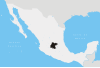
Atarjea is a Mexican city and municipality located in the easternmost region of the state of Guanajuato, within the Sierra Gorda range. The municipality has an area of 318 square kilometres (1.04% of the surface of the state) and is bordered to the north by the state of San Luis Potosí, to the east and south by the state of Querétaro, and to the west by Xichú. The municipality had a population of 5,198 according to the 2005 census.[1][2]
The name of the municipality is of Otomí origin and means "Where they go to drink water."
The municipal president of Atarjea and its many smaller outlying communities is Guadalupe Flores Loyola.[3]
Localities in Atarjea
| Locality | Population | Latitude | Longitude |
|---|---|---|---|
| El Carricillo | 589 | 21°18'56" N | 99°50'00" W |
| Atarjea | 380 | 21°16'04" N | 99°43'06" W |
| Aldama | 348 | 21°10'41" N | 99°50'06" W |
| Álamos | 289 | 21°13'56" N | 99°48'08" W |
| Mangas Cuatas | 258 | 21°15'31" N | 99°45'46" W |
| La Tapona | 255 | 21°11'04" N | 99°52'20" W |
References
- ^ "2005 Census". INEGI: Instituto Nacional de Estadística, Geografía e Informática. Archived from the original on 28 March 2007. Retrieved 2007-03-22.
- ^ "Mexican Municipality Encyclopedia". Enciclopedia de los Municipios de México. Archived from the original on 17 March 2007. Retrieved 2007-03-22.
- ^ "Información General". Archived from the original on 2007-07-03. Retrieved 2007-06-25.
21°16′04″N 99°43′06″W / 21.26778°N 99.71833°W