
Arroio do Meio | |
|---|---|
 Flag  Seal | |
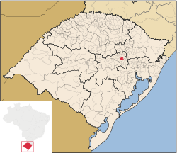 Location within Rio Grande do Sul | |
 Arroio do Meio Location in Brazil | |
| Coordinates: 29°24′03″S 51°56′42″W / 29.40083°S 51.94500°W | |
| Country | |
| State | Rio Grande do Sul |
| Mesoregion | Centro Oriental Rio-grandense[1] |
| Microregion | Lajeado-Estrela[1] |
| Settled | 1853 |
| Founded | November 28, 1934 |
| Government | |
| • Mayor | Danilo Bruxel (Progressistas) |
| Area | |
| • Total | 157.955 km2 (60.987 sq mi) |
| Elevation | 54 m (177 ft) |
| Population (2020 [2]) | |
| • Total | 20,967 |
| • Density | 130/km2 (340/sq mi) |
| Time zone | UTC−3 (BRT) |
| Area/distance code | 95940-000 |
| HDI | 0.769[3] |
| GDP | R$ 405,662,000[4] |
| GDP per capita | R$59.080,01 |
| Website | www |
Arroio do Meio is a municipality in the state of Rio Grande do Sul, Brazil. It is 98 km from Porto Alegre. It is on the banks of the Taquari River.
The territory was little populated before the arrival of Europeans. Settlement in the territory began in 1853, principally by Germans and Portuguese. The territory used to be part of Lajeado and Encantado municipalities.
YouTube Encyclopedic
-
1/5Views:1 1041 307464557867
-
ARROIO DO MEIO -RS # A IGREJA E A PRAÇA ( hd1080p)
-
Historias do Morro Gaucho # Arroio do Meio - RS
-
Travessia da Pinguela de Forqueta Arroio do Meio RS
-
Na subida para o Morro Gaucho # Arroio do Meio - RS
-
Parque Perola do Vale #Arroio do Meio-rs
Transcription
References
- ^ a b "Divisão Territorial do Brasil". Divisão Territorial do Brasil e Limites Territoriais. Instituto Brasileiro de Geografia e Estatística (IBGE). 1 July 2008. Archived from the original on 14 June 2020. Retrieved 11 October 2008.
- ^ IBGE 2020
- ^ "Ranking decrescente do IDH-M dos municípios do Brasil". Atlas do Desenvolvimento Humano. Programa das Nações Unidas para o Desenvolvimento (PNUD). 2000. Archived from the original on 3 October 2009. Retrieved 11 October 2008.
- ^ "Produto Interno Bruto dos Municípios 2002-2005" (PDF). Instituto Brasileiro de Geografia e Estatística (IBGE). 19 December 2007. Archived from the original (PDF) on 2 October 2008. Retrieved 11 October 2008.
External links

 | This geographical article relating to Rio Grande do Sul is a stub. You can help Wikipedia by expanding it. |