
Arratzua-Ubarrundia | |
|---|---|
 View of Ullíbarri-Gamboa | |
 Coat of arms | |
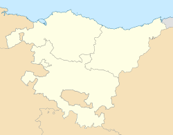 Arratzua-Ubarrundia Location of Arratzua-Ubarrundia within the Basque Country | |
| Coordinates: 42°53′25″N 2°38′21″W / 42.89028°N 2.63917°W | |
| Country | Spain |
| Autonomous community | Basque Country |
| Province | Álava |
| Comarca | Gorbeialdea |
| Government | |
| • Mayor | Blanca Antépara Uribe (EAJ/PNV) |
| Area | |
| • Total | 57.41 km2 (22.17 sq mi) |
| Elevation | 541 m (1,775 ft) |
| Population (2018)[1] | |
| • Total | 982 |
| • Density | 17/km2 (44/sq mi) |
| Time zone | UTC+1 (CET) |
| • Summer (DST) | UTC+2 (CEST) |
| Postal code | 01510, 01520 |
| Official language(s) | Basque Spanish |
| Website | Official website |
Arratzua-Ubarrundia (Basque pronunciation: [arats̻u.a uβarundi.a], Spanish: Arrazua-Ubarrundia [aˈraθwawβaˈrundja])[2] is a municipality located in the province of Álava, in the Basque Country, northern Spain. Its capital is the village of Durana.[3]
Geography
Administrative subdivisions
Arratzua-Ubarrundia is divided into 11 villages, of which 10 are organized as concejos.
| Official name | Basque name | Spanish name | Population (2021)[4] | Area (km2) | Notes |
|---|---|---|---|---|---|
| Arroiabe | Arroiabe | Arróyabe | 91 | 4.70 | Concejo |
| Arzubiaga | Arzubiaga | Arzubiaga | 20 | 2.58 | Concejo |
| Betolaza | Betolatza | Betolaza | 27 | 4.28 | Concejo |
| Durana | Dura | Durana | 363 | 3.92 | Concejo, capital of the municipality |
| Landa | Landa | Landa | 39 | 7.60 | Concejo |
| Luko | Luku | Luco | 60 | 4.57 | Concejo |
| Mendibil | Mendibil | Mendívil | 40 | 3.18 | Concejo |
| Nanclares de Gamboa/Langara Ganboa | Nanclares de Gamboa | Langara Ganboa | 20 | – | |
| Ullíbarri-Gamboa | Ullíbarri-Gamboa | Uribarri Ganboa | 81 | 7.19 | Concejo |
| Ziriano | Zirao | Ciriano | 7 | 3.23 | Concejo |
| Zurbano/Zurbao | Zurbao | Zurbano | 269 | 4.75 | Concejo |
References
- ^ Municipal Register of Spain 2018. National Statistics Institute.
- ^ "150. arauaː Arabako herri izendegia" (PDF). Euskaltzaindia (in Basque). Retrieved 18 May 2022.
- ^ Garate Goñi, Alberto. "ARRAZUA-UBARRUNDIA". Auñamendi Encyclopedia (in Spanish). Eusko Ikaskuntza. Retrieved 18 May 2022.
- ^ "Nomenclátor: Núcleos". Entidades Locales de Álava (in Spanish). Diputación Foral de Álava. p. 1 January 2021. Retrieved 18 May 2022.
External links
 Media related to Arratzua-Ubarrundia at Wikimedia Commons
This article about a location in the Basque Country, Spain, is a stub. You can help Wikipedia by expanding it. |