
Amingaon | |
|---|---|
Neighbourhood | |
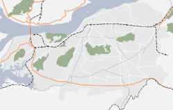 Amingaon Location in Guwahati  Amingaon Location in Assam | |
| Coordinates: 26°11′18″N 91°40′42″E / 26.18833°N 91.67833°E | |
| Country | India |
| State | Assam |
| District | Kamrup district |
| City | North Guwahati |
| Elevation | 31 m (102 ft) |
| Time zone | UTC+5:30 (IST) |
| PIN | 781 XXX |
| Vehicle registration | AS-01 |
| Lok Sabha constituency | Gauhati |
| Vidhan Sabha constituency | Jalukbari[1] |
Amingaon (Assamese pronunciation: [ˈɑ:mɪnˌgɑ̃ʊ]) is a locality in North Guwahati.
YouTube Encyclopedic
-
1/1Views:1 029
-
GHY-NDLS RAJDHANI at 100kph at AMINGAON (M.SHARMA)
Transcription
Geography
It is at 26°11′0″N 91°40′0″E / 26.18333°N 91.66667°E at an elevation of 31 m (102 ft) above mean sea level.[2]
To its north and west is the Agyathuri hill, to its south is the Brahmaputra River, and to its east is IIT Guwahati. A large area of Amingaon is occupied by factories and warehouses, the largest aggregation being the Export Promotion Industrial Park (EPIP) located near the riverbank.
Location
National Highway 27 passes through Amingaon. The nearest airport is Guwahati Airport. Amingaon houses the Agthori railway station, although it is not a major stoppage; and the historical Amin Gaon railway station.
It is connected to Guwahati via the Saraighat Bridge.
References
- ^ "51 JALUKBARI LAC.pdf" (pdf). Government of Assam.
- ^ "Map and weather of Amingaon". Falling Rain.
External links