
 | |
| UTC time | 1894-07-10 |
|---|---|
| Local date | 10 July 1894 |
| Magnitude | 7.0 Ms |
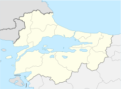
| Epicenter | 40°44′N 29°15′E / 40.73°N 29.25°E[1] |
| Areas affected | Ottoman Empire |
| Max. intensity | MMI IX (Violent) |
| Casualties | At least 1,349[2] |
The 1894 Istanbul earthquake occurred in the Çınarcık Basin or Gulf of Izmit in the Sea of Marmara on 10 July at 12:24pm. The earthquake had an estimated Ms magnitude of 7.0.[3] At least an estimated 1,349 people were killed in towns around the Gulf of Izmit such as Yalova, Sapanca and Adapazarı, and in Ottoman Constantinople (present day Istanbul).[2] The main shock caused a tsunami 1.5 metres (4.9 ft) high.
YouTube Encyclopedic
-
1/3Views:9 463269 72429 849
-
1894 Yılındaki BÜYÜK İstanbul DEPREMİ !
-
ISTANBUL'DAN HEMEN TAŞININ !!! (Kanıtlarla İstanbul Depremi)
-
22 Ağustos 1509 - İstanbul'da 40 Gün Süren Kıyamet Deprem ve Dev Tsunami
Transcription
Background

The Sea of Marmara is a pull-apart basin formed at a releasing bend in the North Anatolian Fault, a right-lateral strike-slip fault. This local zone of extension occurs where this transform boundary between the Anatolian Plate and the Eurasian Plate steps northwards to the west of Izmit from the Izmit Fault to the Ganos Fault. The pattern of faults within the Sea of Marmara basin is complex but near Istanbul there is a single main fault segment with a sharp bend. To the west, the fault trends west–east and is pure strike-slip in type. To the east, the fault is NW–SE trending and show evidence of both normal and strike-slip motion.[4] Movement on the Gulf of Izmit section of the fault, which bounds the Çınarcık Basin, is the most likely cause of the 1894 event.[3] Other possible causes are movement on the Princes' Islands segment of the fault (to the west of the Gulf of Izmit), and movement on a normal fault in the Çinarcik basin, separate from the North Anatolian Fault.
Damage
The earthquake is estimated to have generated shaking with a modified Mercalli intensity of 9 at Sapanca, 8.5 at Yalova, and 8 at Adapazarı, Büyükçekmece, Gebze, Kartal, Küçükçekmece and on the Princes' Islands. The quake killed 990 people in the area around Yalova and Sapanca, 83 in Adapazarı and 276 in Istanbul.[2]
Response
Numerous civil society organisations in Belgrade, capital of the nascent Kingdom of Serbia, organized benefit events to collect aid for victims of the catastrophe.[5]
See also
References
- ^ Parsons, Tom (2004). "Recalculated probability of M ≥ 7 earthquakes beneath the Sea of Marmara, Turkey" (PDF). Journal of Geophysical Research. 109 (B05304): B05304. Bibcode:2004JGRB..109.5304P. doi:10.1029/2003JB002667.[permanent dead link]
- ^ a b c King, Geoffrey C.P.; Hubert-Ferrari, Aurélia; Nalbant, Süleyman S.; Meyer, Bertrand; Armijoa, Rolando; Bowman, David (2001). "Coulomb interactions and the 17 August 1999 Izmit, Turkey earthquake" (PDF). Comptes Rendus de l'Académie des Sciences, Série IIA. 333 (9): 557–569. Bibcode:2001CRASE.333..557K. doi:10.1016/s1251-8050(01)01676-7.[permanent dead link]
- ^ a b Ambraseys, N. (January 2001). "The earthquake of 10 July 1894 in the Gulf of Izmit (Turkey) and its relation to the earthquake of 17 August 1999". Journal of Seismology. 5 (1): 117–128. Bibcode:2001JSeis...5..117A. doi:10.1023/A:1009871605267. ISSN 1573-157X. S2CID 128657125.
- ^ Armijo, R.; Meyer B.; Navarro S.; King G. & Narka A. (2002). "Asymmetric slip partitioning in the Sea of Marmara pull-apart: a clue to propagation processes of the North Anatolian Fault?" (PDF). Terra Nova. 14 (2): 80–86. Bibcode:2002TeNov..14...80A. CiteSeerX 10.1.1.546.4111. doi:10.1046/j.1365-3121.2002.00397.x. S2CID 49553634.
- ^ Dubravka Stojanović (2008). Калдрма и асфалт: урбанизација и европеизација Београда 1890–1914. Belgrade: Udruženje za društvenu istoriju. p. 260. ISBN 978-86-83227-25-9.
Further reading
- Ambraseys, N. (2009). Earthquakes in the Mediterranean and Middle East: A Multidisciplinary Study of Seismicity up to 1900 (First ed.). Cambridge University Press. pp. 774–779. ISBN 978-0521872928.
- Ambraseys, N.N.; Finkel, C.F. (1991), "Long-term seismicity of Istanbul and of the Marmara Sea region", Terra Nova, 3 (5): 527–539, Bibcode:1991TeNov...3..527A, doi:10.1111/j.1365-3121.1991.tb00188.x, ISSN 0954-4879
- Bein, Amit (2008), "The Istanbul Earthquake of 1894 and Science in the Late Ottoman Empire", Middle Eastern Studies, 44 (6): 909–924, doi:10.1080/00263200802426021, JSTOR 40262628, S2CID 144961288